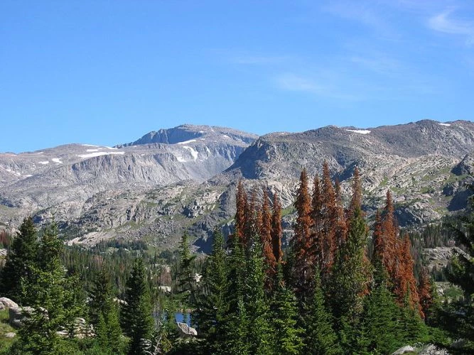
Bighorn Mountains

Bighorn Mountains, Cloud Peak
Cloud Peak (left center of photograph) rises to 13,167 feet in the Bighorn Mountains
 

The northern end of the Bighorn Mountains have been cut by the Bighorn River which carved a canyon almost 50 miles long. The range runs for about 150 miles in north-central Wyoming and south-central Montana.

Glaciated Peaks
The Bighorns are about 30 miles at their widest point and die out in Montana just north of Bighorn Canyon at 4,500 feet. The central crest has glaciated peaks of 13,000 feet. The glaciation did not extend into the area now set aside as Bighorn Canyon National Recreation Area.

The mountains are made of over 9,000 feet of sedimentary rock formed mostly in marine and near shore environments. The deposition of the rocks began 600 million years ago in the Cambrian period and lasted until 65 million years ago at the end of the Cretaceous period. These rocks were deposited layer upon layer over older granite rocks that can be seen in the higher part of the range.

Layer Upon Layer
All the layers were deposited on even older crystalline rock that formed when molten rock material cooled to form coarse grained, red granite. Some metamorphosed schist and gneiss are also present. These rocks were eroded down to a fairly flat plain over millions of years, and it is this erosion surface upon which the many sedimentary layers were to form.

All these rocks were part of the Laramide mountain making deformation which is widespread across the western United States.

Last updated: February 24, 2015

Park footer

Contact Info

Mailing Address:

Bighorn Canyon National Recreation Area South District Visitor Center
20 US Hwy 14A

Lovell, WY 82431

Phone:

307 548-5406
(307) 548-5406 is the South District in Lovell, WY. (406) 666-9961 is the North District in Fort Smith, MT.

Contact Us