Last updated: June 17, 2024
Article
NPS Geodiversity Atlas—Bent's Old Fort National Historic Site, Colorado
Geodiversity refers to the full variety of natural geologic (rocks, minerals, sediments, fossils, landforms, and physical processes) and soil resources and processes that occur in the park. A product of the Geologic Resources Inventory, the NPS Geodiversity Atlas delivers information in support of education, Geoconservation, and integrated management of living (biotic) and non-living (abiotic) components of the ecosystem.
Introduction
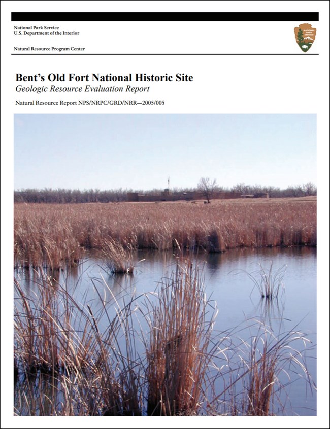
The geologic story of Bent’s Old Fort National Historic Site is part of the heritage of the Great Plains. Bent’s Fort was a trading outpost along the mountain branch of the Santa Fe Trail where traders, trappers, travelers, and the Cheyenne, Arapaho and other tribes peacefully came together for trade. The fort was in use from 1833 through 1849 when it was abandoned due to disease and disasters.
Bent’s Old Fort sits on the floodplain of the Arkansas River near La Junta, Colorado. The Arkansas River was the boundary between the United States and Mexico until the end of the Mexican-American War. The mountain route of the Santa Fe Trail followed the Arkansas River for much of its distance, and was longer and more difficult than the Cimarron route, but was considered safer, and had plenty of water. A few miles west of Bent’s Old Fort, the Santa Fe Trail left the Arkansas River and turned southwest towards Raton Pass, the trail’s most difficult section. The fort was an important place for travelers to get needed supplies, repairs, and food prior to the arduous journey ahead.
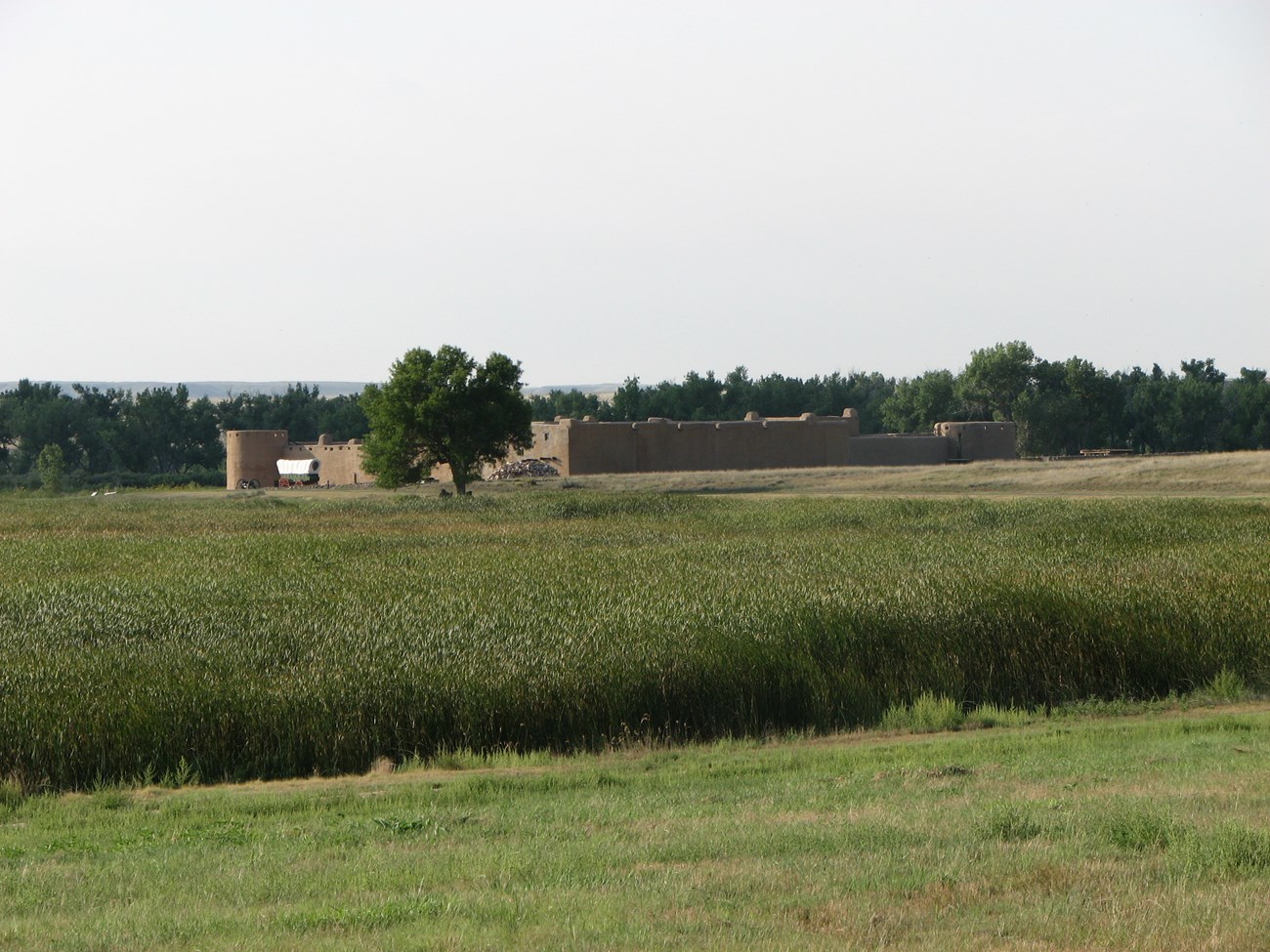
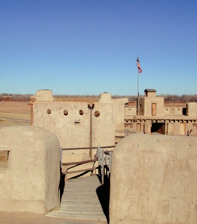
In 1976, the adobe fort was rebuilt on the original foundation and the site today, within its context of the surrounding landscape along with native flora and fauna, allows visitors to step back in time.
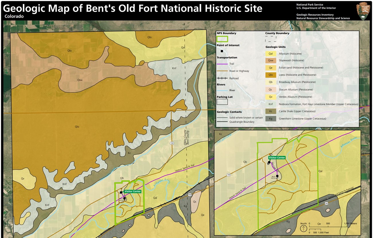
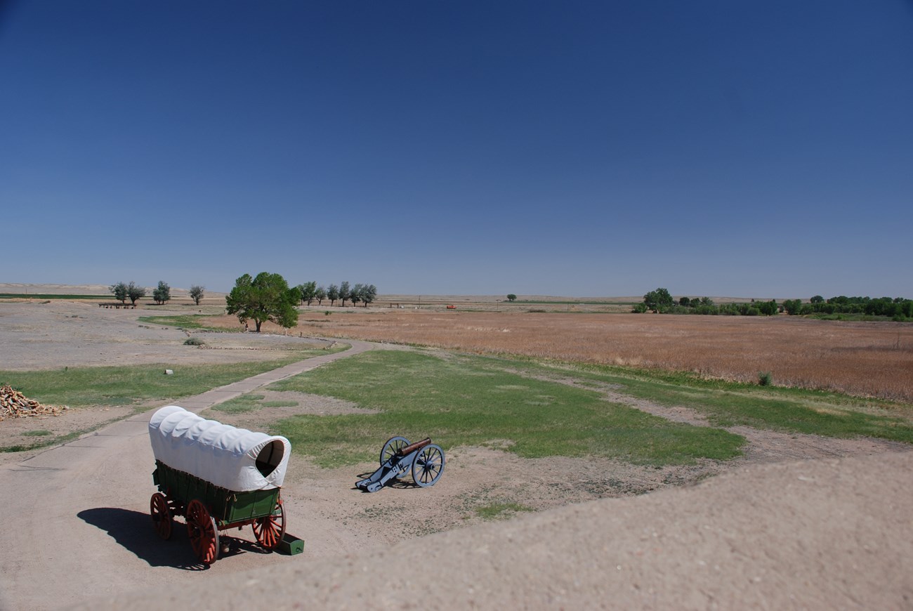
Because Bent’s Old Fort is located next to the Arkansas River, geologic units present at or near the subsurface of Bent’s Old NHS are limited to the Quaternary. The surrounding landscape is characteristic of the Great Plains in eastern Colorado, consisting of a series of flat to gently rolling surfaces with steep intervening slopes. Views of the expanses of the Great Plains from the fort are an important part of the park’s cultural landscape.
A narrow strip of the Cretaceous Greenhorn Limestone mapped along the southern park boundary. The Cretaceous Carlile Shale and Niobrara Formation are mapped further up on the gentle slopes and bluffs above the river valley, and Quaternary loess or eolian deposits cover much of the uplands.
NPS photo.
Geologic Setting & Regional Geology
Bent’s Old Fort lies in the Colorado Piedmont section of the Great Plains province. The Colorado Piedmont is a deeply eroded section of the Great Plains. The Colorado Piedmont is located between the High Plains to the east and the Rocky Mountains to the west. The erosional effects of streams are the most conspicuous features of the landscape of the Colorado Piedmont. The Arkansas and South Platt rivers and their tributaries have eroded away the thick sequence of Paleogene sedimentary rocks that were shed off the Rockies following their uplift and that still underlie the High Plains. This deep erosion has exposed upper Cretaceous rocks at the surface where they not buried by Quaternary deposits, including the deposits that mantle much of the Colorado Piedmont.
The Raton section of the Great Plains, with mesas capped by lava flows and other volcanic landforms lies to the south. The terrain gradually climbs in elevation from the Arkansas River to the Raton section with the boundary between the two being arbitrary.
The Greenhorn Limestone, Carlile Shale and Niobrara Formation were deposited in the Western Interior Seaway during the late Cretaceous. The Western Interior Seaway covered much of central North America from approximately 100 to 70 million years ago. At its greatest extent, the Western Interior Seaway extended from the Arctic to the Gulf of Mexico.
The Bridge Creek Limestone Member of the Greenhorn Limestone is mapped along the southern boundary of the historic site, but is poorly exposed in the Bent’s Old Fort region. The Bridge Creek Limestone member is the uppermost member of the Greenhorn Limestone. The Greenhorn Limestone consists of interbedded fossiliferous limestones and lime-rich shale, with thin beds of bentonite and a local thin bed of limestone conglomerate. It was deposited in shallow-marine conditions with warm temperate waters between 95 and 92.5 million years ago.
The overlying Carlile Shale, which is also poorly exposed in the region, consists mostly of dark-gray to black fissile shale, with sandy limestones present in the upper part of the unit. The lower member of the Niobrara Formation, the Fort Hays Limestone member, is present in the upper part of the slopes above the Arkansas River and Bent’s Old Fort NHS. It consists of chalky limestones and gray calcareous shale. The Niobrara Formation was deposited between 82 and 81 million years ago.
NPS photo.
Arkansas River
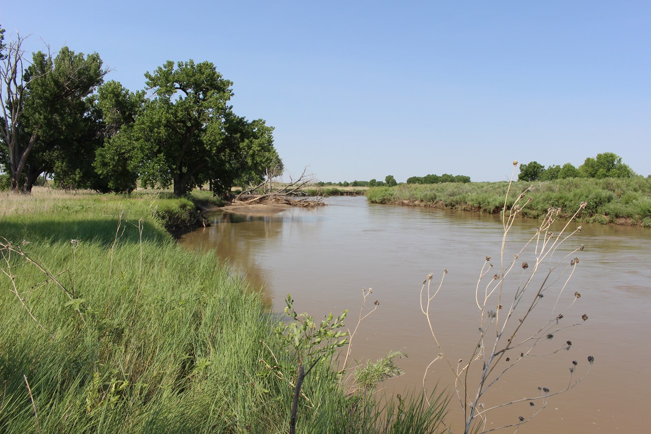
The Arkansas River is the sixth-longest river in the United States, flowing 1,469 miles (2,364 km) from its headwaters in the Rocky Mountains to the Mississippi River. In the vicinity of Bent’s Old Fort, NHS, the Arkansas River is an alluvial, sand-bottomed, meandering river, flowing approximately 6 miles (10 km) within the park boundary to cover a linear distance of 3 miles (6 km). The river’s meanders are developed on a floodplain that is, in general, more than a mile (1.6 km) wide and bordered by low bluffs. The floodplain is entirely developed in unconsolidated materials, underlain by 30 to 40 feet (9 to 12 km) of fill above Cretaceous bedrock. The river gradient is about 6.7 feet per mile (1.3 m/km), and the sediment load carried is moderately heavy, consisting largely of silt and sand in this reach of the river.
The hydrology and natural flow regime of the river has been altered by dam construction, particularly the Pueblo Dam upstream of Pueblo, Colorado, and by irrigation. In the 19th century, the river was intermittent with a wide, shallow, and braided channel. The presence of invasive non-native species such as tamarisk has also altered the river characteristics, although tamarisk has now been removed from the reach of the river within the park boundary.
Peak discharge of the Arkansas River near La Junta is highly variable. It is 2,700 cfs (cubic feet per second) (76 m3/s) on the 1.5 year interval. The 10-year peak discharge is 14,200 cfs (402 m3/s), and the 500-year peak discharge is 64,800 cfs (1,835 m3/s). The highest flow recorded at La Junta to 200,000 cfs (5,664 m3/s) during the June 1921 Pueblo Flood when a intense cloudburst occurred during a period of heavy snowmelt. This flood caused most of the remaining original adobe walls of the fort to collapse. Other floods on the Arkansas River in the La Junta area occurred in 1935, 1942, 1955, and 1965.
Bent’s Old Fort lies on the northern edge of the Arkansas River floodplain. The fort was constructed in 1833 on the edge of a low, floodplain terrace, approximately 300 yards (274 m) from the Arkansas River. Quaternary deposits mapped within the floodplain include alluvium, overbank fines, and saturated soil (wetlands).
Several wetlands are present within the historic site, with the largest being the Arch wetland. The 52-acre (21- ha) Arch wetland lies on the Arkansas River floodplain immediately north of the fort. This wetland has increased in size since the 1980s, likely due to a rise in the water table due to leakage from the Fort Lyon Canal along with recharge from excess surface irrigation. The Fort Lyon Canal runs approximatelyroughly parallel to the Arkansas River and is approximately 1.5 miles (2.5 km) north of the fort. The wetlands provide which include floodwater storage, groundwater recharge, and wildlife habitat, and may play a role in filtering pollutants.
Older Pleistocene terrace deposits are found near Bent’s Old Fort along the Arkansas River valley. The oldest of these is the Verdos alluvium, which has been mapped on the uplands west of the fort. The Verdos alluvium is deeply weathered and has strongly-developed paleosols, and dates to the middle early Pleistocene. The Slocum alluvium is a terrace deposit that is middle Pleistocene in age. The Broadway alluvium has been mapped within the boundary of the historic site. It consists of unconsolidated Pleistocene gravel, sand, and silt in terraces above the Arkansas River.
Eolian Deposits
Windblown sand and loess (windblown dust) blanket large parts of the Colorado Piedmont, smoothing the terrain. Loess deposits are mapped on the uplands above Bent’s Old Fort north of the Arkansas River and eolian sand deposits are mapped on uplands south of the river. No eolian deposits are mapped within the park boundary.
Northwesterly winds have transported fine material from the floodplains of the streams and spread it southeastward over much of the Colorado Piedmont. Arkansas River alluvium is the primary sediment source for the eolian sand deposits south of the river. These sand deposits include a belt of dunes, which consists mostly of blowout dunes, which are large accumulations of sand derived from a “blowout”—a saucer- or trough-shaped hollow formed by wind erosion in a preexisting sand deposit. Most of the eolian deposits near Bent’s Old Fort are currently stable and covered with vegetation, but wind erosion and transport coincide with periods of drought in this semi-desert region, such as during the Dust Bowl.
Related Links
Distribution of Late Quaternary Wind-deposited Sand in Eastern Colorado
https://pubs.usgs.gov/sim/2005/2875/
Paleontological Resources
The most notable fossil that has been found in Bent’s Old Fort NHS is the tusk of a Columbian mammoth that was found in a burrow pit in 1964. A handful of other fragments of mammoth tusk or teeth have been found in the historic site. Pollen, and phytolith (microscopic plant structures made of silica) have also been found. There is the potential for additional fossils to be recovered from Quaternary deposits in the historic site.
The Cretaceous Bridge Creek Limestone Member of the Greenhorn Limestone contains bivalves and a variety of microfossils and nannofossils (from marine phytoplankton).
While not exposed in the historic site itself, the upper members of the Greenhorn Limestone and the Carlile Shale and Niobrara Formation contain variety of fossils, mostly marine invertebrates.
All NPS fossil resources are protected under the Paleontological Resources Preservation Act of 2009 (Public Law 111-11, Title VI, Subtitle D; 16 U.S.C. §§ 470aaa - 470aaa-11).
Regional Geology
Bent's Old Fort is a part of the Great Plains Physiographic Province and shares its geologic history and some characteristic geologic formations with a region that extends well beyond park boundaries.
NPS photo.
Geohazards
Natural geologic processes continue to occur in and around Sand Creek Massacre NHS on time scales ranging from seconds to years. Visitors should be cautious and alert to geohazards that may be present.
Flooding presents a potential hazard along the Arkansas River, and the fort lies within the 100-year floodplain. Floods along the Arkansas River consist of two general types: spring floods from the melt of snowpack and summer floods that result from storm runoff. Spring flows tend to have longer durations than summer floods that have high peak rates, but smaller volumes.
Eastern Colorado has a relatively low seismic hazard. The USGS 2014 Seismic Hazard Map indicates that the Bent’s Old Fort area has a 2% chance that an earthquake peak ground acceleration of between 8 and 10 %g (percent of gravity) being exceeded in 50 years due to earthquakes. Peak ground acceleration between 8 and 10 %g is roughly equivalent to V to VI on the Modified Mercalli Intensity Scale. The expected number of damaging earthquake shaking in eastern Colorado in 10,000 years is between 2 and 4. A M3.4 earthquake occurred in 1998 approximately 14 miles (23 km) south of Bent’s Old Fort.
Related Links
USGS Earthquakes Hazard Program Information by Region-Colorado
Regional Geology
Bent's Old Fort is a part of the Great Plains Physiographic Province and shares its geologic history and some characteristic geologic formations with a region that extends well beyond park boundaries.
- Scoping summaries are records of scoping meetings where NPS staff and local geologists determined the park’s geologic mapping plan and what content should be included in the report.
- Digital geologic maps include files for viewing in GIS software, a guide to using the data, and a document with ancillary map information. Newer products also include data viewable in Google Earth and online map services.
- Reports use the maps to discuss the park’s setting and significance, notable geologic features and processes, geologic resource management issues, and geologic history.
- Posters are a static view of the GIS data in PDF format. Newer posters include aerial imagery or shaded relief and other park information. They are also included with the reports.
- Projects list basic information about the program and all products available for a park.
Source: NPS DataStore Saved Search 2715. To search for additional information, visit the NPS DataStore.
A NPS Soil Resources Inventory project has been completed for Bent's Old Fort National Historic Site and can be found on the NPS Data Store.
Source: NPS DataStore Saved Search 2782. To search for additional information, visit the NPS DataStore.
Related Links
Related Articles
Bent's Old Fort National Historic Site
National Park Service Geodiversity Atlas
The servicewide Geodiversity Atlas provides information on geoheritage and geodiversity resources and values within the National Park System. This information supports science-based geoconservation and interpretation in the NPS, as well as STEM education in schools, museums, and field camps. The NPS Geologic Resources Division and many parks work with National and International geoconservation communities to ensure that NPS abiotic resources are managed using the highest standards and best practices available.

