Last updated: April 17, 2017
Article
Facilities and Climate Change Vulnerability

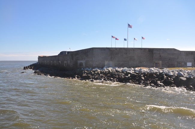
Photo: Western Carolina University Program for the Study of Developed Shorelines
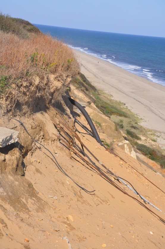
Climate change is one of the critical issues facing the National Park Service (NPS) across the country. Unprecedented coastal storm surges and flooding, severe erosion at inland parks, and an ever-growing list of new risks to park facilities are prompting the need for an agency-wide response. To better understand current and future impacts to NPS assets, operations and resources, the NPS is implementing park-based coastal hazard and climate change Vulnerability Assessments (VAs) and exposure mapping. This project is in partnership with Western Carolina University’s (WCU) Program for the Study of Developed Shorelines and seeks to help parks understand potential climate change impacts and possible coastal adaptation strategies.

Photo: Western Carolina University Program for the Study of Developed Shorelines
To conduct VAs and exposure maps, the NPS utilizes the Coastal Hazards and Climate Change Asset Vulnerability Assessment Protocol and Tool. Developed in collaboration with WCU, it establishes a standard methodology and set of best practices and supports the NPS sustainability vision outlined in the Green Parks Plan.
This tool assists parks in understanding risks to sea level rise and coastal flooding, among other stressors. In particular, when measuring an asset or resource’s level of “vulnerability” under this protocol, park managers must consider the asset/resource exposure and sensitivity.
To do so, the protocol outlines three steps:
- Step 1: Conducting exposure mapping to analyze the exposure of assets to coastal hazards and climate change via five indicators, which are all linked to asset location.
- Step 2: Analyzing the sensitivity of assets to coastal hazards by measuring how assets would be impacted based on their inherent properties or characteristics.
- Step 3: Obtaining an asset’s vulnerability score by combining the exposure and sensitivity scores (which are generated via questionnaire responses linked to steps 1 and 2).
Accomplishments
To date, the NPS has conducted 35 park-based VAs at coastal units across the country, with several more underway; completed exposure mapping at 105 units, and published several case studies associated with coastal vulnerability studies.
Some key deliverables of this work include:
To date, the NPS has conducted 35 park-based VAs at coastal units across the country, with several more underway; completed exposure mapping at 105 units, and published several case studies associated with coastal vulnerability studies.
Some key deliverables of this work include:
- High level mapping of park assets exposed to 1 meter of sea level rise
- A better understanding of the economic costs associated with assets at risk from coastal hazards and/or climate change;
- Readily-available maps and data/ information for decision makers, management teams, and park staff to utilize in work planning, project prioritization, funding requests, and public educational programming/resources

Photo: Western Carolina University Program for the Study of Developed Shorelines
While this initiative has focused exclusively and extensively on coastal parks, the NPS will be expanding the scope of the exposure mapping and VA tool to engage inland parks in understanding asset vulnerability to changing climate factors other than coastal risks. To learn more, visit the NPS Sustainability website.
