Part of a series of articles titled Beach and Coastal Landforms.
Previous: Sandy Coast Landforms
Next: Delta Landforms
Article

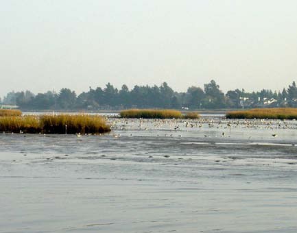
The term “estuary” is derived from the Latin word “aestuarium,” which means tidal. In a geomorphic sense, a typical estuary is a semi-enclosed, elongated coastal basin that receives an inflow of both freshwater and saltwater. From a chemical and physical standpoint, estuaries are buffer zones between river (freshwater) and ocean (saltwater) environments that are affected by tidal oscillations.
Geologically speaking, most estuaries are young basins, established by the flooding of fluvial (river-eroded) or glacially-scoured valleys during the Holocene rise of sea level. Estuaries are generally short-lived: they are quickly destroyed by rapid sediment infilling that is fostered by the high influx of river sediment. Circulation in estuaries not only traps large amounts of river sediment but also imports sand and mud from offshore areas.
Not all semi-enclosed coastal bodies of water are estuaries. For example, lagoons are protected bodies of water that are little affected by tides. Lagoons may receive inputs of seawater and freshwater but are typically dominated by one or the other, making their water motions less complex than the mixing and circulation patterns associated with true estuaries.
Big Cypress National Preserve, Florida—[Geodiversity Atlas] [Park Home]
Cape Cod National Seashore, Massachusetts—[Geodiversity Atlas] [Park Home]
Chesapeake Bay, DC, DE, MD, NY, PA, VA, WV [Home Page]
Fort Matanzas National Monument, Florida—[Geodiversity Atlas] [Park Home]
Kenai Fjords National Park, Alaska—[Geodiversity Atlas] [Park Home]
Olympic National Park, Washington—[Geodiversity Atlas] [Park Home]
Part of a series of articles titled Beach and Coastal Landforms.
Previous: Sandy Coast Landforms
Next: Delta Landforms
Last updated: December 2, 2022