Last updated: April 16, 2025
Article
Unlocking Earth's Secrets, Layer by Layer
Those splendid rocks in our national parks aren’t just scenic wonders; they’re scientific and cultural treasures. A new geological inventory could help protect them.
By Tim C. Henderson, Vincent L. Santucci,Tim Connors, and Justin S. Tweet
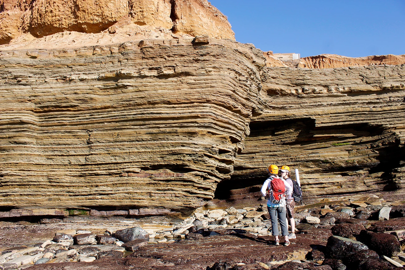
Image credit: NPS
Four and a half billion years ago, our planet formed from a giant ball of molten rock rotating around an infant sun. Life as we know it began about a billion years after that.
We know these things through studying rock layers—strata—which are unique records of meaningful, often extraordinary events in the history of Earth and its people. Locations where strata are well exposed can serve as valuable reference sites. Geologists call these reference layers stratotypes. But timeless as they may seem, rock stratotypes can be (and have been) destroyed by things like road expansion projects, urban development, volcanic eruptions, or earthquakes. In 2020, a group of geologists and one geoscience intern began inventorying stratotypes in the national parks by evaluating published scientific records. Our goal was to capture the knowledge these reference layers hold before they disappear and help protect them where we can.
A Testimony to Change
We can see and study strata in cliff faces, mountainsides, volcanoes, and river bluffs. You may have seen these layers as you drove through developed road cuts on a highway. Did you imagine they held the secrets of life and of Earth’s history? They do. Some strata are filled with the fossilized remains of very old plants and animals, testimony to the evolution of life on Earth. Others tell us stories about the growth and retreat of mountains, glaciers, oceans, and forests. Some even show us how the planet’s surface has shifted through time. All of this helps us understand why and how the Earth is changing in our own time.
They can give us insights about the future, like what to expect as the climate continues to warm.
Serving as a natural library, stratotype study sites contain important characteristics that help geologists recognize rock layers and compare them to strata in other locations. This can tell us things like how far an ancient lake bed reached and what types of fish called the lake home. They can provide clues to how life adapted to our planet’s changing climate in the past. More importantly, they can give us insights about the future, like what to expect as the climate continues to warm.
Geologists who map, describe, and propose a new rock layer often assign a name that indicates the location of its stratotype. Across the United States, there are thousands of named geologic layers with assigned stratotype locations. Many rock layers were named from stratotype locations inside our national parks. For example, the striking Permian De Chelly Sandstone’s stratotype location is Canyon de Chelly National Monument, a national park in Arizona. But many parks don’t know the scope, extent, importance, and distribution of stratotypes in the properties they manage.
From Schist to List
The work accomplished during my internship (Henderson) revealed more stratotypes than we could have imagined. What started as a five-month Geoscientists-in-the-Parks (now called Scientists in Parks) internship project in 2020 transformed into a multi-year endeavor. Our main goal for this project is to document stratotypes described in the scientific literature that are in or near national parks. A longer-term goal is to identify and keep track of all stratotypes on lands managed by the National Park Service. We also make recommendations for monitoring and protecting stratotypes. We build much of our work on data collected nationally by the U.S. Geological Survey since the 1800s.
To better pinpoint the descriptive stratotype locations in national parks, we had to do some detective work.
Our first step was to explore published reports, maps, and online databases. We compiled records of geologic strata identified in or near National Park Service boundaries into a list of all the possible layers and their stratotypes. Next, we searched all the strata listed on the U.S. Geological Survey’s Geologic Names Lexicon. This lexicon is a library of rock names and other valuable information. It keeps track of the original documents that first described a given stratum. One example is the Jurassic Santa Cruz Island Schist, which is a metamorphic rock formed by forces like high heat and pressure deep within the earth. This layer’s stratotype is exposed on Santa Cruz Island in Channel Islands National Park.
Scientists have different ways of publishing stratotype information. Some refer to locations descriptively, relative to nearby geographic features. Others give geospatial information such as latitude/longitude, UTM, or Public Land Survey System coordinates. To better pinpoint the descriptive stratotype locations in national parks, we had to do some detective work. We compared our list of strata and their locations to state geological survey and U.S. Geological Survey maps, using handy tools like MapView.
Scientists can sort and analyze the stratotype information geographically.
Then we mapped individual stratotypes in Google Earth as points, using Earth Point to convert those with known coordinates into Google Earth-compatible (KMZ) files. We imported park-specific GIS geologic maps created by the National Park Service’s Geologic Resources Inventory into Google Earth and layered them over the stratotype points. These additional map layers helped further improve our stratotype location accuracy and validate the descriptive or geospatial information we had found in published descriptions. Once we put all our stratotype locations in Google Earth and verified their accuracy, we converted our layers into ArcGIS format to create park-specific stratotype maps. Scientists can sort and analyze the stratotype information geographically by individual park, inventory and monitoring network, state, or geologic age.
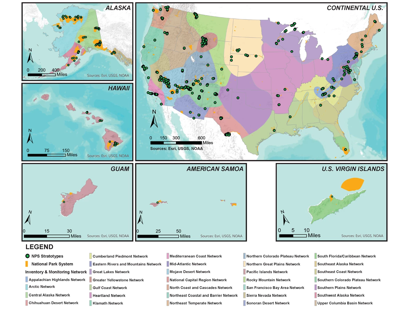
Image credit: NPS
As of 2023, we have inventoried more than 100 different national parks across the country. This includes parts of Alaska, Hawai’i, American Samoa, Guam, and the U.S. Virgin Islands. We found over 700 stratotypes that geologists have described and published over the years in academic journals, professional papers, and maps. As geologists continue to map, measure, and study the planet, they’ll propose additional rock layer designations. Time will allow researchers to scrutinize the rocks, formally naming new units or subdividing existing formations into "members" that have their own unique stratotypes. This could add more stratotypes to our inventory. If you think you’ve identified a new rock layer that we overlooked, let us know!
A Tour of Our Shared Heritage
Factors that influence the number of stratotypes in a particular park are accessibility (i.e., is it near a trail or covered by plants?), geological diversity, and history. The ten national parks with the greatest numbers of stratotypes are concentrated in the western United States. They’re some of the most popular parks in the country. Many of the remarkable geological landscapes of the top ten national parks have a long history of human exploration and have been studied by geologists for decades.
“Stratotype sections are a fundamental building block to America’s geoheritage.”
“Stratotype sections are a fundamental building block to America’s geoheritage,” said Tom Casadevall, a retired scientist with the U.S. Geological Survey. He said the National Park Service inventory data “form a wonderful foundational understanding of our geodiversity and contribute to our understanding of America’s geological evolution.” But stratotypes don’t just have scientific value. They’re also important for cultural, educational, and aesthetic reasons. The geoheritage stories associated with National Park Service stratotypes tell us about things like the origins of rock layers and the history of Indigenous cultural sites. They give information on historic mining operations and often contain fantastic fossils.
Yellowstone National Park
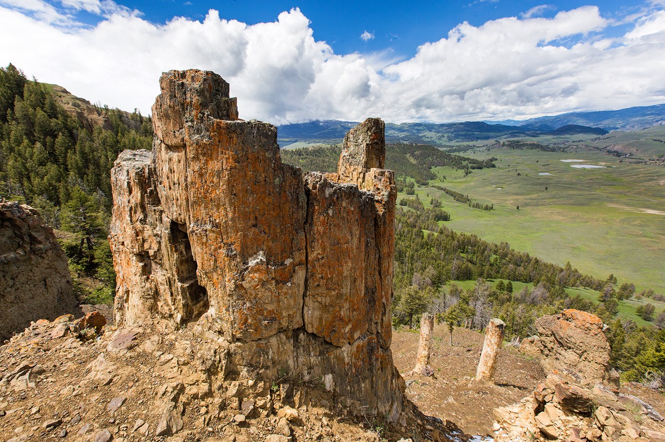
Image credit: NPS / Neal Herbert
In and near Yellowstone National Park, stratotypes document multiple cycles of volcanism associated with the park’s geological hotspot. The Pleistocene Huckleberry Ridge Tuff is a two-million-year-old volcanic ash rock layer produced during the first of three volcanic stages of the Yellowstone hotspot. The stratotype of the Huckleberry Ridge Tuff is located a few kilometers south of Yellowstone along the John D. Rockefeller, Jr. Memorial Parkway.
Going back many thousands of years, hotspot volcanism created the “younger,” 640,000-year-old Pleistocene Plateau Rhyolite, a light-colored rock rich in the minerals silica, potassium, and sodium. The Plateau Rhyolite contains many layers whose stratotypes are exposed in Yellowstone, including the Central Plateau Member, which lies right in the middle of the Yellowstone supervolcano’s caldera (the hole formed when the volcano last erupted).
This was the first confirmed dinosaur fossil ever found in Yellowstone.
Stratotypes in Yellowstone also contain remarkable fossils. Coauthors Santucci and Tweet recently described a tooth found in the Cretaceous Harebell Formation stratotype as belonging to a juvenile Tyrannosaurus dinosaur. This was the first confirmed dinosaur fossil ever found in Yellowstone. The park’s famous Specimen Ridge is part of the stratotype for the Eocene Lamar River Formation. The ridge contains excellently preserved 50-million-year-old fossil forests. Many of the petrified tree stumps of this ancient “forest” stand in their original upright positions, some up to eight feet wide and more than 20 feet tall.
Mesa Verde National Park
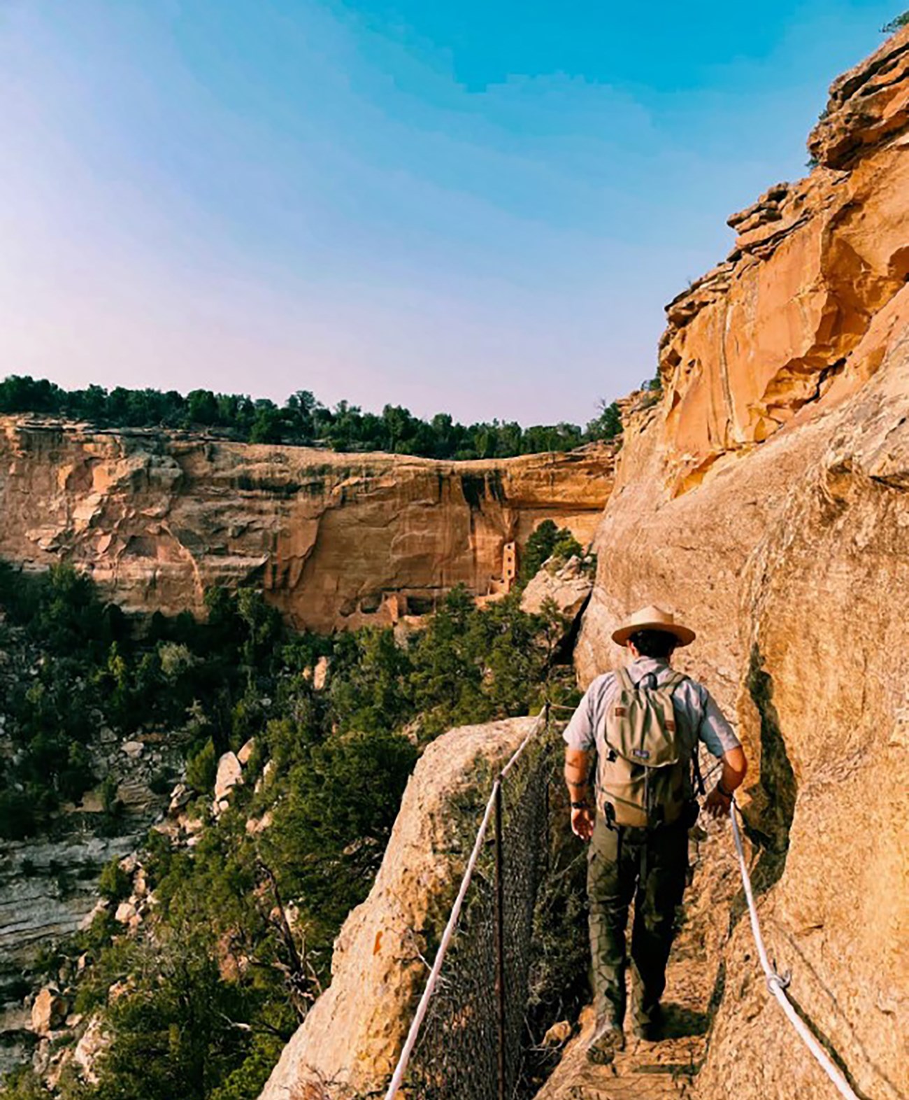
Image credit: NPS
As in several other parks, archeologists and geologists at Mesa Verde National Park work together to study how geology influenced the way past peoples lived. Stratotype designations are associated with the park’s globally renowned cultural heritage sites. For example, the steep-sided cliffs that surround the Ancestral Puebloan cliff dwellings in the park are made up of sandstone, from which the Cretaceous Cliff House Sandstone stratotype gets its name.
The sandstone and underlying rocks provided a valuable source of water for Indigenous people in a region without permanent lakes or streams.
Part of a collection of formations called the Mesaverde Group, the Cliff House Sandstone stratotype tells us about the park’s cultural and regional history. The sandstone and underlying rocks provided a valuable source of water for Indigenous people in a region without permanent lakes or streams. Rain or snow would travel through the porous layers of the Cliff House Sandstone until it emerged as seeps or springs. Scientists think Ancestral Puebloans knew the locations of these critical springs and even carved small depressions into the rock to channel and collect the water.
New River Gorge National Park and Preserve
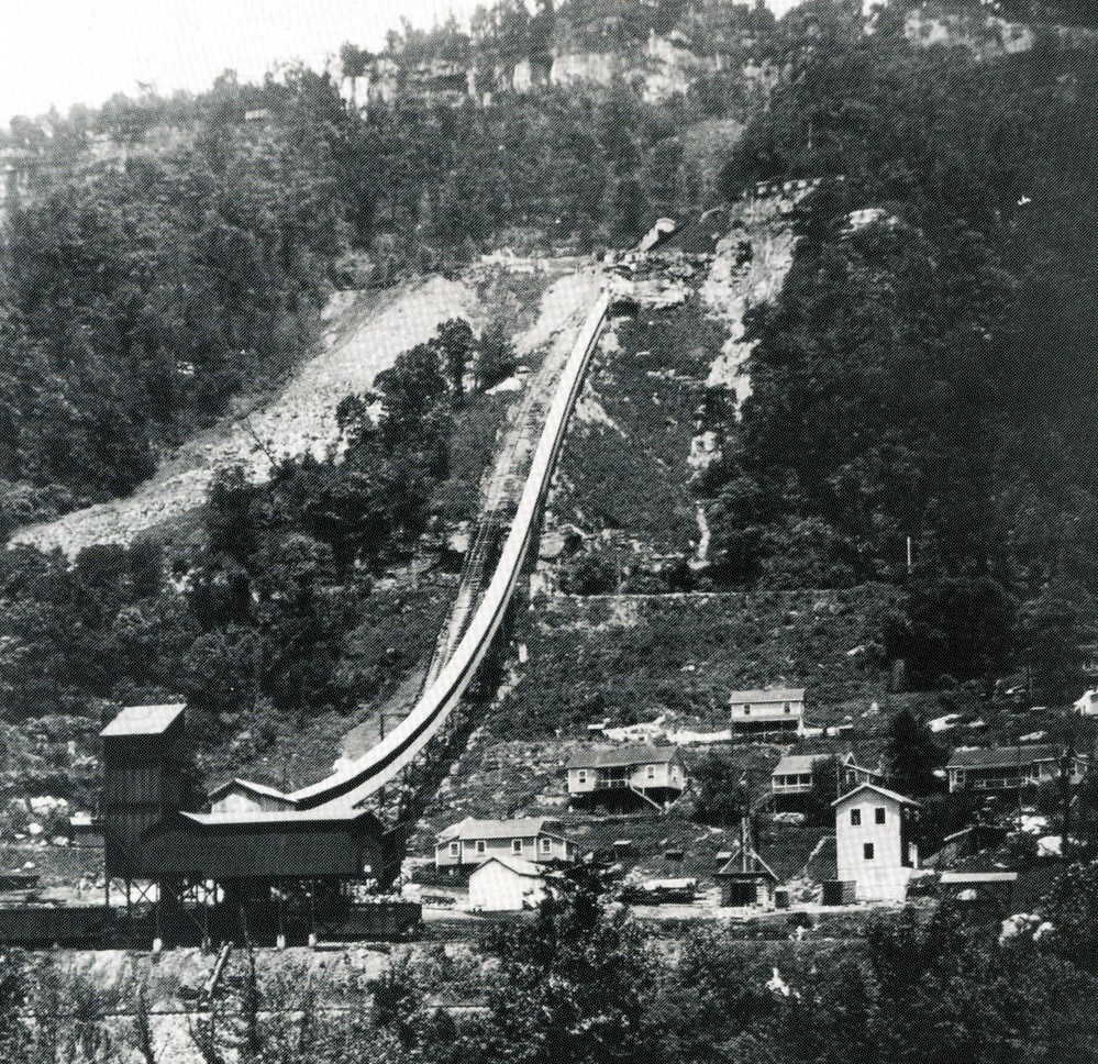
Image credit: NPS
Geologic strata at New River Gorge National Park and Preserve tell stories about the history of West Virginia coal mining. The Pennsylvanian New River Formation shares its name with the park and preserve. It contains coal seams vital to the economics of the area in the 19th and 20th centuries. The stratotype of this formation forms the walls of the gorge. One layer within the New River Formation is called the Nuttall Sandstone Member, named after its stratotype, which is exposed near the mining town of Nuttallburg.
Grand Canyon National Park
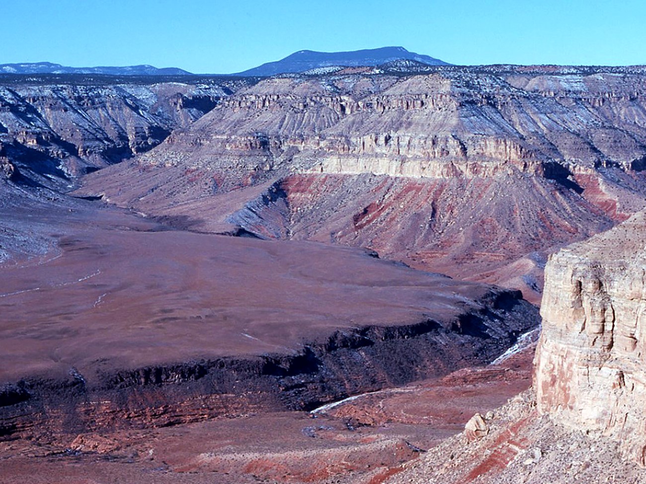
Image credit: USGS
Grand Canyon National Park’s iconic, beautifully scenic rocks are so extensive and accessible they have a long history of geologic research. Some of the park’s oldest rocks—part of the Grand Canyon Supergroup—were first studied by geologists Charles Doolittle Walcott and John Wesley Powell in the late 19th century. Today, many of the layers of that supergroup have stratotypes in the eastern part of the canyon. The Tuckup Canyon Basalt is a sequence of lava flows and eruptive features whose stratotype is located in Tuckup Canyon in the central portion of Grand Canyon.
These lava flows created lava dams that temporarily blocked the flow of the Colorado River many times in the last two million years. The dams could reach thousands of feet high and formed enormous lakes similar to Lake Powell and Lake Mead. As a result of its long research history, Grand Canyon has the largest number of inventoried stratotypes in any U.S. national park.
“Softer” than They Seem
Despite their “rock hard” appearance, stratotypes are vulnerable to human activities like development and climatic or geologic processes like weathering, erosion, flooding, and volcanic activity. We can’t protect them if we don’t even know they exist or where they are, which is why inventorying them is so important.
We can’t protect them if we don’t even know they exist or where they are.
Shenandoah National Park
At Shenandoah National Park, the Neoproterozoic Swift Run Formation has volcanic and metamorphic rocks named after exposures along the historic Swift Run Gap. The formation marks a violent period of Earth’s history when the Shenandoah area experienced explosive volcanic activity. Seven hundred and fifty million years ago, Rodinia, one of Earth’s supercontinents, ripped apart, spewing ash, lava, and other molten rock to the surface. Those events formed the Swift Run Formation and overlying Catoctin Formation.
More than 50 years ago, a road expansion project in the park widened and straightened U.S. Highway 33 along the gap, destroying the stratotype exposures of the Swift Run Formation originally described in the 1940s and ‘50s. As scientists became aware of the damage, they assigned a new stratotype for the formation a short distance to the east, inside the park.
Tule Springs Fossil Beds National Monument
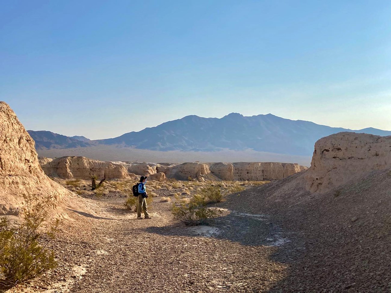
Image credit: NPS
In the 1960s, the stratotype of the Pleistocene Las Vegas Formation was described outside the city of Las Vegas in what is now Tule Springs Fossil Beds National Monument. This formation has fossil-rich sedimentary rock layers, formed when rocks, mud, and plant or animal remains from ancient springs and marshes were deposited over time. These layers span nearly 500,000 years. They contain fossils of large Ice Age mammals like mammoths, camels, bison, and saber-toothed cats.
The expansion and development of Las Vegas resulted in the destruction of the stratotype.
More importantly, the Las Vegas Formation was deposited at a time when Earth’s climate experienced numerous temperature changes, and—like us—life had to adapt to extreme climate change. The formation has valuable things to teach us about how animals and plants adapted. But over the last several decades, the expansion and development of Las Vegas resulted in the destruction of the stratotype. Thankfully, new exposures within Tule Springs have replaced what was lost.
Hawai’i Volcanoes National Park
Volcanic eruptions in Hawai’i Volcanoes National Park in 2018 destroyed a stratotype for the Holocene Uēkahuna Ash. Located along the cliffs of Uēkahuna Bluff at Kaluapele (Kīlauea caldera), this pyroclastic formation is one of numerous layers that tell about the long-lived volcanic activity that created the Hawaiian Islands. Situated above the volcano, the destroyed stratotype was a hand-dug pit exposure that was buried by several meters of rock debris. In geologically active regions such as Hawai’i, continued volcanic eruptions have the potential to create new geologic layers as well as cover or obscure older ones.
Cabrillo National Monument
We could also lose stratotypes to coastal inundation from sea level rise. Located along the California shore, Cabrillo National Monument has stratotypes for the Cretaceous Point Loma Formation and Cabrillo Formation. These sedimentary layers are named for their coastal exposures along the Point Loma Peninsula and in the national monument. They’re so close to the water that researchers went underwater with scuba diving equipment to observe the stratotype of the Point Loma Formation.
Channel Islands National Park
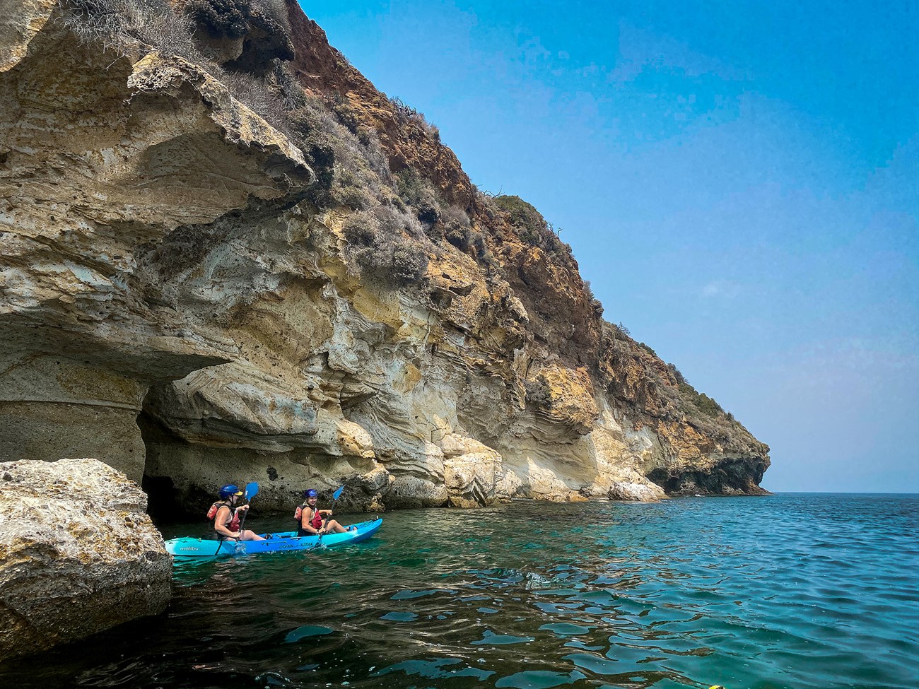
Image credit: NPS / Jen Bauer
At Channel Islands National Park, the Miocene Santa Cruz Island Volcanics is made up of lava flows and deposits originally erupted from below the ocean. One layer within the volcanic strata is the Prisoners Harbor Member, named after its stratotype exposures along the low-lying sea cliffs in the infamous Prisoners Harbor. This was the site of numerous attempts in the 1800s by the Mexican government to establish a penal colony in what was then Alta California.
Lake Clark National Park and Preserve
In Alaska’s Lake Clark National Park and Preserve, several stratotypes lie along the tidal flats of Tuxedni Bay, including the Jurassic Tuxedni Group. Marine fossils are so excellently preserved within this group that its stratotype includes Fossil Point, along the southern shore of the bay. Huge, ancient fossil clams and ammonites abound there. As the climate continues to warm, rising sea levels could obscure and damage these remarkable and valuable geologic sites.
A Unique National Resource
Research geologist Randall Orndorff works for the U.S. Geological Survey. “Geologists can be extremely grateful to the NPS for preserving the standard reference of geologic units,” he said. “As development across the nation endangers type sections, the USGS, state geological surveys, and academic institutions can be assured that current and future sections within the park system will be protected and available for study.”
The National Park Service Stratotype Inventory will give people the tools to protect these sites and the secrets they have yet to reveal.
Diligent inventorying, monitoring, and management will help protect the stratotypes we have now and allow geologists to assign other rock exposures as replacements when the current stratotypes are lost or impaired. In filling a void in park geological information, we hope the National Park Service Stratotype Inventory will give people and parks the tools and understanding to protect these globally important, cherished sites and the secrets they have yet to reveal.
About the authors

Tim C. Henderson is a Colorado State University research associate working with the National Park Service Geologic Resources Inventory. He writes reports about National Park Service geology.

Vincent L. Santucci is the senior paleontologist and coordinator for the National Park Service Paleontology Program.

Geologist Tim Connors is the Physical Resources Program manager for the National Park Service’s Intermountain Region. His interests include geologic mapping, stratigraphy, and best management practices for all geologic resources.

Justin S. Tweet is a paleontological researcher with the National Park Service Paleontology Program.
Tags
- cabrillo national monument
- canyon de chelly national monument
- channel islands national park
- grand canyon national park
- hawaiʻi volcanoes national park
- lake clark national park & preserve
- mesa verde national park
- new river gorge national park & preserve
- shenandoah national park
- tule springs fossil beds national monument
- yellowstone national park
- stratotype
- rock layers
- inventory
- geological inventory
- strata
- geoscientists in parks
- scientists in parks
- tim henderson
- vincent santucci
- tim connors
- justin tweet
- geology
- features
- ps v37 n2
- park science magazine
- park science journal
