Last updated: July 25, 2022
Article
The Heliograph: Summer 2021

In this issue of the Heliograph, we introduce some predictive tools and planning processes that can help park managers make proactive decisions about natural resources in the face of climate change. We also explore some explanations for this spring's highly unusual saguaro bloom, celebrate more of our award-winning staff members, bid farewell to a fantastic botanist, and let you know what we've been up to in the first half of 2021.
The Heliograph is the newsletter for the Sonoran Desert Network and Desert Research Learning Center.

Get Smart—Climate Smart!
How to Avoid Surprises and Meet the Future with a Plan
Plants and animals in Southwestern national parks are adapted to arid conditions, but even desert dwellers have their limits. Entire forests of pinyon-juniper have been killed by bark beetles, and others have been killed by drought. Wildland fires and floods are more severe. Snowpack is declining. Erosion is increasing. Climate projections for a hotter and drier future suggest more change is coming.
In response, park managers are having to rethink how they plan for the future. Instead of figuring out how to conserve everything, park managers are increasingly having to decide what they can save, and what they will have to let go. The decisions can be scientifically challenging—and emotionally agonizing. But many park staff are discovering a tool that can help.
Climate Smart Conservation (CSC) is a process for identifying actions that can help managers achieve goals in the face of coming changes. Together, scientists and managers think through potential climate impacts to park resources, use scientific data to analyze different situations, and then identify and evaluate management options most likely to be feasible, achievable, and most effective given park capabilities. Under this framework, scientists and managers use their collective knowledge to anticipate problems and be proactive, rather than reactive. The process breaks big, complex questions into bite-sized chunks that bring the outlines of hope into clearer focus.

Adapted from a graphic produced by the National Wildlife Federation.
Since the NPS Inventory & Monitoring Division hosted its first workshop at Moab, Utah, in 2016, parks across the West have participated in this process. Today, parks in the NPS Southeast Utah Group are working together to restore and conserve grasslands and pinyon-juniper forests. In the Greater Yellowstone Ecosystem, a consortium of federal agencies are engaged in aquatic resource conservation and whitebark pine conservation. Existing projects are reconfigured to accommodate new knowledge of climate stressors, often incorporating new science to make management actions robust to a range of plausible future conditions.
Want to get involved? Contact program manager Andy Hubbard and ask I&M to engage in this process with you. Why I&M? Because long-term monitoring data from your park, combined with climate data, tell us how sensitive your resources are to climate change—one of the very first steps in being climate smart. It’s also I&M’s job to facilitate connections between park staff and other scientific experts in academia, other agencies, and beyond. It takes all hands because the situation is complex, and creative solutions are paramount. We are the first generation facing this challenge as land managers, and we need to face it head-on if we hope to succeed.
Can’t currently devote the time and resources to a complete planning workshop? The tools used in the CSC process may be able to help you answer more targeted questions. For instance, I&M scientists recently ran a water balance model to help managers at Montezuma Castle National Monument know whether, under future conditions, annual water rights will likely be met by streamflow in Wet Beaver Creek. Exactly what those future conditions may be will depend on a variety of factors, including the kinds of decisions humans make about fossil-fuel consumption. For that reason, the model is run multiple times, under different scenarios. We know the future will be warmer, but precipitation patterns are harder to predict. Under a scenario of warming and increased precipitation (Warm/Wet), water rights will likely be met. But under a scenario of warming and decreased precipitation (Hot/Dry), the frequency of low flows that meet water rights will decrease dramatically—from 70% of years in 1980–2020 to 30% of years in the period 2050–2100.
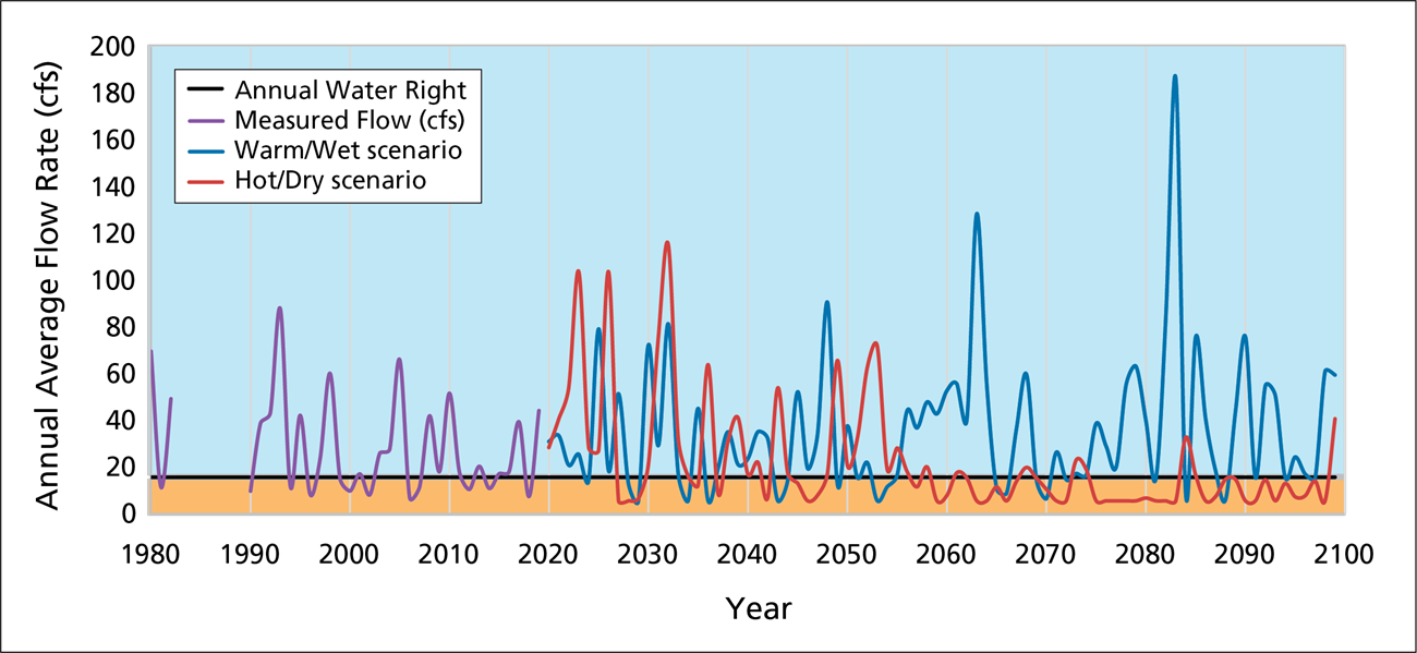
This has ecological implications. Plants and animals adapted to current climate patterns rely on receiving certain amounts of water at certain times. For them, the total amount of water that falls over the course of a year is less important than when that water falls, and at what rate—especially in areas with a bimodal precipitation regime, like the Sonoran Desert. In this case, size matters! Small rains that only wet the surface evaporate quickly. Larger events that wet deeper layers of soil are protected from surface evaporation and do plants good. But severe rainstorms can result in fast, furious flows that run across the surface of the desert, unable to sink into the ground to supply spring flow later, or be used by plants. For this reason, a series of severe rains that fall all at once over the course of a year can’t make up for the vegetation productivity lost to a missed monsoon, or a season of gentle winter rains. Unfortunately, these are the types of rainfall that are increasing in frequency, and expected to continue to do so. At Montezuma Castle, this raises questions about cottonwood and sycamore recruitment along Wet Beaver Creek. The volume of the park’s water right may be secure, but the future of its iconic riparian corridor is less sure. Having this information helps park managers avoid surprises. When you know what to expect, you can plan for it.
For more information, contact I&M landscape ecologist David Thoma, Evan Gwilliam, or Alice Wondrak Biel
NPS/Tani Hubbard
Extraordinary Saguaro Bloom: What Happened?
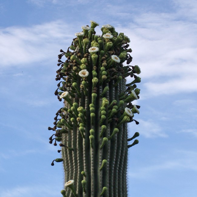
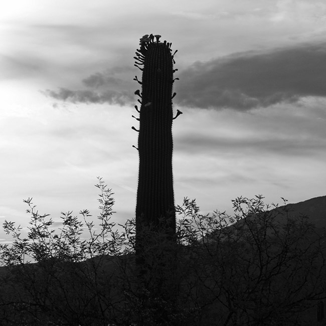
Sonoran Desert residents witnessed an extremely rare phenomenon this spring: saguaro blooms were literally busting out all over. Saguaros typically bloom in spring. And when they do, the blooms are usually confined to a crown at the very top of the main body or mature arms. But after an unseasonal bloom in fall 2020, saguaro flowers this May appeared down the length of main stems and arms, and—remarkably—even on small buds (“nubbins”). See more photos
The reasons for all this are unclear, but it’s notable that 2020 brought Tucson its hottest summer and second-driest monsoon on record—on top of years of regional drought—leading some longtime observers to hypothesize that the extraordinary bloom is a stress response. But the longer climate record may hold some interesting clues, as well.
According to biologist Don Swann, a big surge in recruitment in the 1960s through the early 1990s means a lot of saguaros are starting to reach reproductive age at Saguaro National Park. But recruitment has dramatically declined in the past 25 years or so, coincident with long-term drought. The 2020 saguaro census did find some young saguaros in a few places in the park—mostly in places where soils likely retain more moisture than elsewhere. In fact, the more we learn about soil moisture, the more important it appears to be for plant productivity.
So what is soil moisture?
Soil moisture is a measure of how much water is available for plants to use. It operates on a longer timescale than monthly or even seasonal precipitation. Put simply, the soil is a bank account for water. And like your bank account limits what you can pay for, soil moisture limits how much plants can grow in arid environments. Plants don’t “drink” rain; they use water from soil taken up by their roots. By calculating water balance, we can estimate how much precipitation is actually available to plants. Starting with the total precipitation, we subtract runoff, drainage, and evapotranspiration. The remaining water, stored in soil, can be used by plants.

Annual amount of soil moisture and Normalized Difference Vegetation Index (NDVI, an analogue for plant productivity) at a site on the Cactus Forest Loop Drive, 2001-2021. The point where the two arrows come together represents a “pivot point” where the critical water amount needed to sustain average vegetation condition is met. To the right of that point, soil moisture exceeds what’s needed to meet the basic needs of plants. To the left, it fails to meet that need.
The figure above shows the relationship between soil moisture and plant productivity at a site on the Cactus Forest Loop Drive for the month of April over the past 20 years. The R2 value of 0.88 shows that the soil-moisture values “explain” 88% of the variability in plant productivity. The relationships with other climate variables, such as precipitation and temperature, are not nearly as strong.
In this case, plant productivity in April is strongly tied to the amount of moisture held in the soil during that month—which is the balance of what accumulated over winter and what was used already in the spring leading up to the month of April.
Long-lived plants, like saguaros, are responsive to long-term conditions—more so than, say, an annual brome, whose entire life cycle occurs over the course of a single year. This is because conditions in prior years set the stage for vegetation growth in the current year. As with animals, reproduction is a costly endeavor in plants. It takes energy to make flowers and seeds that contain the energy needed for seedling establishment. Long-lived species take many years to mature—and even then, several years of resource accumulation may be needed for reproduction.
Could it be that it takes a few good years to build up the reserves needed for a masting event (massive seed production) in saguaros, just as it does with many tree species? Look again at the figure above and note that even though April 2021 was notably dry, 2019 and 2020 were well above the “pivot point” where the critical water amount needed to sustain average vegetation condition is met (this is akin to the 8 glasses of water per day typically needed for optimal human function). So even though April 2021 was unusually dry, the stage may have been set in prior years for this year’s impressive bloom in 2021.
NPS/Tani Hubbard
We don’t have definitive answers yet. But in the meantime, the Sonoran Desert Network’s partnership with the Climate Analyzer will make it possible for park managers to know if/when the kinds of climate conditions that led up to this year’s bloom occur in the future. By coding this bloom—or any other ecological anomaly—as a significant event, the Climate Analyzer can be set to send a notification if climate conditions similar to those that led up to it are detected in the future. Tracking events like this can help us determine if the bloom is closely tied to climate conditions—and importantly, which climate conditions are important (hint: in this case, it may be April soil moisture!).
Whether this current reproductive profusion results in widespread saguaro recruitment will depend on what happens next. Early summer rains, followed by a continued cooler and wetter period of a couple of years, are key to producing a cohort of saguaros. We know this because of long-term programs like Saguaro National Park’s decennial saguaro census, and Sonoran Desert Network vegetation monitoring. Photos of the bloom were seen by about 515K people via SODN’s Facebook page, where it generated plenty of theories as well as a lively (yet civil) discussion of climate change and regional weather patterns.
For more information, contact I&M landscape ecologist David Thoma, or Alice Wondrak Biel
SODN/CHDN Team Wins I&M Safety Award

The 2020 Inventory & Monitoring Division Safety Award went to field technicians from the Sonoran Desert Network and Chihuahuan Desert Network who led the development of effective covid mitigation strategies for last year’s field operations. By mid-March, the group had self-organized and begun gathering information on the virus, revising job hazard analyses, and drafting a detailed, cross-protocol Standard Operating Procedure (SOP) that became the basis for much of the servicewide I&M covid response. These approaches were also widely adopted by area parks. Without their efforts, key I&M data would not have been safely collected in 2020. Learn more about the mitigation plan

Jeff Galvin Heads West
SODN recently bid farewell to Jeff Galvin, who after nine wonderful years leading our vegetation mapping and monitoring field efforts, has moved west to become the vegetation ecologist for the Mojave Desert Network. We are really delighted to see Jeff stay within I&M and have no doubt he will excel in this new role! Congratulations, Jeff!
Vegetation ecologist Sarah Studd had this to say about Jeff's time at SODN:
Jeff’s work here will have a lasting impact on our program. His untiring work ethic, and the level of excellence that he brought to everything he did, set an outstanding example for everyone he worked with. His experienced outdoorsmanship expanded our backcountry safety practices. Camping with Jeff taught us all new skills—as well as tips for more comfortable, functional outdoor living. Jeff mentored countless interns, sharing his love of botany and inspiring them to get outside. And yet he still found time to dig deep into the data-management side of our work. Jeff helped improve what often goes unseen but is just as important as field work: the databases and practices that keep our information organized and accessible.
In short, Jeff has been a pleasure to work with—and a pleasure to eat with. (Did we mention he’s a great cook with a definite foodie slant? Potlucks will never be the same . . .) From all of your SODN friends and colleagues, we wish you all the best and hope it’s not too long before our paths cross again.
What's Going On?
Desert Research Learning Center
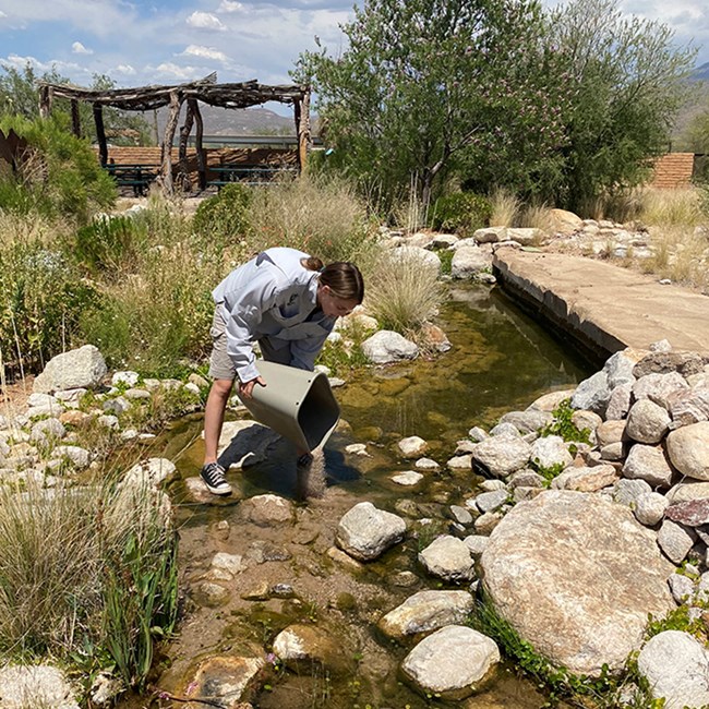
The DRLC has been closed to the public since March 2020, but we are starting a soft re-opening by scheduling onsite visits for educational tours and group programs. We are also starting to recruit interns and plan citizen science trips for 2022.
DRLC coordinator Elise Dillingham was recently interviewed by the Arizona Association for Environmental Education about how DRLC staff have modified programming to improve accessibility for people with disabilities. Read the article
Elise is also the subject of a recent NPS "Dare to Imagine" article. Find out how Elise went from training to become a flight nurse for the US Air Force to engaging youth citizen scientists in Southwestern parks! The Dare to Imagine series presents stories of women in conservation. Learn more about the work they do, the obstacles they have faced, and what they are most proud of.
From January to May, the DRLC teamed up with Tucson Audubon to present a monthly NPS lecture series online. The lectures were held on the third Thursday of every month. We’re taking a summer hiatus, but will likely continue the series in the fall. Lecture topics were wide-ranging, from the Woodbury Fire recovery at Tonto National Monument, to traditional turkey husbandry, to research on high-elevation springs in the Rincon Mountains. We want to thank everyone who presented and we look forward to future lectures.
Exotic Plants–Early Detection
Early detection surveys for non-native and invasive plant species were completed at Gila Cliff Dwellings, Montezuma Castle, and Tuzigoot national monuments this spring. At each park, crews walked areas most likely to be vectors of spread, such as roadsides, trails, and waterways. When a target species was observed, it was mapped using a GPS. The map data not only reflect the location of exotic species, but also capture the abundance, size, and shape of each patch and the life stage of its plants (vegetative, flowering, or fruiting). This latter information is useful for planning the timing of treatments, such as hand-pulling or spraying with herbicide. Data from these surveys are stored in the NPS GIS Portal. Park staff can access these interactive maps to view or download the location information. Please contact Sarah Studd for instructions on accessing the portal.
Vegetation and Soils
The SODN vegetation crew will working a few extra months this season in order to make up for covid-related sampling delays in 2020. From August 2021 through March 2022, crews will be working at Chiricahua, Montezuma Castle, Organ Pipe Cactus, and Tonto national monuments; Coronado National Memorial; and Saguaro National Park.
Streams
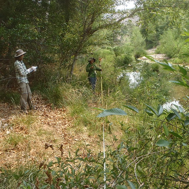
Riparian vegetation is monitored as part of the SODN streams protocol, with semi-permanent sites revisited every five years. This summer, crews have sampled at Pecos National Historical Park (in partnership with the Southern Plains Network), Tuzigoot National Monument, and both units of Montezuma Castle National Monument. Riparian vegetation is strongly influenced by stream-channel dynamics and water quality and quantity. The protocol measures plant community dynamics both at the water’s edge and in the lateral floodplain areas. A density plot captures tree-species demographics and recruitment patterns. We plan to return to these sites in the next year to survey the geomorphology of the channel cross-sections using RTK survey equipment. These precise elevation data will inform vegetation patterns and document channel fluctuations over time.
In partnership with regional staff, the SODN staff is deploying telemetry-enabled logging multi-parameter water-quality instruments (sondes) at locations throughout the network. These instruments use cellular and satellite systems to remotely communicate real-time data to a central cloud-based server 24 hours a day, seven days a week. The server is accessible from computer or smartphone, allowing scientists to immediately see if there are any system failures, rare events, or problems. These telemetry systems are being deployed at Quitobaquito Spring (Organ Pipe Cactus National Monument), at the DRLC (the network testing site), and other locations in the network.
The SODN streams monitoring protocol was implemented in full this year across the network. Water quality samples were collected and logging instruments were deployed in each quarter of WY2021. In June 2021, riparian vegetation was sampled at Pecos National Historical Park (in the Southern Plains Network, a Southwest Network Collaboration partner). Similar monitoring is planned for late June 2021 at Montezuma Castle National Monument. Thanks to all the parks for working with the SODN teams to make this happen!
Springs
Although only 30% of springs-monitoring sites were visited in 2020 (due to the covid-19 pandemic), the 2021 springs sampling year was fully completed through the diligence of the SODN crew and effective teamwork between Southwest Network Collaboration partners and network parks.
Mid-sized Mammals
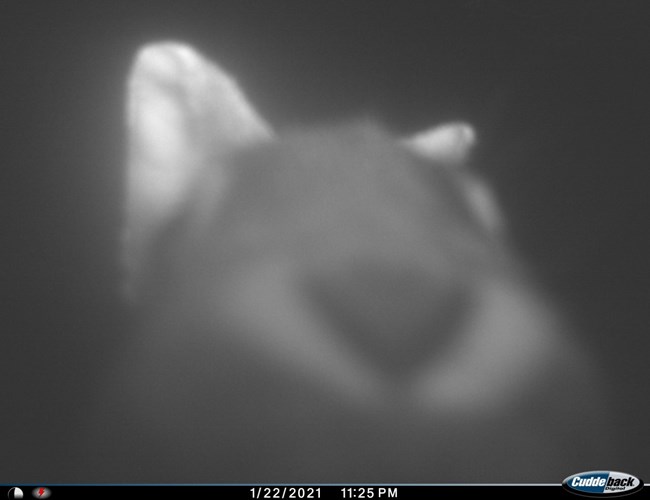
During the 2021 wildlife field season, SODN successfully deployed and retrieved wildlife cameras at Saguaro National Park, Organ Pipe Cactus National Monument, and Chiricahua National Monument. We are currently processing the thousands of photos and will share any notable ones with the parks, such as those that depict T&E species or would otherwise be useful for interpretive purposes. We have now collected five years’ of wildlife data, which is enough to begin occupancy analyses.
At Casa Grande Ruins National Monument, we are continuing to test the functionality of solar-powered wildlife cameras. Our monitoring typically requires more than 1,000 batteries annually to power the wildlife cameras. Although we would like to transition to solar-powered cameras, early test results indicate they may be less reliable than battery-powered ones.
After conducting a controlled experiment at the DRLC investigating how different scents might bias the results of our wildlife monitoring, we have instituted new protocols for camera hygiene. Read the story
Want to Know More?
Read past issues of The Heliograph!
Tags
- casa grande ruins national monument
- chiricahua national monument
- coronado national memorial
- fort bowie national historic site
- gila cliff dwellings national monument
- montezuma castle national monument
- organ pipe cactus national monument
- saguaro national park
- tonto national monument
- tumacácori national historical park
- tuzigoot national monument
- newsletter
- sonoran desert network
