Last updated: November 25, 2025
Article
SECN Highlights June 2024


NPS photo / Michael Flynn
Focus on the Coast
From SECN Program Manager:
Coastal areas in the southeastern U.S. are ground zero for potential impacts due to climate change and rising sea levels. Surface elevation table (SET) data collected in coastal areas by many federal and state agencies can be used to indicate how quickly the ground surface is sinking (or rising). This information is especially important to coastal parks facing threats from sea level rise and can shed light on future conditions once enough of this data can be assimilated and analyzed. Data from many of these monitoring sites, including data collected by SECN staff, were recently summarized in Surface Elevation Trends in North Carolina’s Coastal Wetlands, a white paper published by the North Carolina SET Community of Practice. Findings from this analysis suggest that 80% of sediment elevation monitoring sites in coastal North Carolina did not show ground elevations increasing fast enough to keep up with the rate of sea level rise over the last 30 years. Another regional monitoring effort led by the U.S. Fish and Wildlife Service showed that 85% of their monitored sites were not keeping up with recent sea level rise. This is concerning information, especially if you manage property or resources on the coast. Dave Hallac, Superintendent for the National Parks of Eastern North Carolina, recently commented on this article and believes these findings have important implications for the protective measures often used in sound-side areas and may help park managers make critical decisions on IF and WHERE to provide strategic protection of coastal resources in the future. A broader take on sea-level rise can be found in this recently published article, Ice to Ocean - Coastwatch (ncsu.edu).
Two new coastal monitoring efforts will start soon in the SER including an extensive analysis of SET data collected near park units along the east coast of the U.S. This project is funded by Inflation Reduction Act funds and led by Kevin Whalen, ecologist from the South Florida/Caribbean Network and will incorporate more recently collected data and include parks and sites that were not part of the N.C. white paper study. As this study gears up, another study designed to increase the accuracy of elevational data in marshes at eight Southeast Coast Network (SECN) coastal parks will kick off in FY2025. This USGS-NPS project, funded by the Natural Resource Fund Source, will allow prediction of marsh migration rates in areas of important park natural and cultural resources. Network staff will play an import role in the data collection and communication efforts related to both of these projects. Some initial findings for work already completed at Timucuan Ecological and Historical Preserve were recently published by USGS. See the article, Enhancing Assessments of Coastal Wetland Migration Potential with Sea‑level Rise: Accounting for Uncertainty in Elevation Data, Tidal Data, and Future Water Levels and its accompanying Fact Sheet.
Also, Ches Vervaeke, SECN staff member, is keeping up with the northern most mangroves as they continue their range expansion and northern march across the network’s coastal parks due to warmer temperatures, especially during winters. Although the actual ecological consequences of this species presence in our parks is unknown, their recent arrival in these new areas drives home climate change awareness in a way that is easy for parks and the public to see and appreciate. This issue is getting lots of media attention. See these recent articles for more information: Mangroves Move North as the Climate Heads South | U.S. Fish & Wildlife Service (fws.gov); and Climate change helps mangroves migrate from Florida to Georgia (savannahnow.com). In addition, Ches gave a presentation on the mangroves last month to the Georgia Association of Natural Resource Extension Professionals at their annual meeting in St. Simons Island.

Photo submitted
Elena Kelly is the new SIP Intern
Elena Kelly is the new Scientists in Parks (SIP) intern for the Southeast Coast Network. She started last month with the SECN Vegetation Team at Cumberland National Seashore. Originally from Raleigh, North Carolina, Elena graduated in May with a B.S. in Fisheries, Wildlife, and Conservation Biology and minors in Forest Management and Creative Writing from North Carolina State University. She previously worked as a Park Aide at Wake County Parks, Recreation, and Open Space; a Coastal Environmental Science Intern at the Bald Head Island Conservancy in southeastern North Carolina; and as a Sustainability Intern at N.C. State University. Elena said she is thrilled to join the Southeast Coast Network this year and gain experience in field monitoring and natural resource management of the beautiful biodiversity of the Southeastern U.S. Outside of work, Elena enjoys reading, writing, hiking, and camping. Her two lifelong dreams are to work for the National Park Service and one day, to thru-hike the Appalachian Trail. Welcome aboard Elena!

NPS photos / SECN staff
Fixed Station Repair at Cape Lookout
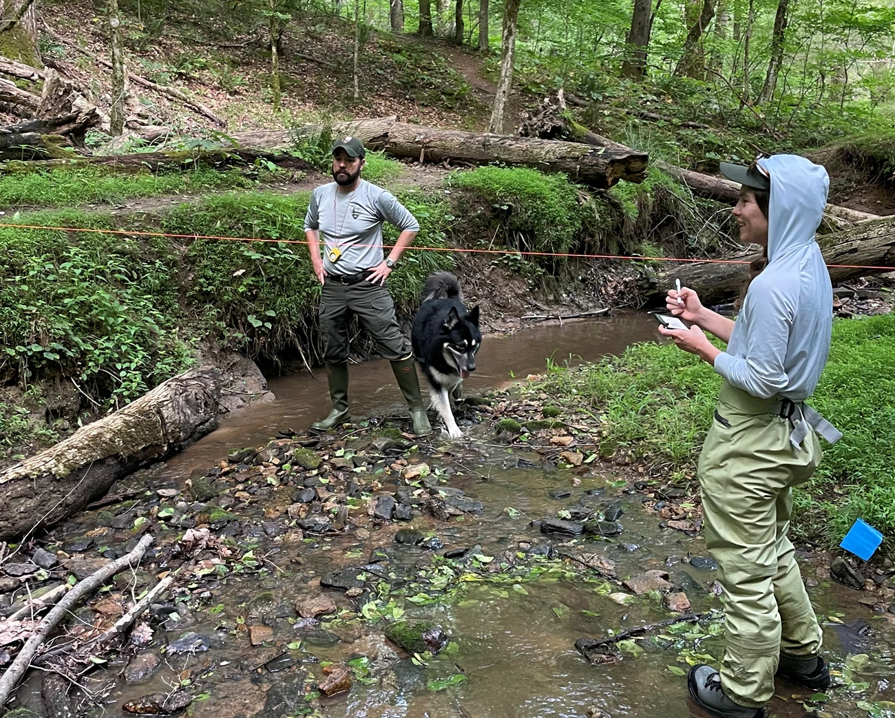
Aquatic Ecologist Eric Starkey and Hydrologic Technician Katie Dagastino traveled to Cape Lookout National Seashore recently to replace the sonde housing at the Shackleford Banks Dock. The new housing was constructed at the Athens office and transported to Cape Lookout and installed at the beginning of May. Assistance was provided by Justin Ridge from North Carolina National Estuarine Research Reserve who also assists the network with data collection at the park. Eric and Katie also traveled to Cape Hatteras National Seashore to check out the park's fixed station site and meet with a new technician who will assist in data collection there.

NPS photo / SECN staff
Goodbye Alyssa
Alyssa Sanderson finished her 52-week Scientists in Parks internship with the Southeast Coast Network last month. Alyssa mainly worked with the vegetation team, completing plot surveys at a number of park units, including Timucuan Ecological and Historic Preserve, Fort Matanzas National Monument, Cape Hatteras National Seashore, Fort Pulaski National Monument, and Cumberland Island National Seashore. This summer, Alyssa is heading on a solo trip to Peru, where she is hoping to explore Machu Picchu and the Amazon Rain Forest. When she returns, Alyssa will be moving to Arizona to pursue a M.S. in Forestry at Northern Arizona University. Her project will focus on using drone technology to better map and monitor wildfire events. Alyssa hopes to eventually return to working in the public lands in a research capacity after obtaining her degree.
From Alyssa:
I thoroughly enjoyed my time working with SECN and meeting all of the wonderful people doing such fantastic work for the I&M program. While I am very excited for myr next steps, I will greatly miss being a part of the SECN team.
Best wishes Alyssa!

NPS photo
Wayne Presents at IALE-NA
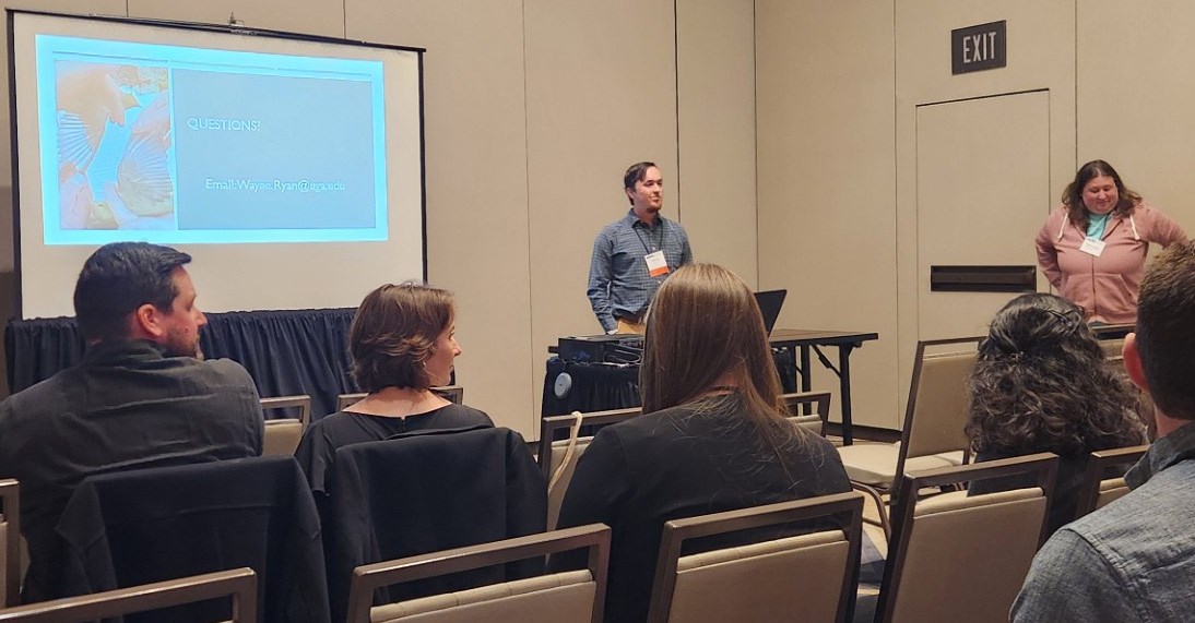
UGA Wildlife CESU Intern Wayne Ryan recently presented his master's research titled, "Effects of Prescribed Fire and Rhododendron Removal on Avian Populations in the Southern Appalachian Mountains" at the North American Regional Chapter of the International Association for Landscape Ecology (IALE-NA for short) conference in Oklahoma City, Oklahoma. Wayne supports the network’s Landbird and Vocal Anuran Communities monitoring programs.
Data Management Update
Efforts of the SECN data management team and the Central Support office Data Strike Team have reached fruition.The following data packages have been published and meet all current standards for data availability and metadata.
- Landbirds 2009-2010 DataStore - Pilot Landbird Monitoring throughout the Southeast Coast Network, 2009-2010 - Data Package (nps.gov)
- Herps 2009-2010 DataStore - [PILOT] Herpetological Monitoring Surveys for the Southeast Coast Network: 2009-2010 - Data Package (nps.gov)
- Veg 2009-2010 DataStore - Pilot Terrestrial Vegetation Monitoring in the Southeastern United States, 2009-2010 - Data Package (nps.gov)
- Herps 2011-2014 DataStore - [PILOT] Herpetological Monitoring Surveys for the Southeast Coast Network: 2011-2012 and 2014 - Data Package (nps.gov)
Many, many, thanks to Judd Patterson, the central support office and data strike team, and everyone in the SECN office that contributed to this huge effort to fill in the gaps in our data.

NPS photos / SECN staff
Checking out the Eclipse
Members of the SECN staff in Athens gathered around a telescope during the solar eclipse that took place in the afternoon of April 8. Wildlife Biologist Michael Parrish was kind enough to supply his 4.5-inch reflector telescope fitted with a solar filter so staff members could get a safe, up-close view. Former SIP Intern Alyssa Sanders brought a pair of eclipse glasses to the "party" giving the network multiple viewing options. Georgia was not in the path of totality as it was back in 2017, but roughly 80% of the sun was covered so the views were still impressive.
Vegetation Monitoring on Cumberland Island
Photos and Collage by Mallorie Davis, SECN Biological TechnicianClockwise from top left:
- Hanna Rosner-Katz, contractor from Florida Natural Areas Inventory, looking up at the tree canopy with SECN Botanist, Forbes Boyle;
- Field mascots, Frog and Toad;
- Former SIP Intern Alyssa Sanderson, Hanna, and Forbes working in the first dune plot of the season;
- Mallorie, Forbes, and Alyssa completing the final wetland plot;
- Forbes, Mallorie, Alyssa, and Kayleigh Hendley (Cultural Resources Program Manager) scouting Christmas Creek. Special thanks to Kayleigh for taking time to help us complete plots along the north end of Cumberland that day!
- Mallorie, Alyssa, Forbes, Sam Ruzkowski (CUIS Fire Specialist), and Lucas Hunkler (CUIS Fire Specialist) surveying an early-successional longleaf pine plot;
- Spring Ladies’ Tresses, Spiranthes, growing within one of the Maritime Forest plots;
- Forbes preparing to sample a “typical” Maritime Forest plot;
- A Ludgwigia growing in one of the non-tidal wetlands on Cumberland Island; and
- Alyssa and Forbes commemorating one of the final days together.

Recent Publications
The Southeast Coast Network recently published the following reports:
- Terrestrial Vegetation Monitoring at Chattahoochee River National Recreation Area: 2021 Data Summary. Availble at: DataStore - Terrestrial vegetation monitoring at Chattahoochee River National Recreation Area: 2021 data summary (nps.gov)
- Terrestrial Vegetation Monitoring at Canveral National Seashore: 2022 Data Summary. Available at: DataStore - Terrestrial vegetation monitoring at Canaveral National Seashore: 2022 data summary (nps.gov)
- Terrestrial Vegetation Monitoring at Cape Lookout National Seashore: 2022 Data Summary. Available at: DataStore - Terrestrial vegetation monitoring at Cape Lookout National Seashore: 2022 data summary (nps.gov)
- SECN Vocal Anuran Community Monitoring Program Summary. Available at: DataStore - Vocal Anuran Community Monitoring Protocol Brief 2024 (nps.gov)

NPS photo / SECN staff
Tags
- scientists in parks
- cape hatteras national seashore
- cape lookout national seashore
- north carolina national estuarine research reserve
- fixed-station water quality monitoring
- surface elevation tables
- sea level rise
- south florida caribbean network
- usgs
- usfws
- 2024 solar eclipse
- north american regional chapter of the international association for landscape ecology
- terrestrial vegetation monitoring
- cumberland island national seashore
- chattahoochee river national recreation area
- fort frederica national monument
- fort pulaski national monument
- timucuan ecological and historic preserve
- fort matanzas national monument
- canaveral national seashore
- horseshoe bend national military park
- kennesaw mountain national battlefield park
- ocmulgee mounds national historical park
- congaree national park
- moores creek national battlefield
- continuous water-quality monitoring
- park-wide assessments
- wadeable stream habitat monitoring
- shoreline change monitoring
- coastal wetlands monitoring
- landbird community monitoring
- vocal anuran community monitoring
- fort sumter and fort moultrie national historic park
- secn network highlights
