Last updated: December 1, 2025
Article
SECN Highlights February 2021


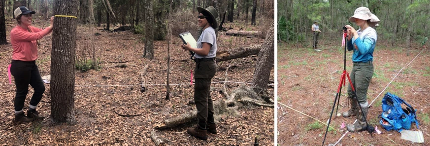
Photos courtesy of Claire Schmidt and Rachel Layko.
Network Staff Comings and Goings...
Claire Schmidt on board as the SECN Coastal Technician
Claire Schmidt began work as the Coastal Technician for the Southeast Coast Network in December. She will assist with shoreline data collection and processing for annual reports, benchmark installations and surveying. For the coastal wetlands project, Claire will handle data collection and processing, and assist with all aspects of new SET site installations. She will also manage field equipment and vehicles for the coastal program. Originally from Little Rock, Arkansas, Claire earned a B.S. degree in Biology with a minor in Earth Science from Knox College (Galesburg, Illinois). She worked as a Geoscientist-in-the-Park at the Alaska Regional Office of the National Park Service for a year and a half, helping to develop their Structure-from-Motion remote sensing program. Claire's professional interests include ecology and remote sensing. During her free time, she enjoys hiking, cooking new foods, and traveling (when we’re not in a pandemic). And, as a result of her recent move to Florida, she confesses she is becoming a beach bum.
Rachel Layko Joins SECN as a Geoscientists-in-the-Parks (GIP) Intern
Rachel Layko started a 20-week internship last month, part of the NPS Geoscientists-in-the-Parks program. Currently working remotely in North Carolina, Rachel will eventually relocate to Timucuan Ecological and Historic Preserve. Her initial project is to review and validate the 2014-2017 and 2017-2020 GTMNERR SET data. Additional project works will include a LiDAR project for the SECN coastal program which involves an inventory of what LiDAR is available for the network's coastal parks, identifying storm event vs. non storm event datasets, and performing a pilot project of change analysis for one of our coastal park beaches using the LiDAR datasets. Rachel is originally from Apex, North Carolina. She received a B.S. in Biology with a minor in Marine Science from William & Mary. She has worked with the Nature Conservancy, the National Audubon Society, and William & Mary’s Center for Geospatial Analysis. In these roles, she applied her background in GIS to support conservation and natural resource management. She currently serves on URISA’s (Urban and Regional Information Systems Association) Vanguard Cabinet where she co-chairs the mentoring subcommittee. Beyond work, Rachel enjoys hiking, running, and reading.
Lisa Cowart Baron leaving for Rocky Mountain National Park
Coastal ecologist Lisa Cowart Baron is leaving the Southeast Coast Network at the end of February to be a research coordinator for the Continental Divide Research Center at Rocky Mountain National Park. The SECN coastal program has grown in the six-plus years under Lisa's leadership. She counts relocating the program to Timucuan Ecological and Historic Preserve to better serve the coastal parks among her many accomplishments. While at the Southeast Coast Network, Lisa developed strong relationships with park staff, NPS colleagues, and various partners including the National Oceanic and Atmospheric Administration (NOAA), U.S. Fish and Wildlife Service (FWS) and the Guana-Tolomato-Matanzas National Estuarine Research Reserve (GTMNERR). Lisa also worked tirelessly to improve the coastal wetland monitoring effort and update the protocol, which should provide benefits for park management in the future.
And since our last newsletter...Wendy Wright is the new Data Manager
Wendy Wright was hired as the Southeast Coast Network's Data Manager last September. During her eight plus years with the Southeast Coast Network, Wendy has held positions as a graduate research assistant, working with our water-quality data and reporting, data management contractor, IT coordinator, and for the last five-plus years, managing editor for five Southeast Region I&M networks. In addition to her experience with regional programs, Wendy has a solid science and resource management background, with a B.S. in Natural Resource Economics and Management, a certificate in Water Resource Management, and an M.S. in Hydrology and Environmental Systems from the University of Georgia.

NPS photos / Forbes Boyle

NPS photo / Lisa Cowart Baron
Publications
The Southeast Coast Network published the following reports since August 2020:
- Wadeable Stream Habitat Monitoring at Kennesaw Mountain National Battlefield Park: 2019 Change Report. Available at: https://irma.nps.gov/DataStore/Reference/Profile/2280026.
- Wadeable Stream Habitat Monitoring at Ocmulgee Mounds National Historical Park: 2019 Change Report. Available at: https://irma.nps.gov/DataStore/Reference/Profile/2280071.
- Back Barrier Erosion Monitoring at Cumberland Island National Seashore: 2019 Survey Report. Available at: https://irma.nps.gov/DataStore/Reference/Profile/2279294.
- Standard Operating Procedure 1.4.11 Tree Measurements-Version 1.1. Available at: https://irma.nps.gov/DataStore/Reference/Profile/2282336.
For More About the SECN: https://www.nps.gov/im/secn/index.htm
Tags
- cape hatteras national seashore
- cape lookout national seashore
- cumberland island national seashore
- fort pulaski national monument
- chattahoochee river national recreation area
- timucuan ecological and historic preserve
- congaree national park
- ocmulgee mounds national historical park
- fort matanzas national monument
- vegetation community monitoring
- water and sediment quality assessment
- water quality monitoring
- landbird community monitoring
- vocal anurans
- shoreline change monitoring
- wadeable stream monitoring
- canaveral national seashore
- coastal wetlands monitoring
- surface elevation table
- secn network highlights
