Last updated: May 18, 2023
Article
Southeast Coast Network News December 2021
Workplan for FY2022 Approved
The Southeast Coast Network held its annual Steering Committee Meeting November 9-10. Due to COVID-19 travel precautions, the meeting was conducted virtually for a second straight year. This year’s meeting was well attended, with over 50 participants joining the meeting. The year’s activities were discussed and the plans for the upcoming year were presented, approved, and signed off on by Region I&M Chief, Brian Mitchell and the SECN Board Chair, K. Lynn Berry (Superintendent, CONG). Also, K. Lynn ended her two-year term as the SECN Board Chair and turn over this leadership position to Chris Hughes (Superintendent, TIMU). SECN staff would like to thank all of the SECN Steering Committee and Board members who work with us to make I&M a more successful program.

NPS photo / Stephen Cooper
Field Work Update
The FY2021 field work season wrapped up in November with a return to Chattahoochee River National Recreation Area by the Wadeable Stream Monitoring team to update a portion of the data collected in May. In addition, water-quality data collection trips were completed in October and November for Congaree National Park, Fort Pulaski National Monument , Cumberland Island National Seashore. Canaveral National Seashore, Fort Matanzas National Monument, and Timucuan Ecological and Historic Preserve. Fixed-station water-quality data collection continued with assistance from park staff and partners at Cape Hatteras National Seashore, and Cape Lookout National Seashore. All data collected for each SECN monitoring program is being processed with reports coming out soon. At the network's virtual Steering Committee and Board Meeting held Nov. 9-10, each program lead discussed field work plans for FY2022:
Coastal Wetlands
Surface Elevation Table (SET) sites were installed at Canaveral National Seashore, Fort Matanzas National Monument, Cumberland Island National Seashore, Fort Frederica National Monument , Fort Pulaski National Monument and Timucuan Ecological and Historic Preserve in FY21. The new sites are more accessible from both a safety and operations perspective. This new network of sites will allow for two readings per year and after any events such as hurricanes or floods. Finally, a new protocol is in review with publication expected early next year.
Landbird and Anuran Communities
Automated recording devices (ARDs) were deployed in Cape Lookout National Seashore, Cumberland Island National Seashore, Fort Sumter National Monument, Horseshoe Bend National Military Park and Kennesaw Mountain National Battlefield Park in FY21. The scheduled parks for FY22 include Canaveral National Seashore, Congaree National Park, Fort Frederica National Monument, Moores Creek National Battlefield and Ocmulgee Mounds National Historical Park. Deployments are scheduled from January to March and will be conducted with the assistance of short-term detail. A scientific review of both landbird and anuran monitoring efforts is also scheduled for FY22.
Shorelines
Shoreline position data was collected this fall at Fort Matanzas National Monument and park staff collected data at Cape Lookout National Seashore. Shoreline data will be collected by SECN staff at Canaveral National Seashore, Cumberland Island National Seashore, Timucuan Ecological and Historic Preserve and Fort Matanzas National Monument in spring 2022. Park staff will collect data at Cape Lookout National Seashore and Cape Hatteras National Seashore in the spring as well.
Vegetation Communities
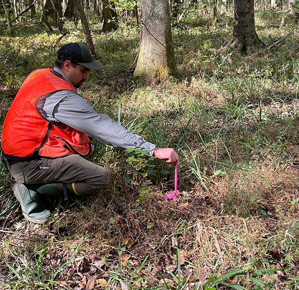
Data is being processed from this summer's field work at Congaree National Park, Ocmulgee Mounds National Historical Park, Chattahoochee River National Recreation Area and Kennesaw Mountain National Battlefield Park in FY21. Parks scheduled for monitoring in FY22 include Cape Lookout National Seashore, Moores Creek National Battlefield, Horseshoe Bend National Military Park and Canaveral National Seashore.
Wadeable Streams
Wadeable stream monitoring surveys will be conducted at Congaree National Park in April 2022. A trip was made last month to the park to confirm the location of permanent benchmarks in preparation for the survey.
Water Quality
Monthly data collection trips by SECN staff will continue for Congaree National Park, Fort Pulaski National Monument , Cumberland Island National Seashore. Canaveral National Seashore, Fort Matanzas National Monument, and Timucuan Ecological and Historic Preserve. Fixed-station time-series data collection also continues with assistance from park staff and partners at Cape Hatteras National Seashore, and Cape Lookout National Seashore. Park-wide assessments will be conducted at Cumberland Island National Seashore and Fort Matanzas National Monument in July 2022.
Recent Publications
The Southeast Coast Network recently published the following reports:
- Fixed-station water-quality monitoring at Cape Hatteras National Seashore: 2017–2019 data summary. Available at: https://irma.nps.gov/DataStore/Reference/Profile/2288146.
- Fixed-station water-quality monitoring at Cape Lookout National Seashore: 2017–2019 data summary. Available at: https://irma.nps.gov/DataStore/Reference/Profile/2288152.
- Fixed-station water-quality monitoring at Cumberland Island National Seashore: 2017–2019 data summary. Available at: https://irma.nps.gov/DataStore/Reference/Profile/2288144.
- Fixed-station water-quality monitoring at Fort Pulaski National Monument: 2017–2019 data summary. Available at: https://irma.nps.gov/DataStore/Reference/Profile/228815240.
Tags
- congaree national park
- fort pulaski national monument
- cumberland island national seashore
- canaveral national seashore
- fort matanzas national monument
- timucuan ecological and historic preserve
- cape hatteras national seashore
- cape lookout national seashore
- surface elevation table
- fort frederica national monument
- landbird and anuran communities
- landbird community monitoring
- anuran community monitoring
- fort sumter national monument
- horseshoe bend national military park
- ocmulgee mounds national historical park
- kennesaw mountain national battlefield park
- shoreline change monitoring
- shoreline position data
- vegetation monitoring
- vegetation community monitoring
- chattahoochee river national recreation area
- wadeable stream habitat monitoring
- wadeable stream habitat surveys
- water-quality data monitoring
- water and sediment quality assessment
- fixed station water quality
- southeast coast network news
