Last updated: November 25, 2025
Article
SECN Highlights August 2024


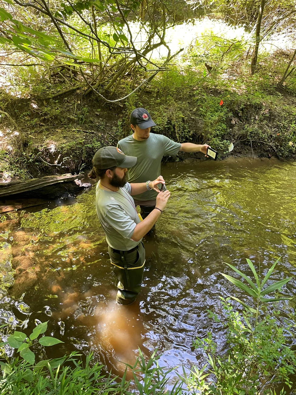
NPS photo / CHAT staff
Stephen and Jake Talk Wadeable Streams
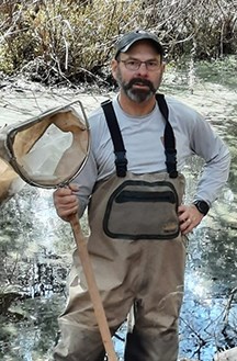
Last month, the SECN's wadeable stream survey crew took a break from work at the Crayfish Creek monitoring site to speak with a group of students from Youth 4 Environmental Action. The volunteers were removing invasive vegetation at a restoration site downstream from the network's site. Physical Scientist and Protocol Lead Stephen Cooper, along with Jacob Bateman-McDonald, an assistant professor at the University of North Georgia, explained what the Southeast Coast Network monitors and how it is interconnected with the surrounding riparian zone and larger ecosystem. They also provided more details on the NPS Inventory and Monitoring Division and the network and the role they play at the parks, as well as opportunities for recent high school graduates or college students in natural resource fields. Stephen and Jake also answered questions from the group. Jake, a former fluvial geomorphologist with the network, is the lead author on the protocol.Data Sets Published
A revised data package has been published for the five-network Surface Elevation Table monitoring effort. It contains surface elevation and marker horizon records collected from 1998-10-14 through 2024-06-28 for sites in the Southeast Coast Network, South Florida/Caribbean Network, Northeast Temperate Network, Northeast Coastal and Barrier Network and National Capital Region Network.A new data package has been published for the Southeast Coast Network. Data from parkwide water quality assessments at Cumberland Island National Seashore from 2007 through 2022 have been published here. Similar water quality data packages are expected for Fort Matanzas National Monument, Fort Pulaski National Monument, and Timucuan Ecological and Historic Preserve by the end of August.
Mangrove Movement Continues
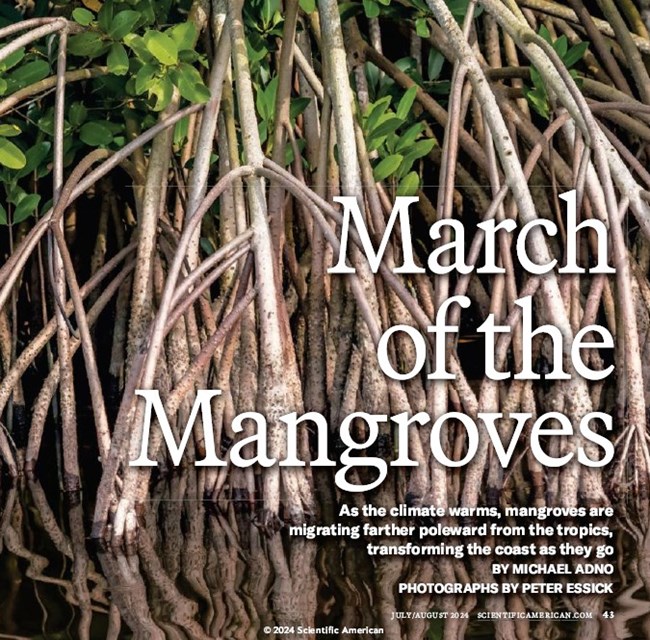
The SECN's Coastal Ecologist William "Ches" Vervaeke continues to spread the word about mangroves expanding their range up the East Coast. Ches is featured in Michael Adno's article, "March of the Mangroves," (online version) which appears in the July/August 2024 edition of Scientific American. Ches, who has studied mangroves for many years, was contacted by Adno about an article he was writing about the northern expansion of mangroves. The pair, along with University of North Florida Assistant Professor of Biology, Scott Jones; and Ilka Feller, an Ecologist with the Smithsonian Institution; searched for mangroves in the marshes near Cumberland and Amelia islands in December 2023, finding red and black mangroves all the way to the Georgia-Florida border. A subsequent trip in January, minus Felker, ended with the discovery of a mangrove off Cumberland Island near the St. Marys River, the first one documented in Georgia. Their find was also the subject of a story from www.thebrunswicknews.com, and was highlighted in a press release from UNF, "UNF biologist helps discover mangrove trees in Georgia farther north than ever recorded."
Ches recently co-authored a paper, "Mangroves of the Warm Temperate Northwest Atlantic," published in the ICUN Red List of Ecosystems Assessments. He also co-authored, "Enhancing Assessments of Coastal Wetland Migration Potential with Sea‑level Rise: Accounting for Uncertainty in Elevation Data, Tidal Data, and Future Water Levels," for Estuaries and Coasts.
SECN Program Manager Moves to New Role
Brian Gregory, SECN Program Manager, was recently selected to assume the role of the Regional Lead for I&M in the Southeast Region starting on September 8. Brian has been the program manager at the network since 2015 and prior to that served as the water-quality specialist for the Southeast Coast Network. “Hopefully, the experiences I have gained working with my staff here and the 17 diverse parks across our network will have prepared me well for this next step” Brian commented. “It was also a great experience serving the parks in the area where I was born and raised as well as having my first park (Ocmulgee Mounds National Historical Park) part of my network.” Brian plans to be more involved in regional natural resource activities and work closely with other divisions. As part of his new role he will be spending more time at the Regional office and at other I&M network offices and parks. Good luck, Brian!
Recent Publications
The Southeast Coast Network recently published the following reports:
- Terrestrial Vegetation Monitoring at Horseshoe Bend National Military Park: 2022 Data Summary. Available at: DataStore - Terrestrial vegetation monitoring at Horseshoe Bend National Military Park: 2022 data summary (nps.gov)
- Assessment of Estuarine Water and Sediment Quality at Cumberland Island National Seashore: 2017 Data Summary-Version 1.1. Available at: DataStore - Assessment of estuarine water and sediment quality at Cumberland Island National Seashore: 2017 data summary—version 1.1 (nps.gov)
- SOP 1.1.05 Plot Photo Points-Version 2.1. Available at: DataStore - Standard Operating Procedure 1.1.05 Plot Photo Points Version 2.1 (nps.gov)
- SOP 1.4.07 Field Season Preparation-Version 1.2. Available at: DataStore - Standard Operating Procedure 1.4.07 Field Season Preparation—Version 1.2 (nps.gov)
- SOP 1.4.10 Site Selection, Plot Establishment, and Return Visits-Version 1.2. Available at: DataStore - Standard Operating Procedure 1.4.10 Site Selection, Plot Establishment, and Return Visits—Version 1.2 (nps.gov)
- SOP 1.4.11 Tree Measurements-Version 1.2. Available at: DataStore - Standard Operating Procedure 1.4.11 Tree Measurements—Version 1.2 (nps.gov)
- SOP 1.4.12 Fuel Load Measurements-Version 1.1. Available at: DataStore - Standard Operating Procedure 1.4.12 Fuel Load Measurements—Version 1.1 (nps.gov)
- SOP 1.4.14 Species Diversity and Seedling/Sapling Measurements-Version 1.1. Available at: DataStore - Standard Operating Procedure 1.4.14 Species Diversity and Seedling/Sapling Measurements—Version 1.1 (nps.gov)

NPS photo / SECN staff
NPS photos / SECN staff
NPS photo / SECN staff

NPS photo / SECN staff
Tags
- chattahoochee river national recreation area
- wadeable stream habitat monitoring
- youth 4 environmental action
- surface elevation table
- park-wide assessments
- estuarine water and sediment quality
- mangroves
- scientific american
- terrestrial vegetation monitoring
- southeast coast network
- fort frederica national monument
- cumberland island national seashore
- fort pulaski national monument
- timucuan ecological and historic preserve
- fort matanzas national monument
- cape hatteras national seashore
- cape lookout national seashore
- horseshoe bend national military park
- moores creek national battlefield
- canaveral national seashore
- congaree national park
- kennesaw mountain national battlefield park
- ocmulgee mounds national historical park
- landbird community monitoring
- vocal anuran community monitoring
- fort sumter and fort moultrie national historic park
- shoreline change monitoring
- coastal wetlands monitoring
- secn-newsletter
- secn network highlights
