Last updated: April 30, 2025
Article
SECN Newsletter April 2025

NPS / SECN
NPS / SECN
Enter the Dragonflies
Katie and Mallorie Help CUIS with the Dragonfly Mercury Project
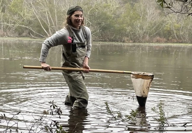
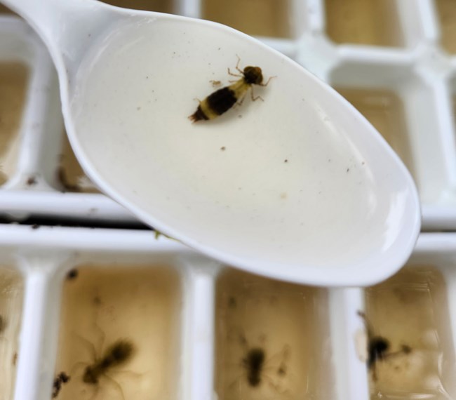
Hydrologic Technician Katie Dagastino and Biological Technician Mallorie Davis assisted Cumberland Island National Seashore with their dragonfly larvae and water sample collection to detect mercury levels in the park’s ecosystem. It is part of a collaborative effort with the United States Geological Survey’s (USGS) Dragonfly Mercury Project. Dragonfly larvae are used as bioindicators of mercury contamination and potential degradation in freshwater aquatic ecosystems, providing valuable insight to the presence and concentration of mercury. Cumberland Island National Seashore is an ideal location to study potential impacts of mercury because of its diverse habitats and wildlife. Katie and Mallorie collected larvae from two wetlands to ensure samples were representative of different environmental conditions.According to Katie, “these larvae will be analyzed for mercury content in a lab, and those data will contribute to a broader understanding of mercury accumulation patterns across various regions of the island.” She added that the work “supports the park’s objectives to understand the health of aquatic ecosystems and the organisms that depend on them. Data collected will not only aid in understanding mercury extent on Cumberland Island but inform future conservation strategies and guide park management practices.”
For More on the DragonFly Mercury Project:
https://www.nps.gov/subjects/citizenscience/dragonfly-mercury-project.htmTo See Data for the DragonFly Mercury Project:
https://www.nps.gov/articles/dragonfly-mercury-data.htm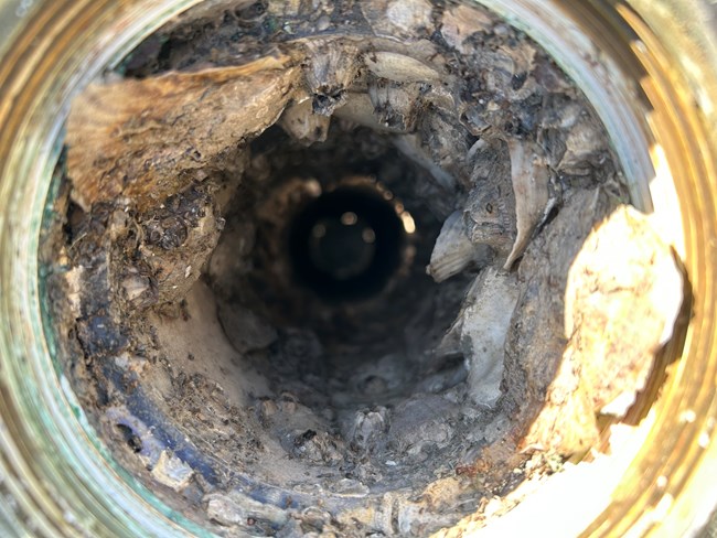
NPS / SECN
From the Aquatic Ecologist:
Winter Maintenance and Sonde Rescue
Over the winter, biological fouling of water-quality sondes typically slows down with lower water temperatures. As such, the network usually takes advantage of this lull in fouling to send off a third of our fleet of sondes for winter maintenance at YSI. This is like taking a car to the mechanic for service at 100,000 miles. They check for cracks in the bulkhead, check O-ring seals, grease this and that, do a pressure test, and fix worn central wipers. Doing this prolongs the life of our equipment, prevents down time and increases the quality of the data. This years’ service has been a little more challenging to get completed but we are finding ways to get it done and hope to get these “fresh” sondes deployed in place of the ones that many of you helped us retrieve earlier in March.
I would be remiss not to thank all of you that helped rescue our sondes from the housings during ongoing travel restrictions. Without your help, the sondes could have been damaged and/or stuck in the housings which would have required a complete re-build of the site. Without monthly maintenance, the housings (PVC pipe) can quickly become restricted due to barnacle growth. Your help saved us a lot of money, and additional downtime! Thanks again! Plans are underway to get all the sondes back to Athens shortly so that we can download and process the data collected January through Mid-March. Fingers crossed that we can get out there in person shortly, but if not we will revert to our COVID operations and send them via FedEx. Please reach out with any data questions and remember that the continuous data are available from the Aquarius Web Portal (https://irma.nps.gov/aqwebportal/).
Aquatic Ecologist (Acting NPM) Eric Starkey

Talking Mangroves
SECN Coastal Ecologist on NPR's Yale Climate Connections
William "Ches" Vervaeke, SECN Coastal Ecologist, was recently featured on National Public Radio (NPR)'s Yale Climate Connections broadcast discussing mangroves and their expansion into Georgia from Florida. "‘Holy cow!’ Mangroves discovered in Georgia, farther north than ever before" aired in February. In the interview conducted by Ethan Freedman, Ches described that first time he and a group of researchers discovered the mangroves had crossed the border. The decreased frequency of freezing temperatures, according to Ches, is the main reason the mangroves are on the move. For more, check out ‘Holy cow!’ Mangroves discovered in Georgia, farther north than ever before » Yale Climate Connections.
Ches was also lead author for the paper, "Ongoing Range Shift of Mangrove Foundation Species: Avicennia germinans and Rhizophora mangle in Georgia, United States," which was published in Estuaries and Coasts in March. The report focuses on data collected from target surveys along the Atlantic coasts of Florida and Georgia at the northern limit of mangroves in the U.S. It available at Ongoing Range Shift of Mangrove Foundation Species: Avicennia germinans and Rhizophora mangle in Georgia, United States | Estuaries and Coasts.
NPS / SECN
FY2025 Monitoring Updates
The FY2025 is underway for the Southeast Coast Network but a pause in travel has limited field work. But, data collected in FY2024 are being processed along with data from the FY2022 and 2023 field seasons. Data packages and reports are coming soon.
Landbird and Anuran Communities
In February, 11 automated recording devices (ARDs) were deployed at Fort Frederica National Monument and CESU and UGA Intern Myra Davis deployed 22 ARDs at Ocmulgee Mounds National Historical Park. The ARDs for Canaveral National Seashore were shipped to the park, who deployed last month. The other FY2025 parks, Congaree National Park and Moores Creek National Battlefield were already deployed. Recordings for the season began last month and continue through July. The ARDs from FY2024 at Cumberland Island National Seashore were retrieved in February. The ARDs from FY2024 at Horseshoe Bend National Military Park, Kennesaw Mountain National Battlefield Park, Fort Sumter and Fort Moultrie National Historical Park and Cape Lookout National Seashore have been collected and data is being processed.
Wadeable Streams
Wadeable stream surveys will be conducted at four sites at Congaree National Park in 2025. Site maintenance is planned for late April and with the surveys scheduled for the middle of May, weather permitting. Monitoring at 13 sites in Chattahoochee River National Recreation Area was completed in 2024 and data collected have been processed. A summary report from FY2021 data collection at Chattahoochee River National Recreation Area was published this spring. Change reports for Kennesaw Mountain National Battlefield Park (2023), Horseshoe Bend National Military Park (2023), Ocmulgee Mounds National Historical Park (2023) and Congaree National Park (2022) will also be published in 2025.
Vegetation Communities
Ninety-five plots are scheduled to be survey across three parks in 2025. The SECN Veg Team is scheduled for Ocmulgee Mounds National Historical Park in early May, Congaree National Park in mid-May to June, and Kennesaw Mountain National Battlefield Park in July. Data collected at 102 plots from during the FY2024 season at Chattahoochee River National Recreation Area, Fort Frederica National Monument and Cumberland Island National Seashore is being processed. Data collected in FY2023 at Cape Hatteras National Seashore, Fort Pulaski National Monument, Timucuan Ecological and Historic Preserve and Fort Matanzas National Monument are processed.
Coastal Wetlands
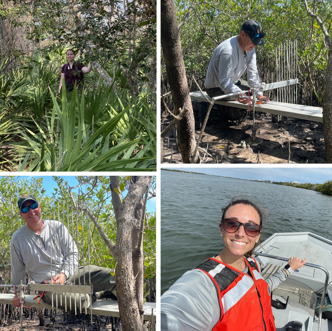
Surface Elevation Table (SET) sites at Timucuan Ecological and Historic Preserve, Fort Matanzas National Monument and Cumberland Island National Seashore were read last month. Other parks scheduled for FY2025 include Fort Pulaski National Monument, Cape Hatteras National Seashore, Cape Lookout National Seashore, Canaveral National Seashore, and Fort Frederica National Monument. Data collected through 2024 have been published as part of a cumulative data package with recent findings to be discussed with park managers. No reports are planned for this monitoring effort until sites have at least five years of data.
Shorelines
Spring surveys were conducted at Timucuan Ecological and Historic Preserve, Fort Matanzas National Monument and Cumberland Island National Seashore . Surveys at Cape Lookout National Seashore, Cape Hatteras National Seashore, and Canaveral National Seashore, will be completed later this spring.
Water Quality
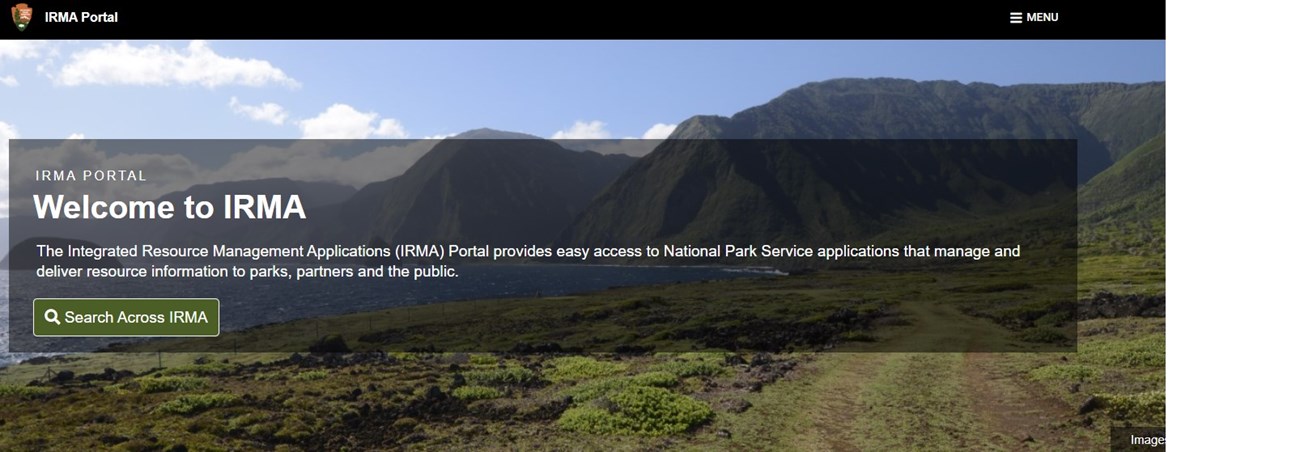
Recent Publications
The Southeast Coast Network recently published the following reports:
Aquatic
- Assessment of Estuarine Water Quality at Canaveral National Seashore: 2024 Data Summary: DataStore - Assessment of estuarine water quality at Canaveral National Seashore: 2024 data summary
- Assessment of Estuarine Water Quality at Cumberland Island National Seashore: 2022 Data Summary: DataStore - Assessment of estuarine water quality at Cumberland Island National Seashore: 2022 data summary
- Assessment of Estuarine Water Quality at Fort Matanzas National Monument: 2022 Data Summary: DataStore - Assessment of estuarine water quality at Fort Matanzas National Monument: 2022 data summary
- Assessment of Estuarine Water Quality at Fort Pulaski National Monument: 2023 Data Summary: DataStore - Assessment of estuarine water quality at Fort Pulaski National Monument: 2023 data summary
- Assessment of Estuarine Water Quality at Timucuan Ecological and Historic Preserve: 2023 Data Summary: DataStore - Assessment of estuarine water quality at Timucuan Ecological and Historic Preserve: 2023 data summary.
Wadeable
- Wadeable Stream Habitat Monitoring at Chattahoochee River National Recreation Area: 2021 Change Report. Available at: DataStore - Wadeable stream habitat monitoring at Chattahoochee River National Recreation Area: 2021 change report
For More About the SECN
Check out Southeast Coast Inventory & Monitoring Network (U.S. National Park Service) (https://www.nps.gov/im/secn/index.htm)Tags
- dragonfly mercury project
- cumberland island national seashore
- timucuan ecological and historic preserve
- continuous water-quality monitoring
- fixed-station water quality monitoring
- mangroves
- landbird and anuran communities
- fort frederica national monument
- ocmulgee mounds national historical park
- congaree national park
- moores creek national battlefield
- horseshoe bend national military park
- kennesaw mountain national battlefield park
- fort sumter and fort moultrie national historic park
- fort sumter and fort moultrie national historical park
- cape lookout national seashore
- cape hatteras national seashore
- wadeable stream habitat monitoring
- chattahoochee river national recreation area
- terrestrial vegetation monitoring
- fort pulaski national monument
- coastal wetlands monitoring
- canaveral national seashore
- fort matanzas national monument
- shoreline change monitoring
- southeast coast network news
- southeast coast inventory and monitoring network
- secn-newsletter
