Last updated: May 18, 2023
Article
Southeast Coast Network News April 2023
SET Data Available on IRMA
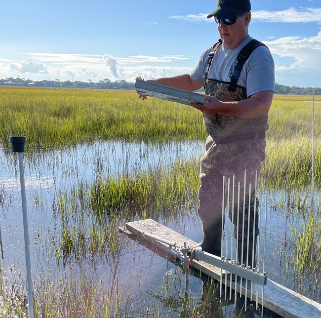
The inaugural data package for surface elevation table (SET) wetland monitoring is now publicly available on the National Park Service DataStore. The data package is the result of a multi-region, multi-network collaboration between the Northeast Temperate Network (NETN; NER), Northeast Coastal Barrier Network (NCBN; NER), National Capital Region Network (NCRN; NCR), Southeast Coast Network (SECN; SER), and South Florida / Caribbean Network (SFCN; SER). This package includes data spanning twenty national park units along the eastern seaboard, from Acadia National Park to the Virgin Islands. The period of record is October 14, 1998 to October 21, 2022. Overall, the data package includes 4,571 individual monitoring events during which 164,925 pin readings and 27,216 marker horizon measurements were collected.The cumulative data package will be updated annually on February 1 and periodically as needed.For more information on the National I&M SET Database or data publication, contact Adam Kozlowski (NETN Data Manager, e-mail us) or Wendy Wright (SECN Data Manager, e-mail us), Dennis Skidds (NCBN Data Manager, e-mail us) or David Jones (NCRN Data Manager, e-mail us).The data package with complete metadata is available in the Data Store at DataStore - Surface Elevation Table (SET) Data Package (nps.gov).
Aquatics Team attends Low-Gradient Stream Symposium at Congaree National Park
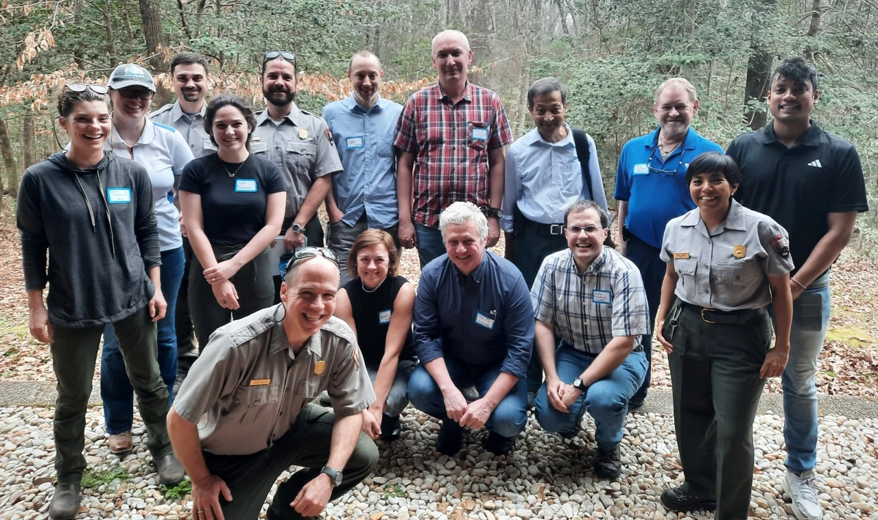
In late February Aquatic Ecologist Eric Starkey, Physical Scientist Stephen Cooper, and Hydrologic Technician Katie Dagastino attended the Congaree National Park’s Low-Gradient Stream Symposium. This was the first event of its kind and was an opportunity to bring together practitioners from multiple agencies to discuss ongoing research and monitoring in low gradient/blackwater streams. The Southeast Coast Network presented results from wadeable stream habitat and water-quality monitoring at sites along Cedar and McKenzie Creeks. Showcasing SECN monitoring at this meeting fostered important conversations with the South Carolina Department of Health and Environmental Control (DHEC) about the need for additional biomonitoring information on these unique stream types and future collaboration on benthic macroinvertebrate sampling in the park. In addition, SECN staff learned more about the dynamic nature of the Congaree River floodplain and the river’s impact on park resources.
Teaching Children to Fish
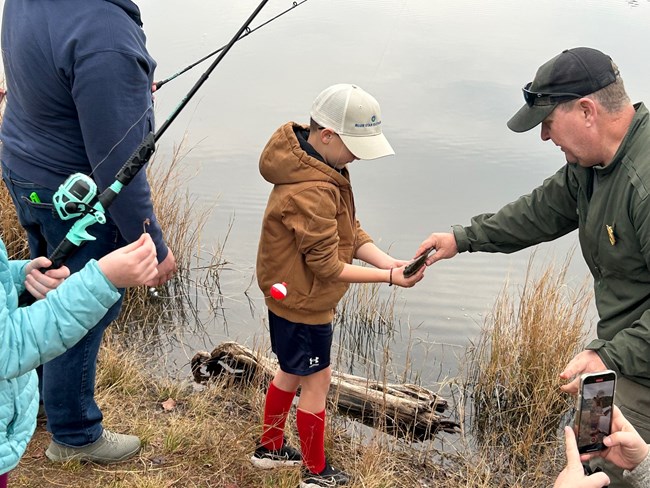
SECN Coastal Ecologist William "Ches" Vervaeke recently particpated in the Junior Ranger Angler Fishing Clinic for Blue Star Families of Jacksonville. Along side park rangers from Timucuan Ecological and Historic Preserve and Timucuan Parks Foundation volunteers, Ches taught the Blue Star youth from age 3-16 how to properly use fishing poles, hooks, lures and nets. Blue Star Families is a national nonprofit that supports military families through community connection.
FY2023 Monitoring Updates
The FY2023 fieldwork season is underway for the Southeast Coast Network. Data collected in FY2022 for each SECN monitoring program is being processed with reports and data packages getting prepared for publication.
Coastal Wetlands
Surface Elevation Table (SET) sites at all coastal parks including Canaveral National Seashore, Fort Matanzas National Monument, Fort Pulaski National Monument, Fort Frederica National Monument and Cumberland Island National Seashore will be read twice in FY2023. A first read at Cape Hatteras National Seashore was completed in February.
A revised monitoring protocol is being reviewed with approval and publication expected later this year. Coastal Ecologist William "Ches" Vervaeke attended the North Carolina SET Community Data Workshop in Morehead City, N.C. at the end of March.
Landbird and Anuran Communities
Automated recording devices (ARDs) for the FY2023 field season have been deployed at Cape Hatteras National Seashore, Chattahoochee River National Recreation Area, Fort Pulaski National Monument, Fort Matanzas National Monument and Timucuan Ecological and Historic Preserve and recordings began in March.
Analysis of FY2021 landbird and vocal anuran monitoring data at Cape Lookout National Seashore, Cumberland Island National Seashore, Fort Sumter and Fort Moultrie National Historical Park, Horseshoe Bend National Military Park, and Kennesaw Mountain National Battlefield Park is nearing completion with all reports expected to be completed this year. In addition to completing the scheduled monitoring for FY 2022, anuran vocalizations collected in FY 2015, 2016 and 2017 are being processed and data sets from these monitoring events will be published in the coming weeks.
Shorelines
Spring shoreline surveys were completed at Timucuan Ecological and Historic Preserve, Cape Hatteras National Seashore, and Cape Lookout National Seashore. Canaveral National Seashore, Fort Matanzas National Monument, Fort Pulaski National Monument, and Fort Frederica National Monument are scheduled to be completed in April.
Data collected during fall surveys at Cape Hatteras National Seashore and Cape Lookout National Seashore, along with post-storm (Hurricanes Ian and Nicole) surveys at Canaveral National Seashore, Fort Matanzas National Monument, Fort Pulaski National Monument and Fort Frederica National Monument are being processed. The post storm report for Canaveral National Seashore has been published (link below). Data collected during spring surveys in FY2022 at Canaveral National Seashore, Cumberland Island National Seashore, Timucuan Ecological and Historic Preserve, Fort Matanzas National Monument, Cape Lookout National Seashore and Cape Hatteras National Seashore have been processed with reports coming soon. Shoreline survey data are made available to parks in a user-friendly dashboard recently created by SECN staff (available at: DataStore - Southeast Coast Network Shoreline Change Monitoring Geodatabases 2018-2022 Shoreline Change Data (nps.gov)).
Vegetation Communities
The FY2023 monitoring season will start in late May or early June at Timucuan Ecological and Historic Preserve. Fieldwork is scheduled at Fort Matanzas National Monument in mid-June and Cape Hatteras National Seashore in late July or early August. Monitoring at Fort Pulaski National Monument is scheduled for late August.
Data collected in FY2022 at Horseshoe Bend National Military Park, Cape Lookout National Seashore, Moores Creek National Battlefield and Canaveral National Seashore is being processed along with data collected during FY2021 at Congaree National Park, Ocmulgee Mounds National Historical Park, Chattahoochee River National Recreation Area and Kennesaw Mountain National Battlefield Park. FY2023 marks the beginning of the second round of vegetation community monitoring at SECN parks.
Wadeable Streams
Wadeable stream surveys will be conducted at three parks in FY2023 including Horseshoe Bend National Military Park, Kennesaw Mountain National Battlefield Park and Ocmulgee Mounds National Historical Park. The tentative schedule is to complete all three parks the week of May 1. Site maintenance and prep at all three parks is scheduled in April prior to the surveys.
Processing continues for data collected from wadeable stream monitoring surveys conducted in FY2022 at Congaree National Park and a summary report from the previous year's data collection at Chattahoochee River National Recreation Area will be published later this year.
Water Quality
In February and March, water-quality data were collected at Fort Pulaski National Monument, Cumberland Island National Seashore, Canaveral National Seashore, Fort Matanzas National Monument, and Timucuan Ecological and Historic Preserve. Data were also collected at Congaree National Park in February. Monthly visits to parks will continue in 2023 with assistance from park staff and partners at Cape Hatteras National Seashore, and Cape Lookout National Seashore. Park-wide assessments are scheduled for this summer at Fort Pulaski National Monument and Timucuan Ecological and Historic Preserve in July.
Data collected during last summer's park-wide water-quality assessments at Cumberland Island National Seashore and Fort Matanzas National Monument will be reported later this year. The revised protocol for estuarine water and sediment quality monitoring is due for publication later this spring.
Recent Publications
The Southeast Coast Network recently published the following reports:
- Post Tropical Storm Ian and Hurricane Nicole Storm Report 2022. Available at: DataStore - Shoreline change at Canaveral National Seashore: Post Tropical Storm Ian and Hurricane Nicole Storm Report 2022 (nps.gov)
Tags
- congaree national park
- low-gradient stream symposium
- south carolina department of health and environmental control
- congaree river
- junior ranger angler fishing clinic
- blue star families of jacksonville
- timucuan ecological and historic preserve
- timucuan parks foundation
- southeast coast network
- surface elevation table
- canaveral national seashore
- fort matanzas national monument
- cumberland island national seashore
- cape hatteras national seashore
- north carolina set community data workshop
- chattahoochee river national recreation area
- fort pulaski national monument
- cape lookout national seashore
- fort sumter and fort moultrie national historical park
- horseshoe bend national military park
- kennesaw mountain national battlefield park
- fort frederica national monument
- shoreline change monitoring
- landbird and anuran communities
- automated recording devices
- ards
- vegetation community monitoring
- ocmulgee mounds national historical park
- wadeable stream habitat monitoring
- estuarine water quality
- estuarine water and sediment quality
- park-wide assessments
- tropical storm ian
- hurricane nicole
- inventory and monitoring division
- southeast coast network news