Last updated: December 1, 2025
Article
SECN Highlights April 2021


Photo courtesy of Ches Vervaeke
USGS Ecologist Assists with Coastal Monitoring
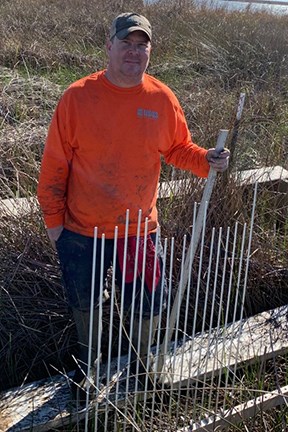
William “Ches” Vervaeke is detailing with the Southeast Coast Network to install and survey Surface Elevation Tables (SETs) at five coastal parks. Ches is a USGS ecologist at the Wetland and Aquatic Research Center (WARC) in Lafayette, Louisiana and is an expert at all things SET, including work on a patent for a device that allows automated SET readings that can be done quickly and more accurately. He was the primary SET reader for a long-term elevation study in the Florida Everglades and an investigation of the effects of sedimentation on elevation change in a brackish wetland. Ches’ real passion in the field of wetland ecology is understanding below ground biotic processes and how these processes contribute to wetland elevation change and their ability to adapt to sea level rise. He earned a BS and MS in Marine Biology and Estuarine Ecology from the University of Southern Mississippi. He is currently enrolled in the University of Louisiana at Lafayette’s Environmental and Evolutionary Biology PhD program studying elevation dynamics of black mangroves as they expand their northern range due to climate change (estimated 2023 graduation). Ches will be assisting the SECN coastal team through June.

NPS photo /SECN staff
Botanist Leads Plant ID Session at Cumberland Island National Seashore
Forbes Boyle, SECN Botanist, led a plant identification training session for Cumberland Island National Seashore staff and volunteers on February 26, 2021. Boyle presented to the Interpretation and Education Division tips on identifying a few of the more common plants on the island, giving them information to use on future guided tours.
Aquatic Team Studies Water-Quality Principles
Hydrologic Technician Daniel McCay and Aquatic Ecologist Eric Starkey recently completed the USGS Water-Quality Principles course (QW1022). The course introduced and reinforced principles and practices fundamental to the development and execution of water-quality studies. Topics included inorganic, organic, and isotope chemistry; ecology and microbiology; concepts of quality assurance and quality control in project work; approaches for evaluating the sources, fate, and transport of contaminants in the aquatic environment; and several methods of illustration and interpretation that can be used to help parks understand water-quality data. In addition to the self- guided online classes, Daniel and Eric participated in “live” video sessions with instructors, worked with a dataset from a case study, and discussed their findings in a final presentation. This training will help the network respond to surface and groundwater issues that may arise in our parks. For more information, contact Eric Starkey.

NPS photo / SECN staff
Elizabeth Rico Takes Part in Prescribed Burn
Elizabeth Rico, SECN Biological Technician, assisted park staff with a prescribed burn at Cumberland Island National Seashore February 4-5. Rico assisted holding the line, checked for spot fires, and ignited the outside edges of the unit. It was not Elizabeth's first time with her feet near the fire. In October 2020, she traveled to California to work as a REAF (Wildland Fire Resource Advisor) to the Bobcat fire in Angeles National Forest. Elizabeth worked with hand crews and heavy equipment to assess, repair, and naturalize sections of dozer and hand lines that crossed through trails and were in Inventoried Roadless Areas (IRAs).

NPS photo / SECN staff
New Stream Name at Chattahoochee River National Recreation Area
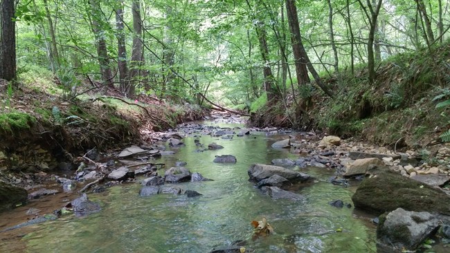
Crayfish Creek, an unofficial name given by the Southeast Coast Network to an unnamed wadeable stream in Chattahoochee River National Recreation Area, is now official. The tributary was recently named Crayfish Creek by the U.S Board on Geographic Names and entered into the Geographic Names Information System, the nation's official geographic names repository, which is available and searchable online at https://usgs.gov/geonames/domestic-names. Stephen Cooper, SECN Physical Scientist; Jacob Bateman McDonald, former SECN Fluvial Geomorphologist; and SECN Aquatic Ecologist Eric Starkey came up with the moniker while conducting surveys for the SECN’s wadeable stream habitat monitoring effort in 2017. The team agreed upon the name after a few crayfish they discovered under rocks in the streambed kept getting their attention. Park Hydrologist Ann Couch spearheaded the effort to get the name on the official books. In addition, a restoration project downstream from the network's monitoring site has adapted the name Crayfish Creek. The stream is part of the Chattahoochee River Wild Trout Improvement Project, a collaborative effort between the park and many external partners including the University of Georgia, Trout Unlimited, and Chattahoochee Riverkeeper.
Recent Publications
The Southeast Coast Network published the following reports since February 2021:
- SOP 2.1.01 Revision of Southeast Coast Network Protocols and Standard Operating Procedures—Version 3.1. Available at: https://irma.nps.gov/DataStore/Reference/Profile/2284603.
- SOP 3.1.01 Reporting of On-Duty Injury, Illness, Near Misses, Hazards and Exposure—Version 5.0. Available at: https://irma.nps.gov/DataStore/Reference/Profile/2284673.
- SOP 3.1.02 Safe Operation of Southeast Coast Network Watercraft—Version 2.1. Available at: https://irma.nps.gov/DataStore/Reference/Profile/2284674.
- SOP 3.1.03 Vehicle Use and Operation—Version 2.1. Available at: https://irma.nps.gov/DataStore/Reference/Profile/2284675.
- SOP 3.1.04 Motor Vehicle Accident Reporting Procedures—Version 2.1. Available at: https://irma.nps.gov/DataStore/Reference/Profile/2284676.
- SOP 3.1.06 Logistics for Camping While Conducting Field Work—Version 2.1. Available at: https://irma.nps.gov/DataStore/Reference/Profile/2284682.
- SOP 3.1.07 Communicating Field Operations with SECN Parks—Version 3.1. Available at: https://irma.nps.gov/DataStore/Reference/Profile/2284677.
For More About the SECN: https://www.nps.gov/im/secn/index.htm
Tags
- cumberland island national seashore
- fort sumter national monument
- cape lookout national seashore
- kennesaw mountain national battlefield park
- horseshoe bend national military park
- canaveral national seashore
- timucuan ecological and historic preserve
- fort matanzas national monument
- congaree national park
- chattahoochee river national recreation area
- ocmulgee mounds national historical park
- fort pulaski national monument
- cape hatteras national seashore
- water quality monitoring
- landbird community monitoring
- vocal anuran community monitoring
- prescribed burning
- shoreline change monitoring
- surface elevation table
- coastal wetlands monitoring
- vegetation community monitoring
- usgs
- secn network highlights
