Last updated: June 1, 2023
Article
Making an Impact: Long-Term Monitoring of Natural Resources at Intermountain Region National Parks, 2021
Science-based management is critical to protecting, restoring, and maintaining national park ecosystems. Underlying the success of these efforts are the dedicated park managers who study how ecosystems and their components function and apply science toward managing those resources.
The National Park Service Inventory and Monitoring (I&M) Division plays a unique role in providing scientific information on long-term monitoring of natural resources to park resource staff. This information informs assessments of ecosystem health, identifies changes in resource condition, and contributes to a wide array of resource management efforts.
Across the Intermountain Region, network staff are helping to track the effects of climate change on natural resources across multiple parks, provide baseline information and tools to enhance resource management, evaluate new technologies, and inspire the next generation of park stewards—to name just a few. The information provided to park managers is invaluable for decisions made today and in the future.
I&M staff collaborate with their park partners to attain the best outcomes for park resources and the American public. In addition to long-term data collection, analysis, and reporting, the seven I&M networks in the Intermountain Region also provide a plethora of science support for park programs, are contributing to the scientific literature, and working hard to enhance public understanding of science in the national parks and in our world. This article highlights accomplishments achieved during fiscal year 2021.
Research Shows Effects of Visitation on Cave-Water Chemistry
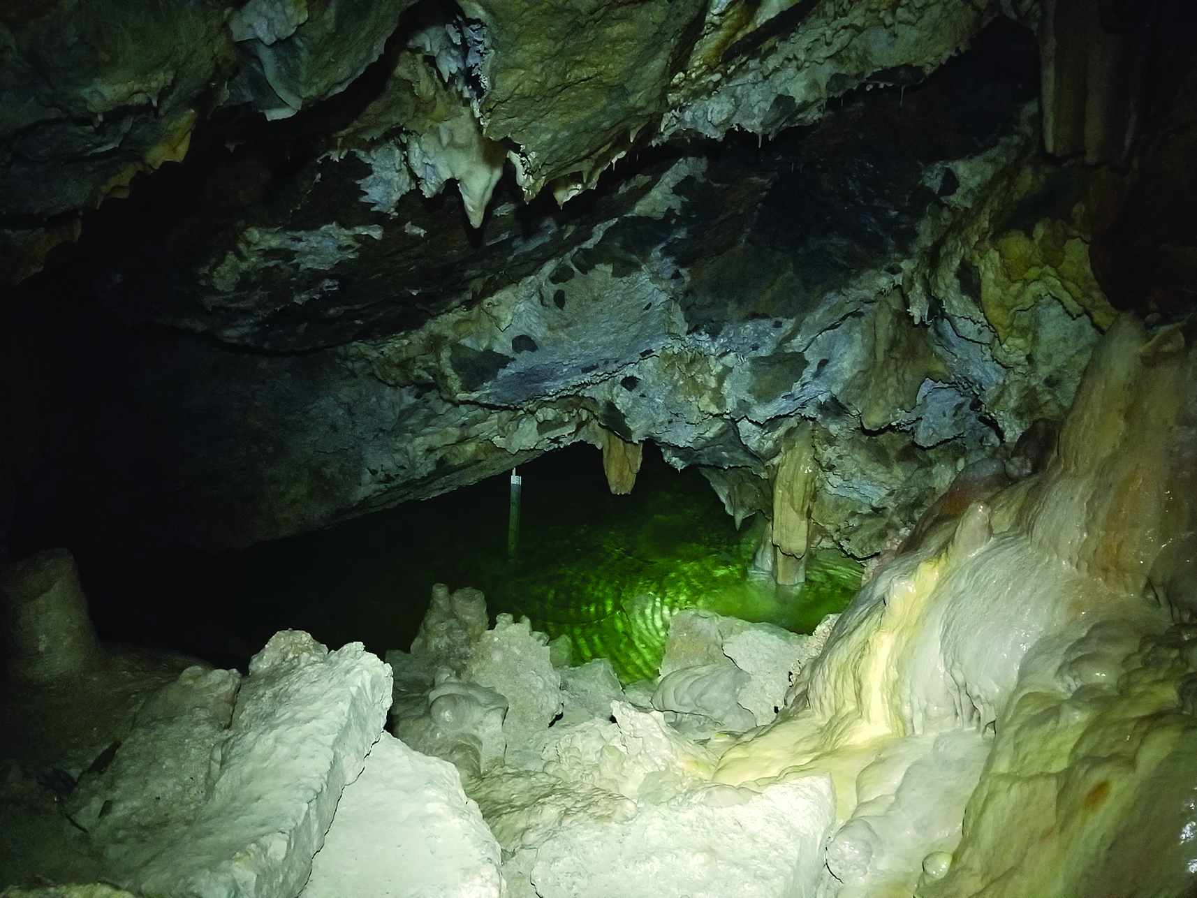 Hansen Lake at Timpanogos Cave National Monument.
A water-quality trend analysis by the Northern Colorado Plateau Network suggested that cave visitation affects cave-water chemistry and, in turn, the potential for cave-decoration formation at Timpanogos Cave National Monument. At Hidden Lake, a decrease in dissolved CO2 corresponded to implementation of a new cave management plan, leading to conditions that favored the formation of speleothems. A new collaboration with Western Kentucky University and the US Geological Survey increased the frequency of cave-water sampling during the COVID-19 closure of the cave in 2020, and added prototype carbon-dioxide sensors to sample the cave atmosphere when cave tours resumed in 2021. This research will help park staff to better understand thresholds of visitor use to support active cave processes.
New Exotic Plants Dashboard Rolled Out
Data managers for the Southwest Network Collaboration (Chihuahuan Desert, Sonoran Desert, and Southern Plains networks; SWNC) built an Exotic Plant Data Dashboard to serve data to park managers, Invasive Plant Management Teams, and other vegetation management programs. The new design uses an intuitive mapping interface to generate clear, quality-controlled information on invasive plant location and density. Because several required data management procedures are now automated, final information is available to end users as soon as field sampling is complete. By shrinking the time between observation and treatment, this approach can dramatically improve the efficacy of weed management efforts in SWNC parks. The dashboard can be accessed via the NPS GIS portal. An NPS VPN connection and addition to the group by network data management staff are required.
Climate Adaptation Workshops Target Grasslands
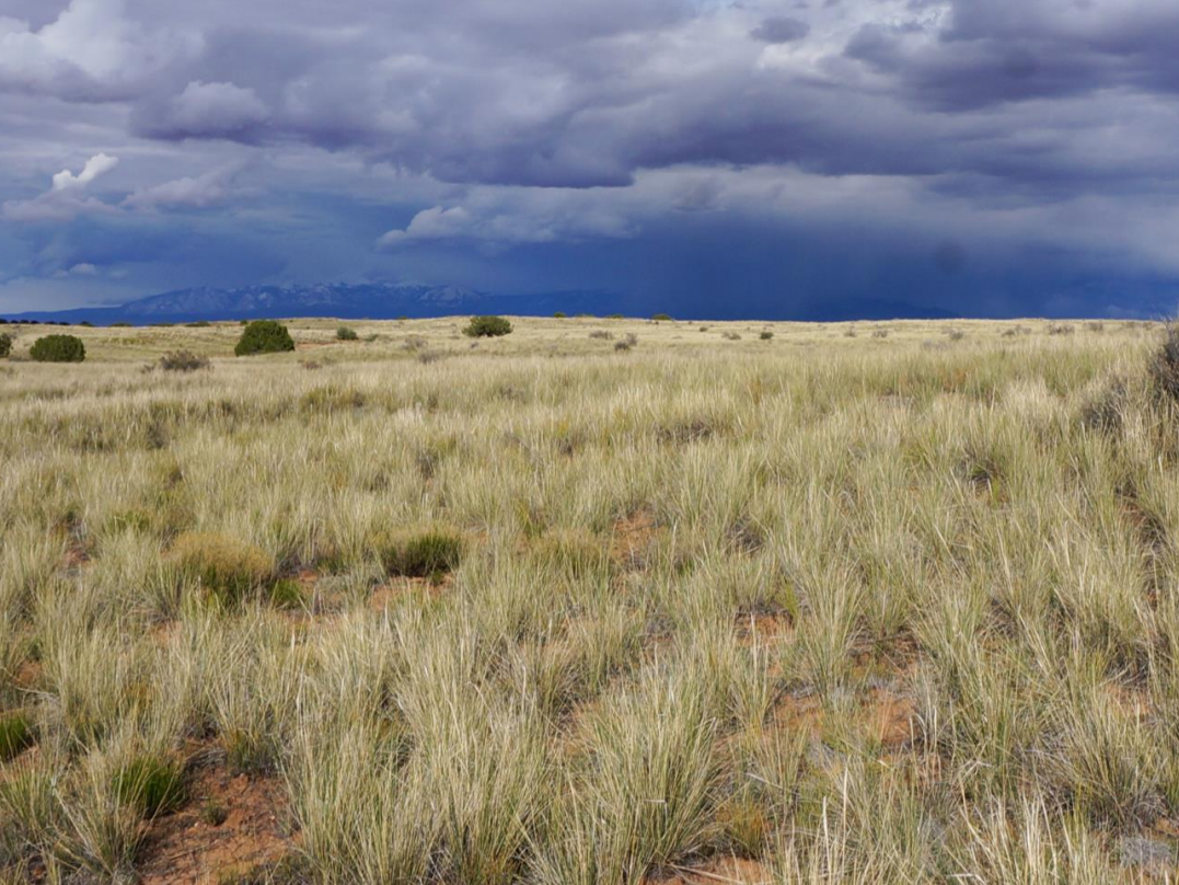 Grassland at Canyonlands National Park.
Following up on Climate Smart Grassland Drought Workshops in 2018 and 2019, the Northern Colorado Plateau Network was a key partner, with the US Geological Survey, Colorado
State University, Northern Arizona University, and the Northern Institute of Applied Climate Science, in an arid-grassland climate-adaptation workshop attended by staff from parks and partners throughout the Colorado Plateau. The workshop tested a climate-adaptation menu with strategies to help parks resist, accept, or direct change. Each park brought an active grassland-management issue to work through the framework to identify climate vulnerabilities, discuss strategies, highlight information gaps, and create a list of potential management actions. Feedback from the workshop will help finalize the climate adaptation menu for Colorado Plateau arid grasslands. A report is available.
Pinyon-Juniper Workgroup Created
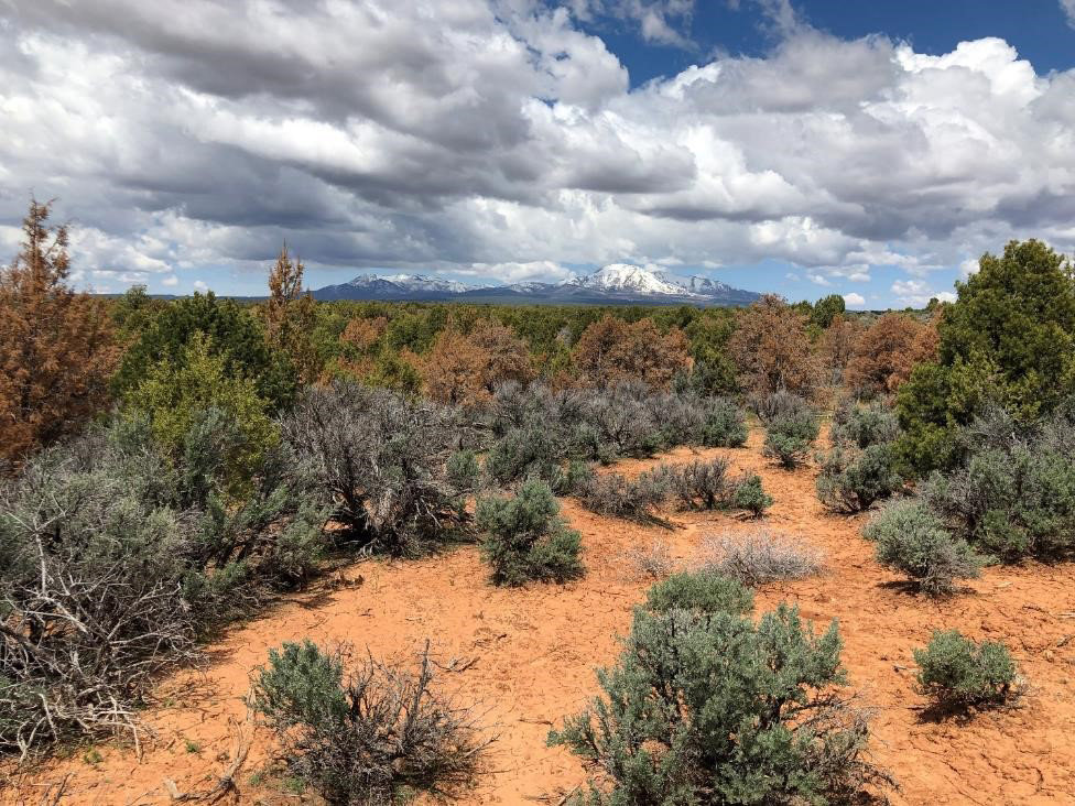 Patch of dying junipers with the Abajo Mountains in the background, Cedar Mesa, Utah, 2019.
Scientists from the Southern Colorado Plateau Network established a workgroup for effective management of pinyon-juniper ecosystems. All SCPN parks have pinyon or juniper species, and pinyon-juniper is the dominant vegetation for many park units. Management of this vegetation type on the Colorado Plateau must contend with three major challenges: (1) Because much of the Plateau is dominated by old-growth pinyon-juniper stands that are not fire-adapted, the common forest treatment of thinning to reduce catastrophic wildfire risk is not necessarily ecologically appropriate; (2) The increasing frequency of stand-destroying fires has exposed them to invasions of exotic species and hampered re-establishment of previous PJ vegetation; and (3) Because traditional satellite metrics have been shown to not work in pinyon-juniper ecosystems, we have no means of monitoring the vulnerability of these ecosystems to disturbance. SCPN staff helped identify this problem several years ago and have continued work to find and validate a suitable replacement satellite vegetation index. To address these challenges, this workgroup facilitates (1) assessments guided by concerns of park resource managers; (2) detailed condition data compiled from a variety of sources (e.g., NPS vegetation, soils, and geologic substrate maps; disease/die-off maps; fire history maps); (3) literature describing outcomes of past management actions in this vegetation type, (4) guidance from experts in the field from the US Geological Survey, Northern Arizona University, Colorado State University, and emeritus research scientists, and (5) a forum where resource managers from multiple parks can combine efforts to discuss and then test different forms of management.
Using Water Balance to Help Explain Vegetation Change at Multiple Spatial Scales
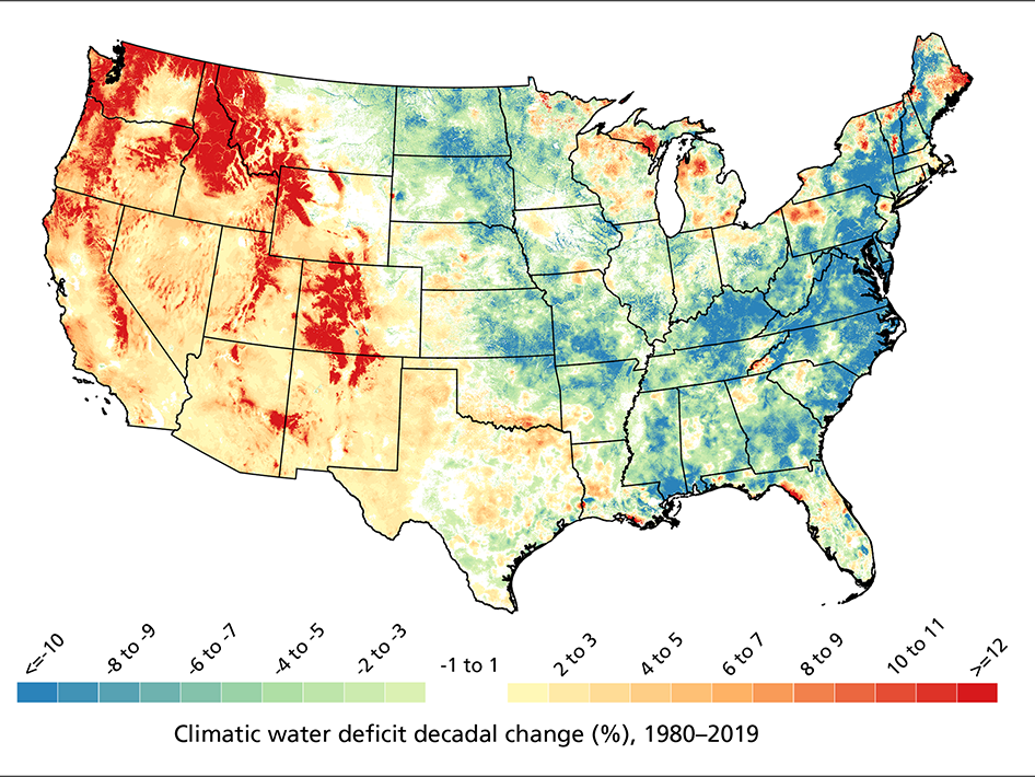 Normalized change (percent of historical mean per decade) in total annual climatic water deficit, 1980–2019.
Staff from the the Northern Colorado Plateau Network and Greater Yellowstone Network partnered with Mike Tercek and the NPS Climate Change Response Program to create a comprehensive set of GIS layers representing 30-year and decadal average water balance calculated at 1-km resolution for the continental US. This cloud-hosted product provides data for 1980 to the present, as well as 24 futures projected to the late 21st century. Recent collaborative research indicates much of the western US has experienced increases in water deficit (drying) since 1980, primarily due to rising temperatures—while much of the eastern US experienced increases in evapotranspiration (wetting) due to increases in precipitation. At a more local scale, vegetation at lower elevations in Sequoia-Kings Canyon National Parks is experiencing more water stress recently than in the past, while vegetation at higher elevations is experiencing less water stress. These findings—based on analyses using the new gridded water-balance dataset described above—explain how the same climate conditions can have different effects over short distances due to local interactions between climate and site characteristics. Collectively, this information can be used to develop management options to help parks adapt to climate change.
Evaluating the Impact of New Wastewater Technology on the Colorado River
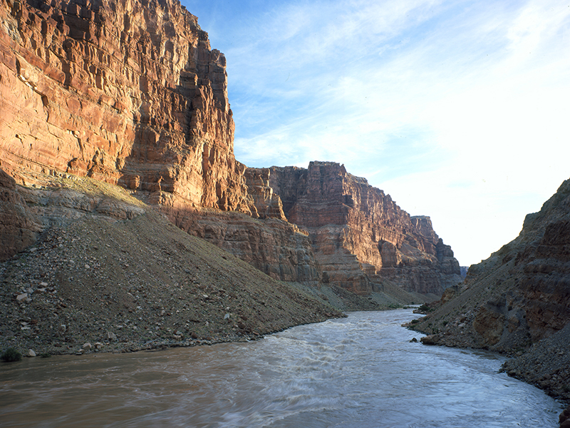 Colorado River near Moab, Utah.
Thousands of chemical compounds enter our water each day. In Moab, Utah, staff from the Northern Colorado Plateau Network and the US Environmental Protection Agency collaborated to determine whether improved methods of wastewater treatment can help reduce the presence of unregulated contaminants in effluent (cleansed discharge from a wastewater treatment plant) discharged to the Colorado River near Arches and Canyonlands national parks. The results from this study indicate that improved technologies resulted in effluent discharge with fewer detected bioactive contaminants, lower instream bioactivities, and increased fish survival. The treatment process dramatically reduced the number and concentration of pharmaceuticals and hormones in the outflow, with many pharmaceuticals dropping below detection limits. Investment in new technologies can reduce the levels of contaminants we already target with wastewater treatment, and a lot of others we don’t. This a win for everyone who depends on clean water for health and survival—and for the places we cherish.
Collaborating with Parks
Staff from the Rocky Mountain Network and their network parks collaborated on post-fire support at Rocky Mountain National Park, an Annual Brome Adaptive Management decision-support tool for Little Bighorn Battlefield National Monument and several Northern Great Plains Network parks, and hydroacoustic monitoring in support of Clark Fork River remediation at Grant-Kohrs Ranch National Historic Site.
Evaluating Drought Effects on Landbirds
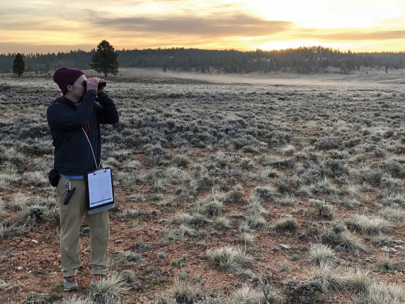 Conducting bird surveys at dawn, Bryce Canyon National Park.
Birds of the desert southwest, a climate-change hotspot, are among the most vulnerable groups in the United States. Recent research determined how bird communities in three habitats responded to drought stress over 12 years in 11 national parks on the Northern Colorado Plateau. Responses depended on habitat type and species traits, demonstrating that increased drought stress is not inherently bad or good for all species. Species that breed in multiple habitats may find it easier to adapt. Knowing how sensitive different species are to drought stress can help land managers to focus on the habitats where certain landbirds are most vulnerable. The results provide managers a clear path to developing a set of options, depending on which species and habitats they decide to focus on.
Vegetation Map Provides Useful Management Tool

The Sonoran Desert Network published a three-volume vegetation mapping report for Saguaro National Park. Knowing what’s growing where, and what kinds of habitat occur in a park, helps park managers with park planning, resource monitoring, interpretive programs, prescribed fire, wildland firefighting, and climate-change response, among other activities. Vegetation maps also provide a baseline for other ecological studies. At Saguaro National Park, a total of 97 distinct vegetation associations were described across the park’s two districts, ranging from low-elevation creosote shrublands to mountaintop Douglas fir forests. A total of 538 species were observed, with three new species added to the park plant checklist. One species believed to be extirpated from the park was also documented. The increased warming and drying of the climate in the 21st century is leading to a decrease in post-fire tree regeneration compared to the end of the 20th century. This is especially true where dominant species (like conifers) are at the lower elevational end of their typical range.
Data Used for Focused Condition Assessments
Data from the Rocky Mountain and Greater Yellowstone networks are being used in focused condition assessments (FCAs) that evaluate the condition of specific natural resources to address important near-term management issues and critical information needs identified by parks. These include the networks' Alpine Vegetation & Soils GLORIA datasets for soil temperature during 2008–2020, which the University of Colorado's Doak Lab is using for a vulnerability analysis and synthesis. The Greater Yellowstone Network participated in FCAs for mountain mahogany at Bighorn Canyon National Recreation Area, hayfield restoration at Grand Teton National Park, and alpine vegetation (GLORIA sites) servicewide.
Frontiers for Young Minds Special Collection

Multiple networks have contributed to a collection of articles for Frontiers for Young Minds, an online science journal published for youth ages 8–15 years old. “Taking the Pulse of US National Parks” will eventually contain 28 articles. Multiple papers by Intermountain Region network staff explore topics including the role of water balance in park management, amphibian resilience in extreme environments, and how stream bugs are an indicator of aquatic health. An eBook will be created from this collection and distributed to educational institutions around the world. The Greater Yellowstone Network's vegetation ecologist leads the editorial team for this project.
Communications and Outreach
Cavallin, J.E., W. Battaglin, J. Beihoffer, B. Blackwell, P. Bradley, A. Cole, D. Ekman, R. Hofer, J. Kinsey, K. Keteles, R. Weissinger, D. Winkelman, and D. Villeneuve. 2021. Effects-based monitoring of bioactive chemicals discharged to the Colorado River before and after a municipal wastewater treatment plant replacement. Environmental Science and Technology 55:974–984. DOI: 10.1021/acs.est.0c05269.
Clark, J.S., . . . R. Daley, . . . K. Legg, . . . E. Shanahan, and others. 2021. Continent-wide tree fecundity driven by indirect climate effects. Nature Communications.12:1242.
Cogan, D., and C. Lea. 2021. Vegetation inventory project: Big Bend National Park. Natural Resource Report. NPS/CHDN/NRR—2021/2275. National Park Service. Fort Collins, Colorado. https://doi.org/10.36967/nrr-2286674.
Cram, J., M. Levandowski, K. Fitzgibbon, and A. Ray. 2021. Water resources summary for the Snake River and Jackson Lake Reservoir in Grand Teton National Park and John D. Rockefeller, Jr. Memorial Parkway: Preliminary analysis of 2016 data. Natural Resource Report. NPS/GRYN/NRR—2021/2247. National Park Service. Fort Collins, Colorado. https://doi.org/10.36967/nrr-2285179.
Fahey, K., and D.W. Perkins. 2021. Invasive exotic plant monitoring in Capitol Reef National Park: 2019 field season, Scenic Drive and Cathedral Valley Road. Natural Resource Report. NPS/NCPN/NRR—2021/2265. National Park Service. Fort Collins, Colorado. https://doi.org/10.36967/nrr-2286627.
Fisk, T.A., and D.P. Thoma. 2021. Responding to climate change in the southeast Utah parks. Intermountain Park Science 2021.
Galvin, J., and S. Studd. 2021. Vegetation inventory, mapping and characterization report, Saguaro National Park: Volume I, main report. Natural Resource Report. NPS/SODN/NRR—2021/2233. National Park Service. Fort Collins, Colorado. https://doi.org/10.36967/nrr-2284709.
Galvin, J., and S. Studd. 2021. Vegetation inventory, mapping, and characterization report, Saguaro National Park: Volume II, association summaries. Natural Resource Report. NPS/SODN/NRR—2021/2237. National Park Service. Fort Collins, Colorado. https://doi.org/10.36967/nrr-2284793.
Galvin, J., and S. Studd. 2021. Vegetation inventory, mapping, and characterization report, Saguaro National Park: Volume III, type descriptions. Natural Resource Report. NPS/SODN/NRR—2021/2238. National Park Service. Fort Collins, Colorado. https://doi.org/10.36967/nrr-2284802.
Hansen, A.J., A. East, R.E. Keane, M. Lavin, K. Legg, Z. Holden, C. Toney, and F. Alongi. 2021. Is whitebark pine less sensitive to climate warming when climate tolerances of juveniles ae considered? Forest Ecology and Management. 493:119–221. https://doi.org/10.1016/j.foreco.2021.119221.
Henderson, T., V.L. Santucci, T. Connors, and J.S. Tweet. 2021.National Park Service geologic type section inventory: Chihuahuan Desert Inventory & Monitoring Network. Natural Resource Report. NPS/CHDN/NRR—2021/2249. National Park Service. Fort Collins, Colorado. https://doi.org/10.36967/nrr-2285306.
Henderson, T., V. L. Santucci, T. Connors, and J. S. Tweet. 2020. National Park Service geologic type section inventory: Greater Yellowstone Inventory & Monitoring Network. Natural Resource Report NPS/GRYN/NRR—2020/2198. National Park Service, Fort Collins, Colorado. https://doi.org/10.36967/nrr-2280034.
Keller Lynn, K. 2020. Tonto National Monument: geological resources inventory report. Natural Resource Report NPS/NRSS/GRD/NRR–2020/2212. National Park Service, Fort Collins, Colorado. https://doi.org/10.36967/nrr-2283508.
Kottkamp, S., V.L. Santucci, J.S. Tweet, R. Horrocks, E. Lynch, and G.S. Morgan. 2020. Carlsbad Caverns National Park: Paleontological resources inventory. Natural Resource Report NPS/CAVE/NRR—2020/2148. National Park Service, Fort Collins, Colorado.
Levandowski, M., A. Litt, M. McKenna, S. Burson, and K. Legg. 2021. Multi-method biodiversity assessments from wetlands in Grand Teton National Park. Ecological Indicators. Volume 131. https://doi.org/10.1016/j.ecolind.2021.108205.
Mebane, C., A. Ray, and A. Marcarello. 2021. Nutrient limitation of algae and macrophytes in streams: integrating laboratory bioassays, field experiments, and field data. PLoS ONE 16(6): e0252904.
Perkins, D.W. 2021. Invasive exotic plant monitoring at Colorado National Monument: 2019 field season. Natural Resource Report. NPS/NCPN/NRR—2021/2268. National Park Service. Fort Collins, Colorado. https://doi.org/10.36967/nrr-2286650.
Ray, A., K. Legg, H. Robison, J. Carpenter, and D. Thoma. 2021. Collaborative vital signs monitoring in Yellowstone National Park. Intermountain Park Science. September 2021.
Roberts, S.G., D.P. Thoma, D.W. Perkins, E.L. Tymkiw, Z.S. Ladin, and W.G. Shriver. 2021. A habitat-based approach to determining the effects of drought on aridland bird communities. Ornithology 138: 3, ukab028, https://doi.org/10.1093/ornithology/ukab028.
Roberts, S., E. Tymkiw, Z.S. Ladin, and G. Shriver. 2021. Status and trends of landbird populations in the Northern Colorado Plateau Network: 2020 field season. Natural Resource Report. NPS/NCPN/NRR—2021/2230. National Park Service. Fort Collins, Colorado. https://doi.org/10.36967/nrr-2284628.
Shanahan E., W.J. Wright, and K.M. Irvine. 2021. Adaptive monitoring in action: Reconsidering design-based estimators reveals underestimation of whitebark pine disease prevalence in the Greater Yellowstone Ecosystem. Journal of Applied Ecology 58(5):1079–1089. https://doi.org/10.1111/1365-2664.13837.
Tercek, M.T., D. Thoma, J.E. Gross, K. Sherrill, S. Kagone, and G. Senay. 2021. Historical changes in plant water use and need in the continental United States. PLoS ONE 16(9): e0256586. https://doi.org/10.1371/journal.pone.0256586.
Thoma, D., M.T. Tercek, W.E. Schweiger, S.M. Munson, J.E. Gross, and S.T. Olliff. 2020. Water balance as an indicator of natural resource condition: Case studies from Great Sand Dunes National Park and Preserve. Global Ecology and Conservation 24:1–17. https://doi.org/10.1016/j.gecco.2020.e01300.
Weissinger R., A. Armstrong, K. Bahr, and C. Groves. 2020.Trends in water quality of cave pools at Timpanogos Cave National Monument, July 2008–September 2018. Natural Resource Report. NPS/NCPN/NRR—2020/2181. National Park Service. Fort Collins, Colorado.
Weissinger, R., D. Thoma, and A.W. Biel. 2021. When nature gets thirsty. Frontiers for Young Minds 9:610018. DOI: 10.3389/frym.2021.610018.
Zachmann, L.J., E.M. Borgman, D.L. Witwicki, M.C. Swan, C.L. McIntyre, and N.T. Hobbs. 2021. Bayesian models for analysis of inventory and monitoring data with non-ignorable missingness. Journal of Agricultural Biological and Environmental Statistics. https://doi.org/10.1007/s13253-021-00473-z.
Battaglin, W., P. Bradley, R. Weissinger, B. Blackwell, J. Cavallin, D. Villaneuve, and J. Kinsey. 2020. Dramatic reductions in chemical concentrations and bioactivity in the Colorado River after replacement of the Moab, Utah wastewater treatment plant in 2018. American Water Resources Association conference, virtual.
Biel, A.W. 2021. Integrating I&M content into park web pages. NPS-IMD science communication webinar series, virtual.
Cavallin, J., W. Battaglin, J. Beihoffer, B. Blackwell, P. Bradley, A. Cole, D. Ekman, R. Hofer, J. Kinsey, K. Keteles, R. Weissinger, D. Winkelman, and D. Villeneuve. 2021. Effects-based monitoring of bioactive chemicals discharged to the Colorado River before and after a municipal wastewater treatment plant replacement. Presentation to Moab city managers and treatment plant operators, virtual.
Greater Yellowstone Network. 2020. Measuring the pulse of Yellowstone: The untold stories. A four-part series presented as part of the Olli School of Learning, Montana State University. All GRYN staff and Yellowstone National Park’s Vegetation Ecologist presented.
- The High Country – GLORIA and Whitebark Pine
- Mid-elevation Part 1 – amphibian
- Mid-elevation Part 2 – Upland Vegetation, water quality
- Flowing Waters and Climate
Legg, K. 2021. GYF HBCUI/Intern X Career & Leadership Workshop: STEM Careers Panel. Greening Youth Foundation. July 28, 2021. Virtual.
Livensperger, C. 2021. I&M data to support adaptation projects. NPS CO Plateau Grasslands Climate Adaptation Workshop, virtual.
Norris, J. 2021. Webinar, “What happens when it’s wrong? Challenges with using vegetation indices and phenometrics in the western United States” Department of Interior Remote Sensing Group. March 29.
Palumbo, J. 2021. Communicating science for resource management webinar series.
- Part I, presented on May 19, was based on a survey of science communicators in NRSS divisions and in parks to learn about the communication products they produce.
- Part II: presented on July 21, was based on a survey of park natural resource managers and staff on the utility and effectiveness of science communication products produced by NRSS divisions. Webinars were attended by about 100 people each.
Ray, A. and C. Peterson. 2020. Ecological insights from 70 years of Greater Yellowstone amphibian studies. This was a 90-minute virtual public presentation with more than 75 participants.
Ray, A., J. Cram, K. Legg, M. Bozek. 2020. Amphibian and wetland protocol science review. December 8–10, 2021. Virtual Workshop. https://irma.nps.gov/DataStore/DownloadFile/651844.
Ray, A. 2021. Moderated a breakout session. Northern Rockies Conservation Cooperative: 2021 Virtual Jackson Hole Wildlife Symposium. May 26, 2021.
Shanahan, E. 2021. Encouraging stronger youth engagement in the plight of whitebark pine in the Greater Yellowstone Ecosystem. Northern Rockies Conservation Cooperative: 2021 Virtual Jackson Hole Wildlife Symposium. May 26, 2021.
Shanahan, E. and S. Daw. 2021. Advancements in Analytical approaches improve whitebark pine monitoring results. https://irma.nps.gov/DataStore/DownloadFile/659024.
Southern Colorado Plateau Network. Monthly webinar series.
- 1/14/2021, Matthew Johnson, SCPN, Meet and Greet with Matthew Johnson
- 2/11/2021, Paul Whitefield, Flagstaff Area Monuments, Volcanic Feature Inventory and Baseline Condition Assessment for SUCR
- Jodi Norris, SCPN, Using the Seedlot Selection Tool (to assess effects of climate change)
- 3/11/2021, Matthew Smith, PEFO, Discovery of microfossils in expansion lands
- Megan Swan, SCPN, Status and Trends of Petrified Forest Grasslands, 2007-2018
- 4/8/21, Craig Allen, USGS, 40 years of place-based ecological research, monitoring, & NPS resource management support in the Jemez Mts. of northern New Mexico
- Tucker Bauer, New Mexico Game and Fish Dept., Reintroducing Rio Grande Cutthroat Trout to the Rito de los Frijoles in Bandelier National Monument
- 5/13/21, Lonnie Pilkington, GRCA, Experimental Vegetation Treatments in the Colorado River Ecosystem
- Jodi Norris, SCPN, Phenocam monitoring results and new Phenology Vegetation Index proposal
- 6/10/21, Tova Spector, MEVE, Chapin Mesa Milkvetch Recovery
- John Bradford, USGS, Quantifying drought & climate change impacts on SCPN vegetation resources: opportunities
- 7/8/21, Bob Parmenter, VALL, Long-Term Monitoring of Streams and Fisheries on Valles Caldera National Preserve Reveal Complex, Dynamic Responses to Wildfire
- Dr. Matthew Johnson, SCPN, Fish Habitat Use and Food Web Structure Following Pond-And-Plug Restoration of a Montane Meadow in the Sierra Nevada, California
- 8/12/21, Murt Sullivan, SAPU, Birds of Salinas Pueblo Missions National Monument
- Dr. Jim Saracco, Institute for Bird Populations, Demographic responses of birds to drought and fire in the Four Corners region of the southwestern US
- 9/9/21, Ken Hyde, GLCA, Pilot Study for the new Park Conditions Summary project and a Focused Condition Assessment
- Dr. Corinne Diggins, Virginia Tech, Pre-WNS distribution and activity patterns of a desert bat community
Thoma, D., A. Ray, J. Cram. 2021. Greater Yellowstone climate adaptation workshop – aquatic resources. April 27–29. Virtual Workshop.
Thoma, D. 2021. Climate impacts in GYE. Talk with touring bicycle group promoting climate action, June 2021.
Walker, J., and J. Norris. 12/10/2020. “Solar and sensor geometry, not vegetation response, drive satellite NDVI phenology in widespread ecosystems of the western United States.” Presentation to the American Geophysical Union meeting. In AGU Fall Meeting Abstracts (Vol. 2020, pp. B051-0018).
Weissinger, R. 2020. Exploratory data analysis: examples using NCPN water quality data. NPS-IMD exploratory data analysis working group, virtual.
Weissinger, R. 2021. Nonpoint source water quality in the National Park Service: 2020 update. Utah Division of Water Quality annual stakeholder meeting, virtual.
Weissinger, R. 2021. NCPN water quality trend analysis – an example from Timpanogos Cave. NPS-IMD water professionals working group, virtual.
Tags
- alibates flint quarries national monument
- amistad national recreation area
- arches national park
- aztec ruins national monument
- bandelier national monument
- bent's old fort national historic site
- big bend national park
- bighorn canyon national recreation area
- black canyon of the gunnison national park
- bryce canyon national park
- canyon de chelly national monument
- canyonlands national park
- capitol reef national park
- capulin volcano national monument
- carlsbad caverns national park
- casa grande ruins national monument
- cedar breaks national monument
- chaco culture national historical park
- chickasaw national recreation area
- chiricahua national monument
- colorado national monument
- coronado national memorial
- curecanti national recreation area
- dinosaur national monument
- el malpais national monument
- el morro national monument
- florissant fossil beds national monument
- fort bowie national historic site
- fort davis national historic site
- fort larned national historic site
- fort union national monument
- fossil butte national monument
- gila cliff dwellings national monument
- glacier national park
- glen canyon national recreation area
- golden spike national historical park
- grand canyon national park
- grand teton national park
- grant-kohrs ranch national historic site
- great sand dunes national park & preserve
- guadalupe mountains national park
- hovenweep national monument
- hubbell trading post national historic site
- lake meredith national recreation area
- little bighorn battlefield national monument
- lyndon b johnson national historical park
- mesa verde national park
- montezuma castle national monument
- natural bridges national monument
- navajo national monument
- organ pipe cactus national monument
- pecos national historical park
- petrified forest national park
- petroglyph national monument
- pipe spring national monument
- rainbow bridge national monument
- rio grande wild & scenic river
- rocky mountain national park
- saguaro national park
- salinas pueblo missions national monument
- sand creek massacre national historic site
- sunset crater volcano national monument
- timpanogos cave national monument
- tonto national monument
- tumacácori national historical park
- tuzigoot national monument
- walnut canyon national monument
- washita battlefield national historic site
- white sands national park
- wupatki national monument
- yellowstone national park
- yucca house national monument
- zion national park
- american southwest
- climate change
- drought
- science
- ecosystem monitoring
- invasive plants
- invasive species
- inventories
- monitoring
- plants
- research
- science and resource management
- swscience
- caves
- caves and karst
- cave water
- grasslands
- pinyon juniper
- water quality
- water balance
- waterbalancecc
- wastewater
- wastewater management
- vegetation mapping
- sodn
- romn
- sopn
- ncpn
- gryn
- scpn
- chdn