
NPS/Josh Spice Taken from the 1985 General Management Plan for Yukon-Charley Rivers: A review of all lands within the preserve regarding their suitability or nonsuitability for preservation as wilderness has been accomplished in accordance with section 1317 of ANILCA and section 3 of the Wilderness Act. The Wilderness Act created a national wilderness preservation system to be made up of federally-owned lands designated by Congress. The intent was to "secure for the American people of present and future generations the benefits of an enduring resource of wilderness." The Wilderness Act prohibits certain uses in wilderness areas, stating that commercial enterprise, permanent or temporary roads not "necessary to meet minimum requirements for the administration of the area," motorized vehicles and equipment, and structures are incompatible with wilderness. However, ANILCA enacts certain wilderness management provisions for Alaska, in recognition of its unique conditions. Section 1315 permits the continuation of existing public use cabins and the construction of a limited number of new public use cabins or shelters if appropriate and under certain restrictions. Section 1110 authorizes the use of motorboats, snowmachines, and airplanes for traditional activities in wilderness study areas, and federal regulations allow the continuation of established uses of aircraft and motorboats in all areas unless specifically prohibted by the superintendent. Wilderness designation will not prohibit or otherwise restrict sport hunting, fishing, trapping, or traditional subsistence activities in the preserve. 
The wilderness suitability review examined all lands in the preserve on an individual drainage basis except for the Nimrod Peak/Jëjezhuu Tr’injàa/Windfall Mountain area. The criteria for suitability included factors of ownership, existing uses, environmental character, and size of the area. All factors were examined together to determine each drainage's suitability for wilderness designation. Generall, those drainages with large amounts of nonfederal land or unpatented mining claims were deemed unsuitable for wilderness because of the associated high probability of environmental impacts within their watersheds. The lands deemed suitable for wilderness desgnation (eligible wilderness) include the approximately 1,815,370 acres. This is 72 percent of the total acreage of the preserve and 85 percent of the federal acreage in the preserve. Approximately 1.1 million acres of this total occur in the Charley River basin. These outstanding primitive areas include a designated national wild river and other outstanding natural features in efficient management units. The Charley basin, a primitive watershed specially recognized by Congress, is particularly suitable, and its designation as wilderness would further carry out the intent of Congress to maintain it in its natural and undeveloped condition. The native allotment and cemetery/historic site applications in any of these units are not expected to affect wilderness suitability: if conveyed, they could be easily excluded, or if not excluded, wilderness designation is not likely to have n effect on the traditional activities of the holders of those allotments. Following analysis of public response on this suitability review, the National Park Service may make a wilderness proposal to the secretary of the interior, who will in turn make a recommendation regarding wilderness designation to the president and Congress. As required in ANILCA, the president is to make his recommendations prior to December 2, 1987. Regardless of this suitability review or any subsequent National Park Service proposal, wilderness can be designated only by Congress, and any subsequent change in the status and management of designated areas can also be accomplished only by Congress. 
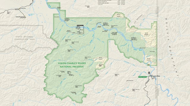
View Yukon-Charley Rivers Maps
View maps of Yukon-Charley Rivers 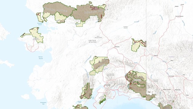
Alaska NPS Wilderness Boundaries Map
View the Alaska NPS Wilderness Boundaries Map 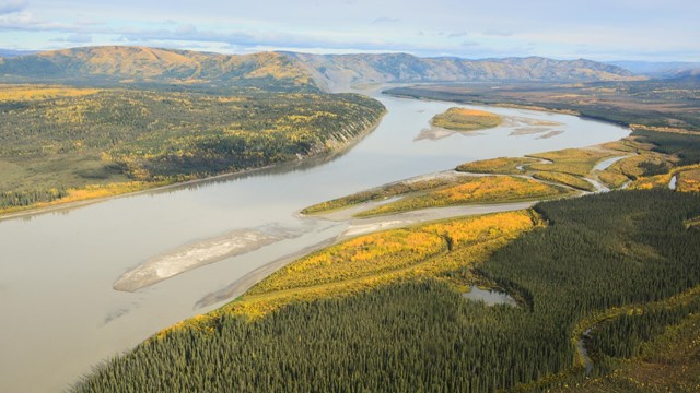
What is Yukon-Charley Rivers?
Learn about Yukon-Charley Rivers Related Yukon-Charley Rivers Wilderness Content |
Last updated: August 3, 2023