Take A Hike!

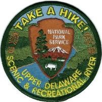
Take a Hike! patch
Hike all six trails to earn a free
Take A Hike! patch.
Join the National Park Service and the Let's Move Campaign to get outdoors, get great exercise, and earn a free Upper Delaware Take A Hike! patch.

1. Hike all of the trails listed on the Take A Hike! Brochure. Simply send an email requesting a copy of the brochure.

2. Record your hikes on the Upper Delaware Hikes checklist.

3. Return the checklist to any Upper Delaware location to receive your free patch.

All hikers should follow CDC guidance to prevent the spread of COVID-19 including social distancing, comply with state and local guidance, and follow Leave No Trace principles.

 
Upper Delaware Hikes Date Hiked
Bouchoux Trail
Damascus Forest Trail
Tusten Mountain Trail
Cobey Pond Trail
Minisink Battleground Park Trails
Mongaup River Trail
 
For Your Safety
  • The trails are not maintained nor are they regularly patrolled: travel carefully and at your own risk.
  • Wear sturdy shoes or hiking boots. Sneakers or sandals will not provide proper support.
  • Well cushioned socks and a hiking stick may be helpful on difficult trails.
  • Bring plenty of drinking water.
  • Insect repellent may be needed. Always check yourself for ticks. If you're allergic to insects come prepared.
  • Watch for snakes sunning on exposed rocks.
  • Keep pets leashed at all times.
  • Never feed or disturb wildlife.
  • These are carry-in, carry-out trails. Please don't litter.
 
Bouchoux Trail map

Bouchoux Trail (Jensen's Ledges)
NY DEC GL 209

Bouchoux Road
Lordville, NY
GPS 415231.6 - 751047.8

Length: 2 miles
Duration: 1 1/2 hours
Difficult - steep inclines, uneven footing

A difficult hike leads to an amazing panoramic view of the Upper Delaware River Valley at the summit of Jensen's Ledges. Quarrying of bluestone was once a large industry in the area as evidences by the large bluestone piles.

To get to the trail in Lordville, NY turn onto Bouchoux Road. Travel 2.8 miles to the end of the road. The trailhead is on the left side at the end of the cul-de-sac.

 
Damascus Forest Trail map

Damascus Forest Trail

MacCubbins Road
Beach Lake, PA
GPS 413808.4 - 750343.8

Length: 2 miles
Duration: 45 minutes
Easy - level terrain

Enjoy the varied landscape of wetlands, uplands and old growth forests on this easy two mile loop trail. A large stand of old growth hemlock trees remind us of the virgin forests that once stood.

From PA Route 652 near the Narrowsburg Bridge turn onto River Road. Travel 2.8 miles. Turn left on MacCubbins Road. Travel 0.6 miles. The parking lot is on the right hand side.

 
Tusten Mountain Trail map

Tusten Mountain Trail

Crawford Road
Narrowsburg, NY
GPS 413316 - 750108.9

Length: 3 miles
Duration: 1 - 3 hours
Difficult - steep inclines, uneven footing

The Tusten Mountail Trail is a partnership with the Greater New York Council of the Boy Scouts of America. This moderately difficult three mile trail takes you on a loop through historic remains of the Tusten Settlement as you climb to the summit for a magnificent view of the Upper Delaware Valley.

The trailhead is near the Ten Mile River Access on Crawford Road (off Route 97) between Narrowsburg and Barryville, NY.

 
Cobey Pond Trail map

Cobey Pond Trail
PA Game Lands 316

Plank Road
Masthope, PA
GPS 0493513 - 4600411

Length: 3 miles
Duration: 1 hour
Moderate - some inclines

A leisurely stroll around this moderate three mile loop trail offers hikers ample opportunities for wildlife and waterfowl viewing.

From PA Route 590 in Lackawaxen, PA turn onto Masthope Plank Road and travel approximately 9 miles. PA Game Lands 316 is on the right side.

 
Minisink Battleground Park Trails map

Minisink Battleground Park Trails

County Route 168
Barryville, NY
GPS 0502479 - 4592744

Length: From 1/4 - 1/2 mile
Duration: 30 minutes or more
Easy - level terrain

This easy loop trail system allows you to visit the site of the only Revolutionary War battle fought in the Upper Delaware River Valley.

From NY Route 97 turn onto County Route 168 (across from the Roebling Bridge) and travel 0.8 miles. The park entrance will be on the left.

 
Mongaup River Trail map

Mongaup River Trail
NY DEC

Route 97
Town of Deerpark, NY
GPS 412537.8 - 744519

Length: 2 miles
Duration: 1 hour
Moderate - some inclines

This linear trail provides a moderate hike with abundant opportunities to view eagles and waterfowl. Large Eastern Hemlock trees tower overhead and shade this steep ravine landscape. Trail closed from December 1st - March 31st.

This trail is located just south of the Mongaup River on Route 97. Look for a small pull off with a bulletin board.

 
Hiking symbol

For even more hiking opportunities close by in
Sullivan County, NY visit the TrailKeeper.

Last updated: March 15, 2023

Park footer

Contact Info

Mailing Address:

274 River Road
Beach Lake, PA 18405

Phone:

570 685-4871

Contact Us