Park Planning

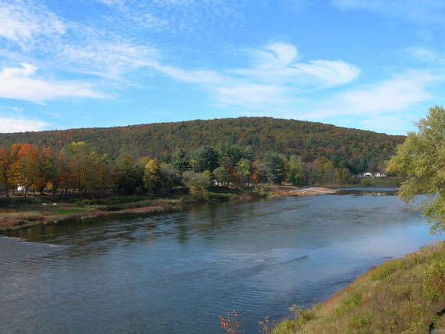
Boaters paddling on the Delaware River.

National Park Service

The planning process at Upper Delaware Scenic and Recreational River is guided by laws, regulations, policies, guidelines, and park-specific plans.

The park's enabling legislation, Section 704 of the National Parks and Recreation Act of 1978 amended the Wild and Scenic Rivers Act to specifically determine this park's purpose, and contains some general directions for park operations. This legislation called for the creation of a management plan for the Upper Delaware River, which was ultimately issued in 1986 after public involvement.

The River Management Plan was written to ensure that the Upper Delaware's 15 Towns and Townships will use their laws, plans and ordinances, including their zoning powers, to manage land use within the river corridor to be protective of river resources. In this way, land use decisions remain in the hands of local government, while the National Park Service manages commercial and recreational use of the river, provides technical and financial assistance to the Upper Delaware Council and its members, and works to protect and enhance the values that prompted the Upper Delaware's designation in the National Wild and Scenic Rivers System.

Each unit of the national park system is required to have a formal statement of its core mission that will provide guidance for all planning and management decisions, known as the park foundation document. Upper Delaware Scenic and Recreational River's Foundation Document identifies the park's purpose, significance, outstandingly remarkable values (ORV's), interpretive themes, special mandates and administrative commitments, and its setting within the region. It also presents as assessment of planning and data needs that will guide future planning efforts for the park.
 

The Foundation Document describes the park's unique planning context as follows:

Upper Delaware Scenic and Recreational River is the dividing boundary between Pennsylvania and New York along portions of 5 counties and 15 towns/townships. The NPS unit is a working partnership dedicated to preserving the "outstandingly remarkable scenic, recreational, geologic, fish and wildlife, historic, cultural...and other similar resource values that qualified Upper Delaware for inclusion in the National Wild and Scenic Rivers System." (Upper Delaware Act P.L. 95-625 November 10, 1978)

The Upper Delaware Council, a nonprofit organization whose membership consists of the...municipalities, 2 states, the Delaware River Basin Commission (DRBC), and the NPS (as a nonvoting member), is charged with responsibility for implementing the River Management Plan and assuring substantial conformance with the Land and Water Use Guidelines. The NPS partners with the Upper Delaware Council, as well as local, state, and federal partners, and other community organizations with an interest in the river corridor, through technical assistance and collaboration. (Foundation Document, pp. 3-4)

The NPS owns only 30.4 acres of the just over 55,575 acres of land within the river corridor for which the agency has management responsibility under the enabling legislation. NPS-owned lands include the historic Roebling's Delaware Aqueduct and portions of the Delaware and Hudson (D&H) Canal, Zane Grey Museum, and Corwin Farm, as well as administrative areas. The remaining predominantly privately owned land is managed in accordance with the Land and Water Use Guidelines (Guidelines) set forth in the 1986 Final River Management Plan for the Upper Delaware Scenic and Recreational River (River Management Plan), as required by the enabling legislation, which describes ways that existing local and state laws and authorities will be used to safeguard the Upper Delaware's resources.

 
View of the Lackawaxen Access on the Delaware River.

National Park Service

Within Upper Delaware Scenic and Recreational River, park managers set priorities and submit projects to accomplish the goals and action described in the River Management Plan, guiding both the park's partnership activities and its more traditional park operations. They also prioritize and perform the planning studies identified in the park's Foundation Document. Upper Delaware applies annually for project funds from Congress, competing with all other national parks for these funds.

The park's five year strategic plan expresses what the park would like to accomplish within its operating budget over the next five years. It was developed with input from all park staff and key partners.

Various divisions within the park also participate in their own specific planning processes. For example, the Interpretive Division develops a Long Range Interpretive Plan to guide its program.

Some decisions require environmental and/or historic compliance and public involvement. Projects currently open for public review at the Upper Delaware Scenic and Recreational River can be found on the National Park Service Planning, Environmental, and Public Comment (PEPC) website.

Here are some resources that pertain to the River Management Plan and its implementation, as well as other plans and guidance documents that inform the park's management decisions:

Foundation Document and Values


Upper Delaware Scenic and Recreational River Foundation Document (2014)

Upper Delaware Scenic and Recreational River Foundation Document Overview (2014)

Delaware River Basin Wild and Scenic River Values (2012)

Land Management and Water Use Planning

The Final River Management Plan (1986)

The Land and Water Use Guidelines

Substantial Conformance and Project Review Workbook (1988)

Click Here to Download a Digital GIS Shapefile of the Upper Delaware River's Scenic and Recreational Segments from the NPS Data Store Website.

Additional Resources

Last updated: January 17, 2020

Park footer

Contact Info

Mailing Address:

274 River Road
Beach Lake, PA 18405

Phone:

570 685-4871

Contact Us