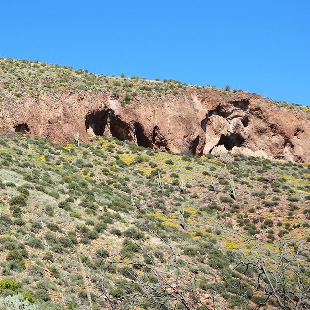
The geology of now Tonto National Monument played an essential role in the lives of the Salado, providing them raw material from which they shaped tools and the building blocks for their dwellings. Geologic processes created the shallow caves that shelter the Upper and Lower Cliff Dwellings and produced a productive river basin where they farmed.
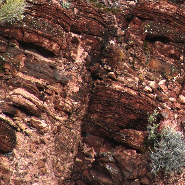
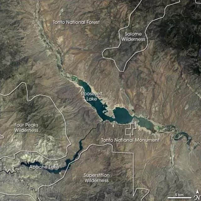
The Tonto Basin is one in a series of large intermontane basins, meaning it is situated between mountains. This deep basin was filled with debris that had been eroded and carried from the adjacent mountain ranges. Layers of rock were formed as the land was repeatedly covered with by ancient seas that deposited sediments. Debris washed away from the mountains was interbedded or layered among the sediments. Mud cracks formed when sediments dried out during low tide which created patterns on the rocks. Some rocks display ripples of cross bedding which formed in shallow water. Most of the exposed rocks at Tonto National Monument are sedimentary rocks, or rocks created by sediments binding together.
Today's mountains were formed through cycles of layer deposits, block uplifts, and erosion. As the final uplift began, the Salt River began downcutting, carrying debris to the surrounding lowlands. The coarsest materials were dropped close to the mountains, while finer sediments were carried out into the center of the basin.
The Upper and Lower Cliff Dwellings were built into naturally formed caves in the Dripping Springs Quartzite layer, which is composed primarily of quartz and feldspar but contains a small amount of carbon and extremely fine grains of pyrite disseminated throughout. The caves were mostly created by spalling. Spalling is caused by cracks forming in the rocks that are enlarged, usually by water, until a piece of rock falls off.
The distinctive Gila Conglomerate is also seen at Tonto National Monument. Gravel, clay, and silica were cemented together to form these rocks. Some cementing is done with caliche, the Southwest's natural cement. As groundwater evaporates, it leaves behind a tiny amount of lime, which gradually cements the smaller stones together. Many smaller rocks appear to be stuck together within a larger rock. Weathering and erosion are forces that continue to change Tonto National Monument's landscape.