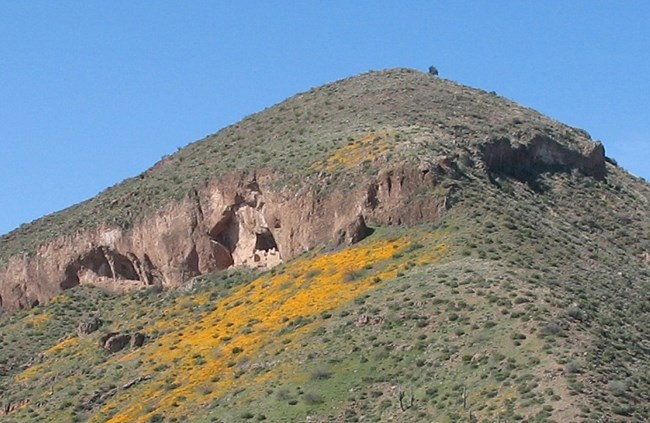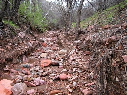
Why is This Important?The geologic history of central Arizona, of which Tonto National Monument is a part, is particularly interesting because of the concentration of archeological sites found in the area. The geologic processes of erosion and deformation set the stage for where the Salado people would eventually settle. Geology provided the raw material from which they shaped tools and the building blocks for their dwellings and terraces. Additionally, geologic processes created the major stream systems, including the Salt River that the Salado used for farming. IntroductionTonto National Monument is in an area underlain by rocks that are roughly a billion years old. These rocks are now being exposed after being buried by relatively younger gravel and conglomerate (a sedimentary rock that contains larger pebbles and is bound by smaller particles or chemical cement). They have been broken by faults, uplifted, tilted, and intruded by igneous rocks. However, the rocks we now see at the Monument reflect only a small part of the complex geologic history of central Arizona. Determining Rock AgesThe ages of the rocks are based on two principal lines of evidence: comparisons with dated rocks in other areas and dates obtained by calculating the rate of decay of radioactive minerals in central Arizona rocks. Using the few roughly established dates as starting points, other ages are determined by extrapolation. Obviously, precise ages cannot be stated, but general ages are still meaningful because the time involved in geologic history is so great. Geologic EventsThe first geologic events we know about in central Arizona took place between 1.5 to 2 billion years ago. There is no evidence of any events that may have occurred during the preceding 2 to 3 billion years of earth's history. Seas covered central Arizona and great thicknesses of sedimentary and volcanic rocks were deposited. When the seas withdrew, the whole area was lifted, folded, and faulted. Laramide OrogenyHot solutions circulated through cracks in the rocks and deposited metal-bearing minerals in veins and disseminated deposits. The copper deposits in the Globe-Miami and Superior districts were emplaced during this period, but not as near to the surface as they are today. This period of intense deformation, called the Laramide orogeny, no doubt uplifted the central part of Arizona and most likely produced a region of high mountains. Mountainous country, however, is particularly subject to erosion, and these mountains were worn down so that the once deeply buried ore deposits and ancient rocks were again exposed. The exposure was temporary because a sheet of lava was poured out on to the land’s surface sometime between 10 to 30 million years ago. 
Gila conglomerateThe major mountain ranges of today were crudely defined by the uplifted or tilted segments. The basins began to be filled with rock debris eroded from surrounding highlands and swept into the low areas by swift streams. The gravel deposited at this time constitutes the Gila conglomerate, the rock that underlies Roosevelt basin north of Tonto National Monument. The Gila conglomerate accumulated to tremendous thicknesses in the centers of the major basins and probably covered or nearly covered most of the lower mountain ranges. Minor volcanic activity sometimes accompanied deposition of the Gila conglomerate, as indicated by a few basalt flows with the interbedded gravel. Finally, less than a million years ago, central Arizona along with a much larger area was lifted perhaps as much as three or four thousand feet. The uplift was fairly gentle and uniform with movement along faults in the lifted area. It was relatively insignificant, unlike the earlier stages of deformation, which broke and jumbled the rocks and created great mountain ranges and vast basins. As a result of the uplift, a new cycle of erosion started, which is still in effect today. Major stream systems developed, and the streams began removing the tremendous accumulations of Gila conglomerate. Gradually, the Salt River cut a deep channel that enabled it to carry its deposits out to the deserts of the Phoenix area and points west. The mountainous areas continue to be worn down and the rock debris deposited in the lowlands, but the rate at which the basins are being filled is slower than the rate at which the streams are removing material from the area. The result is that the valleys in central Arizona are slowly being deepened, the areas around the basins that once were buried by gravel are reappearing, and even the resistant rocks that form the mountains are steadily being worn away. Although the area experienced more recent changes such as side canyon flooding and rock falls, by 10,000 years ago the geologic landscape at Tonto National Monument looked similar to how we see it today. This fact sheet is adapted from Robert Raup’s 1962 report titled Some Geological Features of the Tonto National Monument. It is available through the National Park Service’s archives. |
Last updated: June 20, 2021
