Last updated: December 6, 2023
Thing to Do
McKittrick Canyon to Dog Canyon
NPS Photo
This is an extremely rewarding trail, offering both the variety of McKittrick Canyon and the grandeur of the high ridges that surround it. The floor of McKittrick Canyon provides a panoramic experience through the unique environments of the canyon; to protect this special habitat, visitors are asked to stay on the trail and stay out of the water.
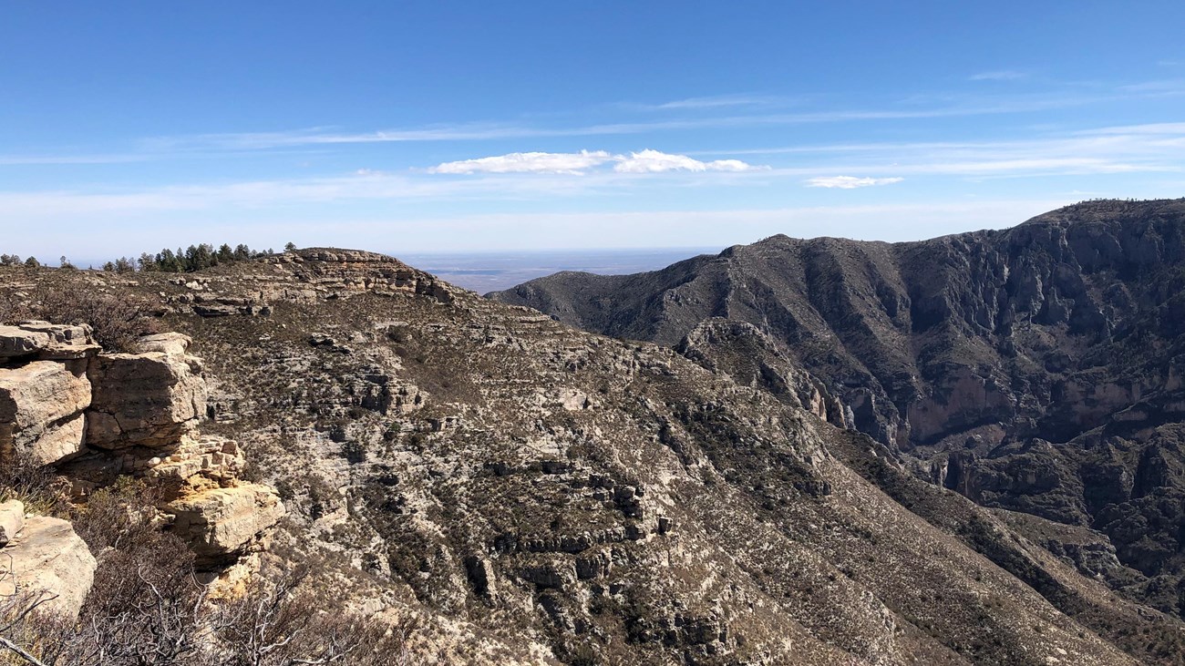
The McKittrick Canyon Trail follows the floor of South McKittrick Canyon for four miles before climbing steeply to gain the ridge on the north side of the canyon. This is an arduous climb of 2,380 feet in about two miles and provides spectacular views into the canyon and to the ridges that border it. The trail continues along the ridge above South McKittrick Canyon, ascending to a high point of 7,916 feet and gradually descending to a junction with the Tejas Trail.
The route passes the saddle at Lost Peak. No trail leads to the summit itself. Descending from the area of Lost Peak the trail passes through the grassy areas that define the northern portion of the park.
Overnight backpacking is recommended at the McKittrick Ridge Wilderness Campground.
- Distance: 15.0 miles (24.1 km) one way. For more detailed information on trails, check our trail descriptions page.
- Time Estimate: 8-12 hours
- Difficulty: Strenuous
- Duration: Minimum of one night, two days.
- Trailheads: McKittrick Canyon and Dog Canyon Trailheads. The drive between the trailheads is two hours. No shuttle service runs between the two trailheads.
Details
Duration
8-12 Hours
Activity
Hiking
Pets Allowed
No
Pets disturb wildlife and are not allowed on trails. Your pets should remain at home as opportunities for pets are very limited in the park.
Reservations
No
If done as a day hike, no reservations are needed. If done as part of a multi-day overnight itinerary, a Wilderness Use Permit is required. If staying at Dog Canyon Campground, reservations are required.
Season
Year Round
Time of Day
Any Time
The McKittrick Canyon trail complex is designated a day use area below the McKittrick Ridge Wilderness Campground; Wilderness Use Permits must be obtained to camp overnight. The gate to the canyon closes daily at 5:00 p.m. Mountain Time. Visitors must be out of the area before the gate closure time.
Accessibility Information
Trail surfaces are loose rock or hardened rock surfaces. Hiking or trekking poles are highly recommended. Trail widths vary from two to six feet depending on the trail.
Parking
All trailhead areas have accessible parking available.
Service animals
Only service animals that have been individually trained to perform specific tasks for the benefit of persons with disabilities are allowed in the park and on trails.