Last updated: October 30, 2025
Thing to Do
Drive Foothills Parkway (Walland to Wears Valley)
NPS
Overview
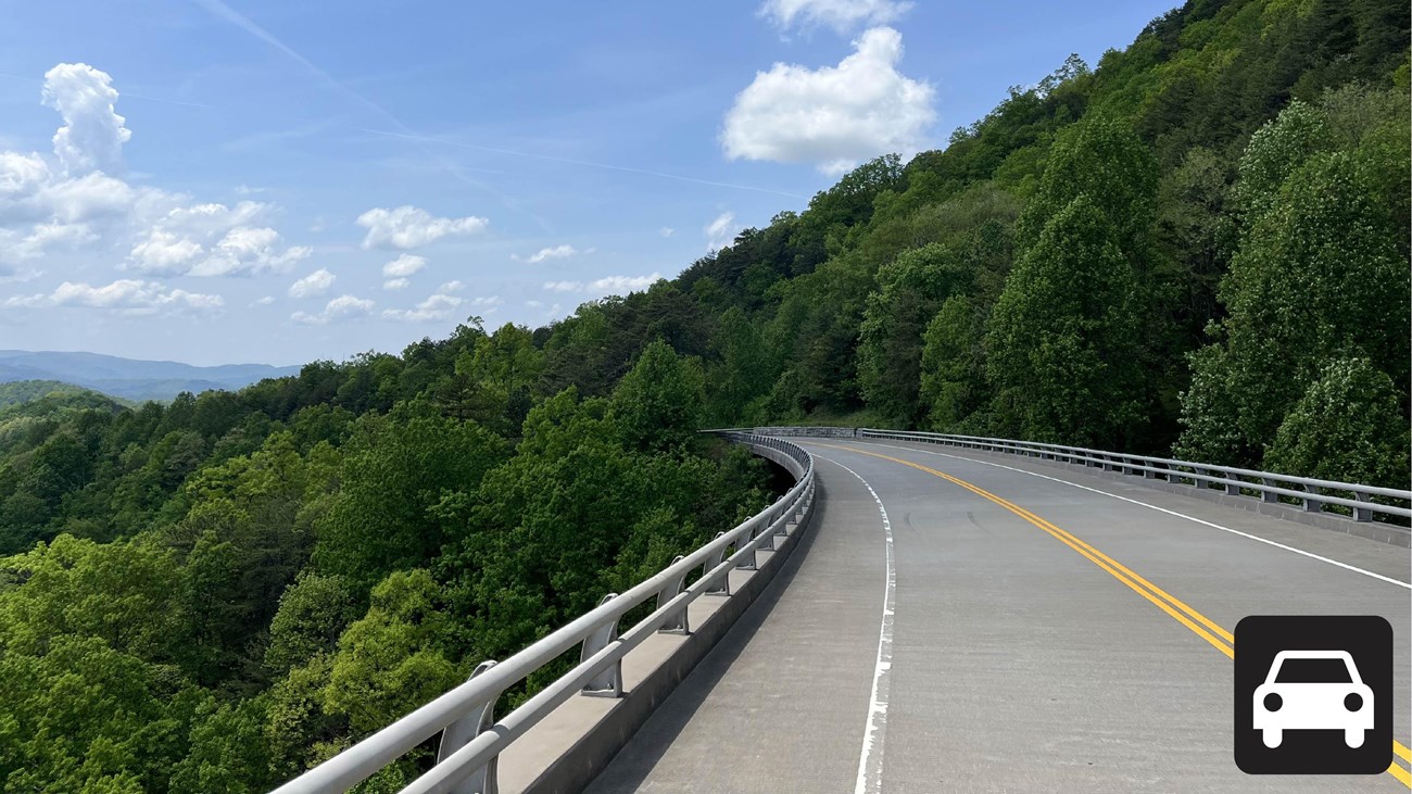
Drive the Walland to Wears Valley section of the Foothills Parkway that is approximately 14.75 miles (23.74 km) long and climbs to nearly 2,500 feet in elevation near Caylor Gap. This section of the Foothills Parkway was completed in 2018 and has expansive views of Great Smoky Mountains National Park. The smooth road clings to the southern slopes of the mountains with winding viaducts that cross valleys and connect Grassy Mountain, Rocky Mountain, and Davis Mountain. There are multiple scenic overlooks and ample parking to view Great Smoky Mountains and Wears Valley. See the Foothills Parkway Overview for additional information.
Foothills Parkway (Walland to Wears Valley) is accessible from U.S. 321 south of Walland and northeast of Line Springs Road in Wears Valley. There are 10 waysides and overlooks that allow visitors to stretch their legs, picnic, and enjoy the views including at:
- Milepost 17: four parking spaces, a curb cut, and a sidewalk to the welcome sign
- Milepost 18: 17 parking spaces and two accessible parking spaces with views of the Little River
- Milepost 21: Capshaw Branch Overlook has 44 parking spaces and four accessible parking spaces
- Milepost 22: six parallel parking spaces
- Between Milepost 23 and Milepost 24: parking area on the mountainside of the road and access to a seasonal roadside waterfall
- Milepost 25: parking area on the mountainside of the road about halfway up Dancing Gap Mountain
- Near Milepost 25: Townsend Overlook, 10 parking spaces, one accessible parking space, views of Townsend and the “peaceful side of the Smokies”
- Between Milepost 26 and 27: two parking areas near Caylor Gap: main parking area with 12 parking spaces, including one accessible parking space; secondary parking area with five parallel parking spaces, views of rolling hills to the West and full panoramic views of the Smoky Mountains
- Milepost 28: 10 parking spaces and one accessible parking space with views of Mount. Le Conte and Roundtop Mountain
- Milepost 29: Six parallel parking spaces
Length
14.75 miles (23.74 km) one-way
Parking
Ample but varied parking along the parkway. Don't forget your parking tag.
Nearest Restroom
Similar Routes
Details
Activity
Scenic Driving
Pets Allowed
Yes
The Gatlinburg Trail and Oconaluftee River Trail are the only two park trails where pets are permitted. Pets are also allowed in picnic areas, in campgrounds, and on roads.
Activity Fee
Yes
A parking tag is required to park in the Smokies for more than 15 minutes.
Reservations
No
Accessibility Information
Listed overlooks have accessible parking spaces.