Last updated: October 30, 2025
Thing to Do
Drive Foothills Parkway (Chilhowee to Walland)
NPS
Overview
Drive the section of Foothills Parkway West that connects the community of Walland to the southwest corner of Great Smoky Mountains National Park at Chilhowee Lake. The parkway is popular among individuals seeking to drive US-129 otherwise known as the “Tail of the Dragon” north of Chilhowee Lake. Between Chilhowee Lake and Walland, Tennessee, the parkway has 16 parking areas, 14 of which are scenic overlooks. The parkway climbs the ridge of the foothills over Happy Valley and offers views looking both east towards Great Smoky Mountains National Park and west overlooking Maryville and Alcoa.
The views available along the parkway vary throughout the drive. Along the southern portion of the parkway, southeastern overlooks face the mountains that surround Cades Cove, providing the opportunity to see the sunrise over one of the most iconic locations of the park. Southeast-facing overlooks along the northern portion of the parkway offer views of working farms in Millers Cove. On clear days, the Cumberland Plateau can be visible from northwest facing overlooks.
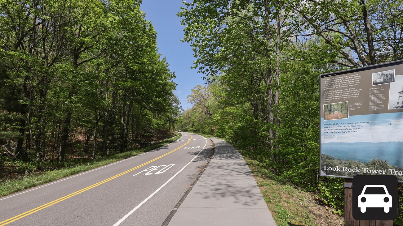
Two improved viewing platforms can be found at Look Rock, 7.1 miles from the southern entrance to the parkway. A set of stairs lead down to the lower platform, directly adjacent to the parking lot. Just north of the parking lot, a short, paved trail leads to the Look Rock Tower.
There are no trash cans available at the parking areas throughout the parkway, so please be sure to pack out your trash.
This section of Foothills Parkway stretches from US-129 by Chilhowee Lake to US-321 near Walland, Tennessee. Mileposts mark the distance from the Chilhowee Lake entrance.
- Between Mileposts 3 and 4: Two overlooks that face southeast.
- Between Mileposts 4 and 5: Two overlooks that face southeast.
- Mile 6.4: One scenic overlook facing southeast.
- Mile 7.1: Look Rock Tower Trail and lower Look Rock Overlook have ample parking and access to Look Rock Tower.
- Mile 7.5: Look Rock Picnic Area and Campground provide restrooms and ample parking.Between Mileposts 10 and 11 are two parking areas and one overlook facing northwest.
- Mile 11.4: Two overlooks on either side of the parkway.Between Mileposts 13 and 14: Two overlooks that face northwest
- Mile 14.2: Parking area on the southern side of road.Between Mileposts 15 and 16: Two parking areas that face southeast.
- Mile 16.6: intersection with US HWY 321
Length
16.6 miles (26.7 km) one-way
Parking
Parking is available throughout the parkway. Don't forget your parking tag.
Nearest Restroom
Look Rock Picnic Area (available seasonally)
Similar Routes
Details
Activity
Scenic Driving
Pets Allowed
Yes
The Gatlinburg Trail and Oconaluftee River Trail are the only two park trails where pets are permitted. Pets are also allowed in picnic areas, in campgrounds, and on roads.
Activity Fee
Yes
A parking tag is required to park in the Smokies for more than 15 minutes.
Reservations
No
Accessibility Information
All parking areas and turn offs provide at least one accessible parking space with most providing two accessible parking spaces. Larger parking areas at miles 7.1 and 15.4 provide four and three accessible parking spaces, respectively. The lower Look Rock viewing area is only accessible by stairs. Look Rock Tower Trail is a 0.8-mile paved trail of mild to moderate steepness, and the ramp accessing the top of the tower is steep.