



News Release
News Release Date: May 14, 2025
Contact:
Public Information Officer, 505-581-6922
For more information about the closed areas of the Abó Unit, please refer to the map included.
The LiDAR and Photogrammetry Assessment will collect LiDAR and natural color imagery to provide the park with essential data to identify structurally vulnerable areas of the Church and Convento. The information gathered will support development of management strategies and monitoring protocols to prevent degradation and improve the resiliency of the historic structures.
For questions, please contact the park’s Public Information Officer at 505-581-6922.
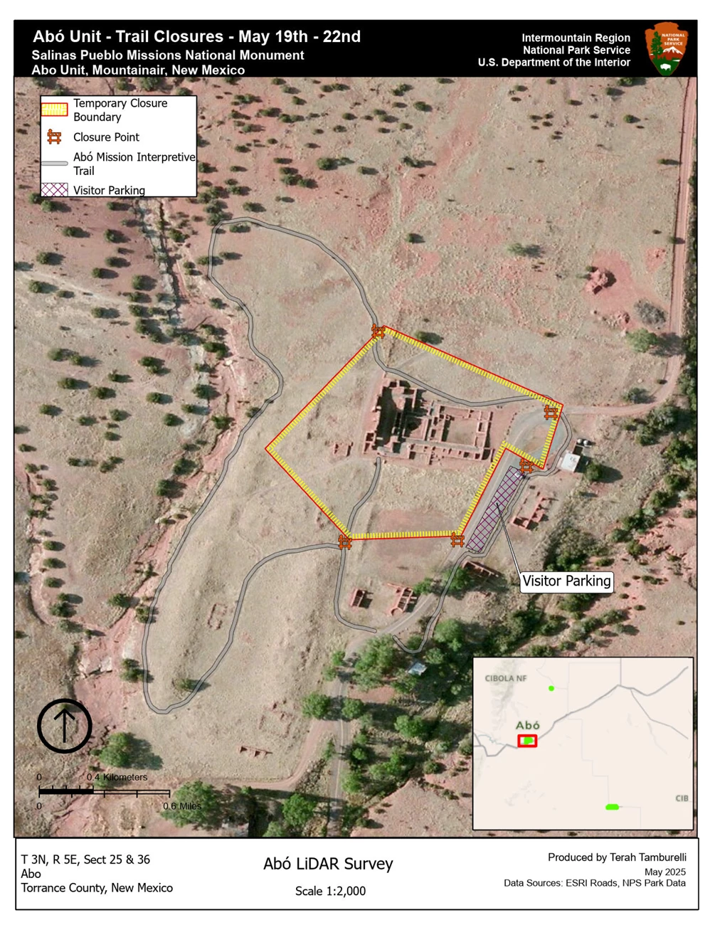
NPS map
Last updated: May 14, 2025