News Release
You are viewing ARCHIVED content published online before January 20, 2025.
Please note that this content is NOT UPDATED, and links may not work. For current information,
visit https://www.nps.gov/aboutus/news/index.htm.

Courtesy RMNP
|
Subscribe
|
Contact: Kyle Patterson
Contact: Park Information Office, (970) 586-1206
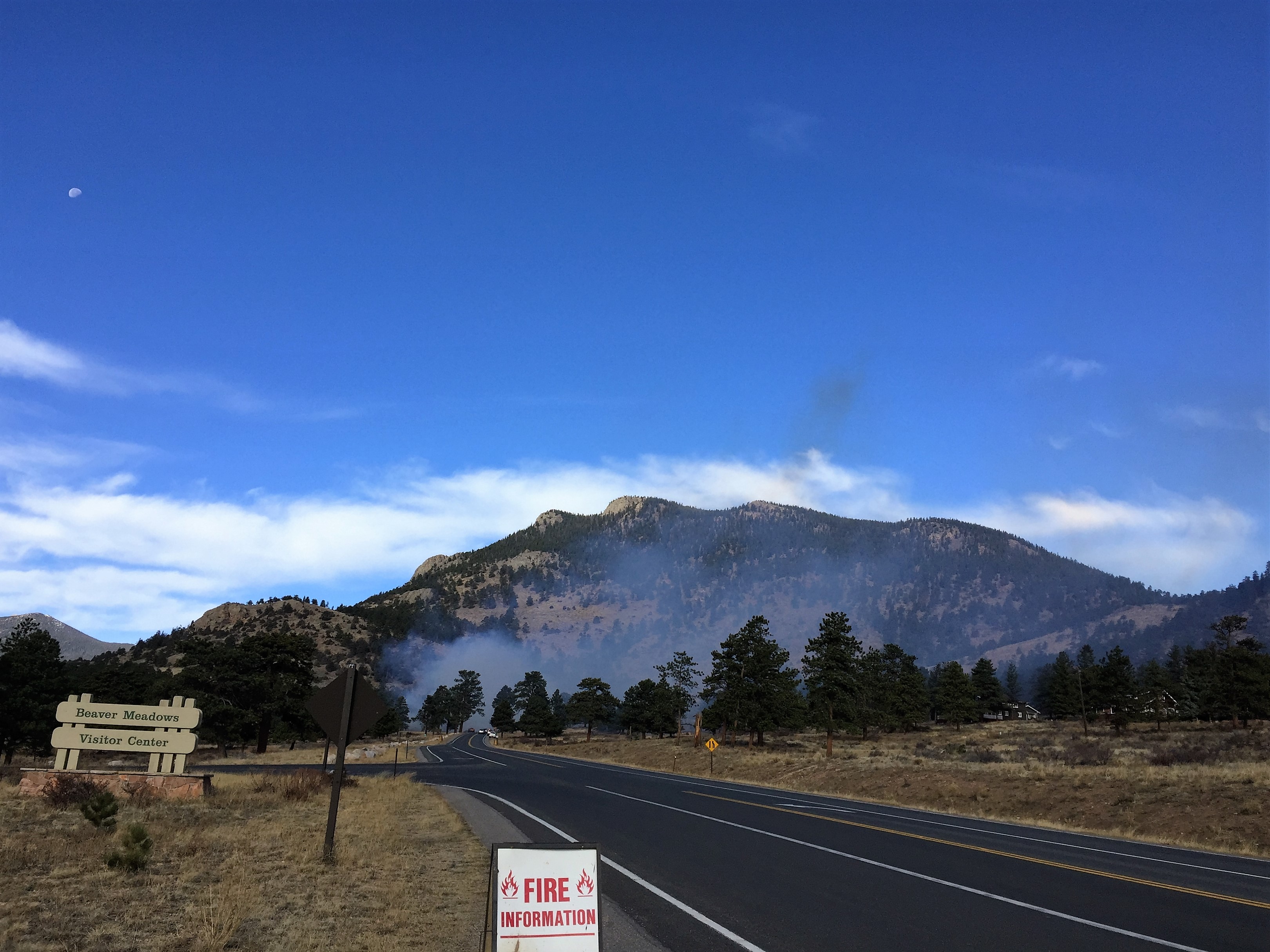
Based upon the arrival of cool weather and the amount of precipitation in the extended weather forecast, fire managers at Rocky Mountain National Park are preparing to conduct a prescribed burn if favorable weather and fuel conditions allow. Fire managers may burn up to a 300-acre area. This would take place west of the Beaver Meadows Visitor Center and south of U.S. Highway 36. Burning operations would be conducted over several days to limit daily smoke production.The primary goal of the project is to reduce the threat of wildland fire to adjacent communities and park infrastructure by using prescribed fire to reduce the amount of fuel available in this area. When fighting the East Troublesome Fire in 2020 and the Fern Lake Fire in 2012, firefighters were able to take advantage of previous and existing prescribed fire and hazardous fuels treatment areas that provided a buffer between the fire and the town of Estes Park. Prior hazard fuels projects were instrumental in stopping the fire from jumping Bear Lake Road and Trail Ridge Road.
Depending on when and if weather and fuel conditions are suitable, prescribed burning operations may begin late October or any time through the winter. Ignitions will likely occur on weekdays with smoldering and smoke emissions lasting for an additional 3-10 days. If burning operations take place, traffic control will be in place on U.S. Highway 36 within the burn area.
Smoke may be visible both inside and outside the park. Every effort will be made to minimize smoke impacts on visitors and the adjacent community; however, some smoke is anticipated to disperse east of the park. Smoke may affect your health: For more information see https://www.colorado.gov/pacific/cdphe/wood-smoke-and-health. No trail or road closures are anticipated but visitors passing through active burning areas may be escorted by fire personnel to ensure their safety.
For the safety of visitors and firefighters, park visitors will not be allowed to stop along U.S. Highway 36 within the burn area. Visitors will also not be able to walk within the burn area.
Safety factors, weather conditions, air quality, personnel availability and environmental regulations are continually monitored as a part of any fire management operation. For more information please contact the park’s Information Office at (970) 586-1206.
Last updated: October 23, 2024
