Things to Do
From forest trails to coastal adventures, find out how to experience Redwood National and State Parks.
Finding Your Way to Redwood National and State Parks
Redwood National and State Parks span approximately 50 miles along the northern California coast, from Crescent City near the Oregon border to the Redwood Creek watershed south of Orick. The parks are about 325 miles (a six-hour drive) north of San Francisco.
Where to Begin Your Visit
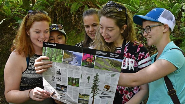
The best way to start your journey is at one of the park’s visitor centers, where you can find maps, get up-to-date conditions, and talk to park staff. There are five visitor centers located throughout the parks, each offering unique insights and resources.
Visitor Centers and What They Offer
Depending on where you're starting, these visitor centers can help you plan your experience. Before choosing a location, we recommend that you visit the Visitor Centers page in order to get seasonal hours and information for each center.
-
Thomas H. Kuchel Visitor Center
Highway 101, south of Orick, CA 95555
The largest and most comprehensive visitor center, featuring exhibits, a bookstore, and direct beach access. This is the best starting point for first-time visitors.
-
Prairie Creek Visitor Center
Newton B. Drury Scenic Parkway, Orick, CA 95555
Located in Prairie Creek Redwoods State Park, this center is a great stop for those exploring trails, elk viewing areas, and coastal redwood groves.
-
Hiouchi Visitor Center
Highway 199, 9 miles east of Crescent City, CA 95531
Near Jedediah Smith Redwoods State Park, this center provides information on scenic drives, hiking trails, and camping options in the northern section of the parks.
-
Crescent City Information Center
1111 Second Street, Crescent City, CA 95531
A convenient stop for visitors entering from the north, offering maps, trip-planning assistance, and general park information.
-
Jedediah Smith Visitor Center (Seasonal)
Located within Jedediah Smith Redwoods State Park, near the Smith River
Open during the summer months, this small center provides trail information and camping resources in the northernmost part of the parks.
Each visitor center offers valuable guidance, but if you’re unsure where to begin, the Thomas H. Kuchel Visitor Center is the most comprehensive and accessible option.
Park Headquarters: What You Need to Know
The park headquarters is located in Crescent City at:
1111 Second Street
Crescent City, CA 95531
This is the administrative office for the parks and does not function as a visitor center. It does not provide trip-planning services, exhibits, or general visitor information. However, certain permits and official park business may require a visit to headquarters.
Important GPS Navigation Tips
Many GPS and digital mapping services provide incorrect directions within the park, sometimes leading visitors onto unpaved or restricted roads. To ensure you stay on the right path:
- Use a printed park map.
- Follow official road signs rather than GPS directions.
- Plan your route in advance, especially when traveling to remote areas.
For the most up-to-date visitor center hours and information, see our Visitor Center page and Current Conditions page.
Arriving by Automobile
Redwood National and State Parks follow the north-south U.S. Highway 101 corridor, spanning approximately 50 miles between Crescent City and Orick, California. Various scenic roads and highways provide access to different areas of the parks.
Unlike many national parks, there are no formal entrance stations along these routes. It’s entirely possible to drive through the parks without realizing you’ve been surrounded by some of the world’s most magnificent forests and tallest trees! To make the most of your visit, we recommend stopping at one of the visitor centers for maps and trip-planning information.
From the Oregon Coast (Highway 101)
Park headquarters and the Crescent City Information Center are located 26 miles south of Brookings, Ore., off of U.S. 101. To directly access Jedediah Smith Redwoods State Park (including the Jedediah Smith Campground, Jedediah Smith Visitor Center, and Hiouchi Visitor Center), travel 16 miles south of Brookings, Ore. on U.S. 101 then exit North Bank Road/Calif. 197 and continue southeast ~7 miles to the junction with U.S. 199 in the heart of Jedediah Smith Redwoods State Park.
From Central Oregon (Grants Pass, Ore./Interstate 5 corridor)
From Grants Pass, Ore., take U.S. 199/Redwood Highway and travel ~70 miles southwest to the northeast boundary of the parks near Hiouchi, Calif.; continue west an additional 5 miles on U.S. 199, then south ~4.5 miles on U.S. 101 to Crescent City, Calif. (home to the Crescent City Information Center).
From the California Coast (Highway 101)
The Kuchel Visitor Center near the parks' southern boundary is located ~40 miles north of Eureka, Calif. (or 312 miles north of San Francisco, Calif.) just off of U.S. 101. It is 1-mile south of Orick, located on Freshwater Beach. Look for the brown highway signs for Kuchel Visitor Center / Park Information. Do not rely on online maps to give accurate directions: this visitor center is NOT in the town of Orick.
Continue north on U.S. 101 ~3 miles to access Bald Hills Road or ~7 miles to access the Newton B. Drury Scenic Parkway.
From Central California (Redding, Calif./Interstate 5 corridor)
From Redding, Calif., exit Eureka Way/Calif. 299 and continue west ~140 miles to U.S. 101 near Arcata, Calif. Travel north on U.S. 101 ~30 miles to the Kuchel Visitor Center near the parks' southern boundary. Continue north on U.S. 101 ~3 miles to access Bald Hills Road or ~7 miles to access the Newton B. Drury Scenic Parkway. Do not rely on online maps to give accurate directions: this visitor center is NOT in the town of Orick.
Arriving by Air
Several nearby airports offer commercial flights, making it easier to reach Redwood National and State Parks. Below are the closest airports, their airlines, and their proximity to visitor centers for trip-planning convenience.
Crescent City, Calif. (map)
Airport: Del Norte County Airport/Jack McNamara Field (CEC)
Carrier: Contour Airlines. Daily direct flights to Oakland, CA.
Nearest Visitor Center: Crescent City Information Center, ~4 miles south of airport.
Medford, Ore. (map)
Airport: Rogue Valley International-Medford Airport (MFR)
Carrier: Horizon Air, Delta Connection operated by SkyWest Airlines, Allegiant Air, and United Airlines and United Express operated by SkyWest Airlines.
Nearest Visitor Center: Hiouchi Visitor Center, ~100 miles west of airport.
McKinleyville, Calif. (map)
Airport: Arcata-Eureka Airport (ACV)
Carrier: United Express operated by SkyWest Airlines. Daily direct flights to San Fransisco, Los Angeles, Denver.
Nearest Visitor Center: Kuchel Visitor Center, ~25 miles north of airport.
Public Transportation (local)
Redwood Coast Transit (RCT) offers service between and among the communities of Smith River, Crescent City, Gasquet, Klamath, Orick, and Arcata, Calif. For information about routes and fares, or for other inquiries, call RCT at (707) 464-6400 or visit them online at .
Circle of Parks
Plan to visit all the national parklands in the Klamath region of southern Oregon and northern California.
- National Park, 3½ hours from Crescent City, CA, 140 miles; 217 miles from Orick, CA
- National Monument, 1½ hours from Crescent City, CA, 60 miles; 114 miles from Orick, CA
- National Recreation Area, 4¼ hours from Crescent City, CA, 215 miles; 160 miles from Orick, CA
- National Park, 5 hours from Crescent City, CA, 230 miles; 231 miles from Orick, CA
- National Monument, 6 hours from Crescent City, CA; 262 miles from Orick, CA
|