



Last updated: July 11, 2026
Place
True Parting of the Ways
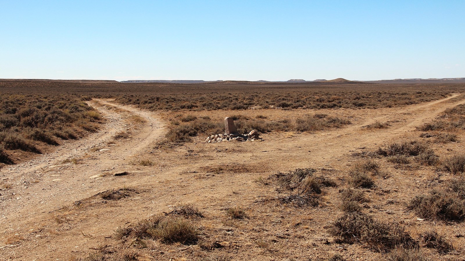
Photo/L. Kreutzer
Quick Facts
Location:
True Parting of the Ways is 15 mi northeast of Farson, WY, on public land 3 miles north of WY-28 GPS 42.257561 -109.228253. From WY-28 between mileposts 16 and 17, turn north onto unsigned BLM Rd 4106 (Squaw Rd, GPS 42.235987 -109.170851). Drive 3.4 miles to a concrete trail post on the left. Turn west there and drive 4 miles on the historic trail. A wayside exhibit is on the left and the fork in the trail is obvious. An inscribed, vertical stone (not historical) surrounded by rocks stands at the fork. The right branch is the Sublette Cutoff to Fort Hall; the left leads to Fort Bridger, Salt Lake City, and California.
Significance:
Parting of the Ways was a split in the emigrant trail where wagon traffic, after sharing a common corridor across present Nebraska and most of Wyoming, diverged toward different destinations. Some parties chose to follow the original Oregon Trail southwest to Fort Bridger and continue to Salt Lake City or California, while others took the more direct (but waterless) Sublette Cutoff west toward Oregon.
Designation:
Historic site on the California, Mormon Pioneer, Oregon, and Pony Express NHTs.
MANAGED BY:
Amenities
2 listed
Historical/Interpretive Information/Exhibits, Scenic View/Photo Spot
There were 2 ways across the barren Green River Basin, observes geologist and trail enthusiast Keith Meldahl, author of Hard Road West: “a long way—the trail to Fort Bridger—and a hard way—the Sublette Cutoff.” The trail split at the Parting of the Ways in western Wyoming, where travelers had to choose. The “long way” was the original Oregon Trail from South Pass to the southwest corner of Wyoming, where Jim Bridger and Louis Vasquez established Fort Bridger trading post in 1843. From there, the old trail turned northwest toward Fort Hall on the Snake River. It was an indirect “V” route that took travelers miles out of their way, but it followed streams with water and grass for livestock.
Beginning in 1846, travelers on this route could continue southwest from Fort Bridger to Salt Lake City, then go on to California. This branch came to be known as the California or Mormon Road. The “hard way,” opened by Caleb Greenwood in 1844 but popularly called the Sublette Cutoff, went west at Parting of the Ways and rejoined the original Oregon Trail (the leg heading toward Fort Hall) at the Bear River, near today’s Cokeville, WY. It cut across the top of the old “V,” saving over 40 miles or 2 ½ days’ travel to Fort Hall. What made this the “hard way,” though, were 50 dry miles of ravine crossings and steep climbs and descents between the Big Sandy and Green River.
Emigrants made their decision based on the condition of their livestock and reports of the grass along the way. Elisha Perkins’s 1849 company arrived at Parting of the Ways to find “some 40 or 50 notes stuck up in forked sticks with directions and news & from those in advance to acquaintances behind.” At least one company simply let the oxen choose. Some parties with divided opinions split up, while other companies took a vote. “Which road to take we could scarcely choose,” reads Edward Jackson’s journal entry of July 1, 1849, “but by vote, decide to take the Mormon” – the trail to Salt Lake City. They found “the grass plenty and the water good.” Two days later, the company met a man “who was on his way to stop emigrants from taking the [Sublette Cutoff], as the grass is so scarce and the water so poor that the cattle are dying off by the hundreds.”
About 2/3 of the emigration that season chose the more direct “hard way.” A high clearance 4-wheel-drive vehicle is recommended for the drive to Parting of the Ways, which requires several crossings of streambeds, usually dry in summer.
Site Information
Location (True Parting of the Ways is 15 mi northeast of Farson, WY, on public land 3 miles north of WY-28 GPS 42.257561 -109.228253. From WY-28 between mileposts 16 and 17, turn north onto unsigned BLM Rd 4106 (Squaw Rd, GPS 42.235987 -109.170851). Drive 3.4 miles to a concrete trail post on the left. Turn west there and drive 4 miles on the historic trail. A wayside exhibit is on the left and the fork in the trail is obvious. An inscribed, vertical stone (not historical) surrounded by rocks stands at the fork. The right branch is the Sublette Cutoff to Fort Hall; the left leads to Fort Bridger, Salt Lake City, and California.)