



Last updated: July 9, 2026
Place
Rattlesnake Pass
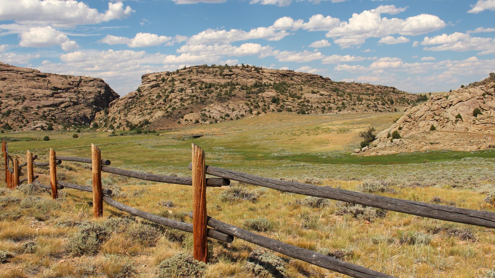
Photo/L. Kreutzer
Quick Facts
Location:
Rattlesnake Pass (7600 WY-220, Alcova, WY) is near Devil’s Gate, about 5.5 miles southwest of Independence Rock State Historic Site on WY-220. The Bureau of Land Management’s Devil’s Gate Historic Site on WY-220 provides an impressive view of the mouth of Rattlesnake Pass. The pass can also be accessed on foot through the Martin’s Cove Visitors’ Center property. Rattlesnake Pass/Fulkerson Grave: GPS 42.4439666664 -107.2066888889 BLM Devil’s Gate Historic Site overlook & interpretation of Devil’s Gate and Rattlesnake Pass: GPS 42.437177 -107.217337
Significance:
All traffic on the trail corridor—including hundreds of thousands of overland emigrants—converged at Rattlesnake Pass, a narrow gap in the Sweetwater Hills around Devil’s Gate. Near the mouth of the pass lies the marked 1847 grave of Frederick Richard Fulkerson, among of the oldest known emigrant graves on the Oregon Trail.
Designation:
Historic site on the Oregon, California, Mormon Pioneer, and Pony Express NHTs.
MANAGED BY:
Amenities
12 listed
Benches/Seating, Historical/Interpretive Information/Exhibits, Information Kiosk/Bulletin Board, Parking - Auto, Parking - Bus/RV, Picnic Shelter/Pavilion, Restroom, Scenic View/Photo Spot, Toilet - Flush, Trailhead, Water - Drinking/Potable, Wheelchair Accessible
About 5 ½ miles southwest of Independence Rock lies Devil’s Gate, another natural wonder that fascinated passing emigrants. The gate is a 300-foot-deep, V-shaped cleft cut by the Sweetwater River through a granite spur of the Sweetwater Hills—the exposed peaks of a buried mountain range. Rather than follow the gushing river through Devil’s Gate, wagons funneled through the next opening to the south, a gap called Rattlesnake Pass. The pass runs for about ½ mile, parallel to nearby Devil’s Gate. It lies between low, broken cliffs on the north and the flank of a smaller granite turtleback to the south. Both the pass and the “gate” open into stunning, 100-mile-long Sweetwater Valley.
Historians estimate that 300,000 to 500,000 westbound emigrants plodded up the sandy plain from Independence Rock and took their turn through Rattlesnake Pass. Travelers sometimes paused to carve their names into the granite walls of the pass, where faded inscriptions still can be found. Many left dead and dying livestock, poisoned by alkali pools, lying along the trail. Diarists complained of the nauseating carrion stench that wafted through the pass and valley like a drifting fog. Some left behind loved ones in trailside graves. One of these unfortunates was 17-year-old Frederick Fulkerson, whose 1847 grave is among the oldest marked burials on the Oregon Trail. The young man took ill after swimming his family’s livestock across the cold North Platte River some 60 miles to the east. He died here on July 1 and is buried near the mouth of Rattlesnake Pass. A granite boulder there once bore Fulkerson’s epitaph, recorded in at least one emigrant journal, but the markings soon faded away. A later visitor to the site, T. Baker, deeply inscribed his own name there in 1864 before continuing his journey, and Baker’s name is still clearly legible.
Today a fence protects Fulkerson’s grave and a historic marker tells his story. As many as 20 burials, including several near the Fulkerson grave and others on the ridge near the present-day highway, are believed to exist in the area, but nearly all have melted anonymously into the landscape with the passage of time. The Bureau of Land Management’s Devil’s Gate Historic Site on WY-220 provides an impressive view of the mouth of Rattlesnake Pass. From Independence Rock State Park, turn westbound onto WY-220 and drive 5.5 miles. The interpretive site is on the north side of the highway. The pass also can be approached on foot from the Martin’s Cove Visitors’ Center. From the Devil’s Gate Historic Site overlook, drive westbound on WY-220 for ¾ mile. Turn right onto the center’s entrance road and continue past the housing and handcart outfitting areas to Sun Ranch Road. Turn right and drive about ¼ mile, where the road is closed to vehicle traffic. Park along the shoulder and walk or bike about 1/3 mile to the Fulkerson grave.
Site Information
Location (Rattlesnake Pass (7600 WY-220, Alcova, WY) is near Devil’s Gate, about 5.5 miles southwest of Independence Rock State Historic Site on WY-220. The Bureau of Land Management’s Devil’s Gate Historic Site on WY-220 provides an impressive view of the mouth of Rattlesnake Pass. The pass can also be accessed on foot through the Martin’s Cove Visitors’ Center property. Rattlesnake Pass/Fulkerson Grave: GPS 42.4439666664 -107.2066888889 BLM Devil’s Gate Historic Site overlook & interpretation of Devil’s Gate and Rattlesnake Pass: GPS 42.437177 -107.217337)