



Last updated: July 11, 2026
Place
Big Sandy Crossing
Photo/L. Kreutzer
Quick Facts
Location:
The Fort Bridger/Salt Lake City trail branch crossed the Big Sandy River at today’s WY-28 bridge at Farson, WY. Bridge GPS 42.108217 -109.451323. From the intersection of US-191 and WY-28 at Farson, drive west on WY-28 for about 0.2 mile. A turnout with monuments and a historical marker is on the north (right) side WY-28 immediately west of the bridge. GPS 42.107950 -109.453239. The Sublette Cutoff crossing of the river (not accessible to the public) is about 10 miles north at approximately GPS 42.240665 -109.408111.
Significance:
For travelers on the Sublette Cutoff, the Big Sandy River provided the last water before a 45-mile, multi-day dry drive across the Little Colorado Desert to the Green River. Travelers bound for Salt Lake City and California via the Fort Bridger route forded the river 10 miles south of there at present Farson, WY, where a Pony Express Station operated in 1860-1861.
Designation:
Historic site on the California, Mormon Pioneer, Oregon, and Pony Express NHTs.
OPEN TO PUBLIC:
No
Amenities
3 listed
Historical/Interpretive Information/Exhibits, Parking - Auto, Scenic View/Photo Spot
Back at the Parting of the Ways, trail traffic split between the Sublette Cutoff, which heads west across rugged terrain and desert, and the Fort Bridger route, which curves southwest toward the fort and Salt Lake City. The Sublette reached the Big Sandy River in the vicinity of present-day Eden Reservoir, while the Fort Bridger route crossed the river about 10 miles south, at today’s community of Farson, WY. Travelers on the heavily used Sublette faced a 2- to 3-day dry drive from the Big Sandy to the next water at the Green River. To prepare for the crossing of the Little Colorado Desert, those emigrants filled every container with water from the Big Sandy, pulled bunchgrass to feed their oxen, and tossed belongings from their wagons to lighten their loads for the draft animals.
J. Goldsborough Bruff, reaching Big Sandy Crossing on the Sublette Cutoff on Aug. 4, 1849, reported that another company had abandoned “several hundred weight of fat bacon, beans, lead, iron, tools, and a cast-iron stove, &c” beside the river. (Farther down the trail, facing starvation, that company regretted dumping its food.) Forty-niner Joseph Middleton marveled in his journal, “Saw a piece of real brick with several broken pieces. Who would have thought that any person would have hauled a brick so far over such horrible roads?” Perhaps it was someone’s cherished memento of home.
The Big Sandy River ford here was typically about 100 feet wide and 2 feet deep—sometimes deeper—with a steep climb on the west side. Many parties crossed at dusk and started their desert trek in the dark to spare their draft animals from the hot sun. Today the Sublette crossing location is on private land, difficult to access, and lacks exhibits and historical signs.
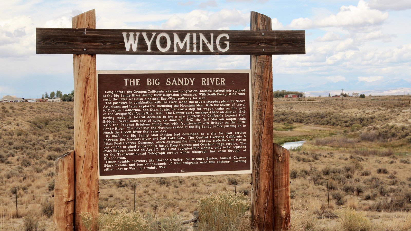
Travelers on the Fort Bridger route, on the other hand, had no need to stock up on water and hay at the Big Sandy Crossing at Farson. After fording, their wagons could follow the Big Sandy to the Green River. The lands on both sides of Big Sandy Crossing were used as campgrounds by Latter-day Saints emigrating to the Salt Lake Valley and by thousands of forty-niners traveling through Salt Lake City on their way to California. Wagons forded where the WY-28 bridge now crosses the Big Sandy. On WY-28 west of the river is a turnout with a state historic sign and a concrete monument that commemorates the meeting of Brigham Young and Jim Bridger at the Little Sandy Crossing, several miles to the east.
Site Information
Location (The Fort Bridger/Salt Lake City trail branch crossed the Big Sandy River at today’s WY-28 bridge at Farson, WY. Bridge GPS 42.108217 -109.451323. From the intersection of US-191 and WY-28 at Farson, drive west on WY-28 for about 0.2 mile. A turnout with monuments and a historical marker is on the north (right) side WY-28 immediately west of the bridge. GPS 42.107950 -109.453239. The Sublette Cutoff crossing of the river (not accessible to the public) is about 10 miles north at approximately GPS 42.240665 -109.408111.)