



Last updated: July 2, 2026
Place
Avenue of Rocks
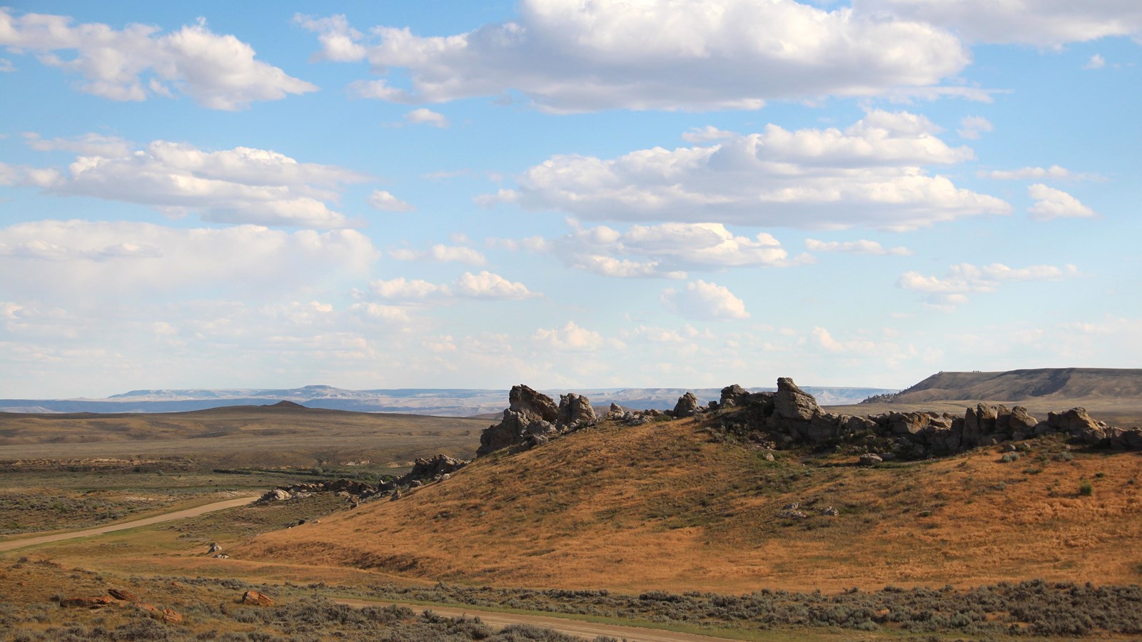
Photo/L. Kreutzer
Quick Facts
Location:
To find the Avenue of the Rocks, drive west from Casper, WY, on Zero Rd/County Rd 202. In about 9 miles, Zero Rd curves southwest and becomes Poison Spider Rd. Four miles from the curve, turn left (south) onto County Rd 319/Oregon Trail Rd (unpaved). In 6.5 miles, Avenue of the Rocks is on the right. Park along the road to explore the site. GPS 42.738526 -106.664073
Significance:
Avenue of Rocks was a notable landmark along the combined trail corridor southeast of present Casper, WY, frequently described in emigrant journals. Several members of the Martin Handcart Company of Latter-day Saints perished while camping here in bitter weather on Oct. 29, 1856.
Designation:
Historic site on the California, Mormon Pioneer, Oregon, and Pony Express NHTs.
MANAGED BY:
Bureau of Land Management
This landmark on the combined corridor of the California, Mormon Pioneer, Oregon, and Pony Express trails was a roadside curiosity to passing emigrants, who sometimes sketched and noted it in their journals. The mile-long line of jutting, broken sandstone, caused by squeezing of the earth’s crust, looked to overlanders like the spine of a gigantic animal.
Sir Richard Burton, a British adventurer traveling by stagecoach in 1860, described Devil’s Backbone as “a jagged, broken ridge of huge sandstone boulders, tilted up edgeways, and running in a line over the crest of a long roll of land. . .like the vertebrae of some great sea-serpent.” Others called the feature Avenue of Rocks, Rock Avenue, or Rock Lane. While passing through a narrow gap between the formation and a ridge to the east, some travelers paused to carve their names on the stone. Many of those inscriptions, though, have been eroded by weathering or destroyed by blasting for road construction in the mid-20th century. However, keen eyes can still spot a few faint carvings on rock faces protected by overhangs.
Helen Carpenter, traveling through with her family in June 1857, neglected to describe the “backbone” in her journal, as her attention was captured by another feature of the area. “The high wind which prevailed,” she wrote, “interfered very much with our locomotion and switched the dresses about, leaving the pedal extremities in a precarious condition.” That is, gusts lifted the women’s long skirts scandalously high, exposing their feet and ankles. Some of her companions pinned rocks in the hems of their skirts to calm their flapping, “never dreaming of the black [bruised] shins they would carry for the next week,” Helen continued, amused. “It is needless to say that their invention was not a success and so was never patented.” High winds still “prevail” at Avenue of Rocks.
Helen’s party was unaware that, eight months earlier, on Oct. 29, 1856, several members of the Martin Handcart Company of Latter-day Saints died at Avenue of Rocks while encamped, starving, in winter conditions. The company was still two days from the rescue wagons sent to help them.
Today the site is managed by the Bureau of Land Management. Please do not mark the rocks; modern carving further diminishes the historical integrity of the site.
Site Information
Location (To find the Avenue of the Rocks, drive west from Casper, WY, on Zero Rd/County Rd 202. In about 9 miles, Zero Rd curves southwest and becomes Poison Spider Rd. Four miles from the curve, turn left (south) onto County Rd 319/Oregon Trail Rd (unpaved). In 6.5 miles, Avenue of the Rocks is on the right. Park along the road to explore the site. GPS 42.738526 -106.664073)