 and zoomorphs (animal-like figures) grace the cliffs.")
The Southern Paiute believe their Creator placed them on these lands, where they have lived in respectful balance since time immemorial. Religious specialists made petroglyphs in places full of power such as locations with important plants, rocks, or water. They documented events, histories, family stories, and perhaps their own vision quests in places like Nampaweap. Petroglyphs shed light on the world where the Old Ones lived. Stories of game kills, enemy attacks, marriages, family lives, and relationships with plants and animals remain as teaching tools for the elders who continue to take youths to visit petroglyphs to share history, culture and spiritual beliefs. The Southern Paiute are one of twelve tribes who claim the monument as part of their ancestral homelands. 
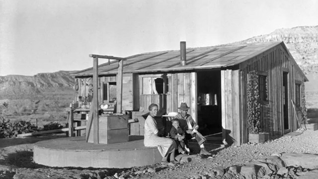
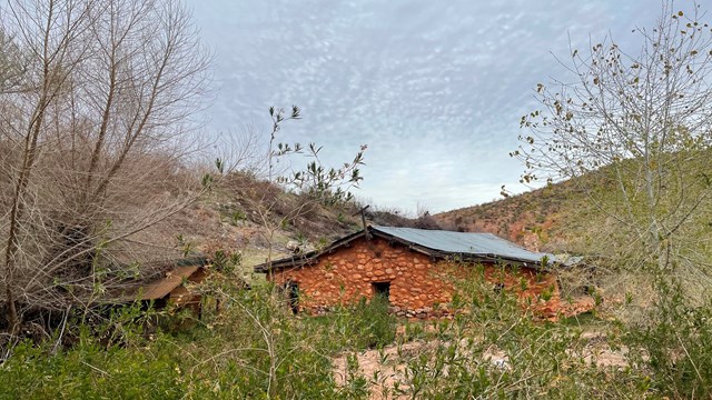
NPS/ T. Miller Presidential Proclamation"Archaeological evidence shows much human use of the area over the past centuries. Because of their remoteness and the lack of easy road access, the sites in this area have experienced relatively little vandalism. Their good condition distinguishes them from many prehistoric resources in other areas. Prehistoric use is documented by irreplaceable rock art images, quarries, villages, watchtowers, agricultural features, burial sites, caves, rock-shelters, trails, and camps. Current evidence indicates that the monument was utilized by small numbers of hunter-gatherers during the Archaic Period (7000 B.C. to 300 B.C.). Population and utilization of the monument increased during the Ancestral Puebloan Period from the Basketmaker II Phase through the Pueblo II Phase (300 B.C. to 1150 A.D.), as evidenced by the presence of pit houses, habitation rooms, agricultural features, and pueblo structures. Population size decreased during the Pueblo III Phase (1150 A.D. to 1225 A.D.). Southern Paiute groups replaced the Pueblo groups and were occupying the monument at the time of Euro-American contact. Archaeological sites in the monument include large concentrations of ancestral Puebloan villages, a large, intact Pueblo II village, numerous archaic period archeological sites, ancestral Puebloan sites, and Southern Paiute sites. The monument also contains areas of importance to existing Indian tribes. In 1776, the Escalante-Dominguez expedition of Spanish explorers passed near Mount Trumbull. In the first half of the 19th century, Jedediah Smith, Antonio Armiijo, and John C. Fremont explored portions of this remote area. Jacob Hamblin, a noted Mormon pioneer, explored portions of the Shivwits Plateau in 1858 and, with John Wesley Powell, in the 1870s. Clarence Dutton completed some of the first geological explorations of this area and provided some of the most stirring written descriptions. Having traversed this area by wagon at the request of the territorial legislature, Sharlot Hall recommended it for inclusion within the State of Arizona when it gained Statehood in 1912. Early historic sawmills provided timber that was hauled 70 miles along the Temple Trail wagon road from Mt. Trumbull down the Hurricane Cliffs to St. George, Utah. Ranch structures and corrals, fences, water tanks, and the ruins of sawmills are scattered across the monument and tell the stories of the remote family ranches and the lifestyles of early homesteaders. There are several old mining sites dating from the 1870s, showing the history of mining during the late 19th and early 20th centuries. The remote and undeveloped nature of the monument protects these historical sites in nearly their original context."
| ||
Last updated: July 5, 2024