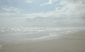
NPS Photo The National Seashore's Gulf shoreline is traditionally subdivided into several beaches. Five are named. Moving from north to south the named beaches are: North Beach extends from the park's northern boundary 1.1 miles to a row of bollards (or posts) crossing the beach, which marks the boundary with Closed Beach. The sand on North Beach is usually firmly packed so two-wheel-drive vehicles can normally travel on it with little problem. Closed Beach extends from there approximately 4.5 miles to another row of pylons marking its southern boundary. This beach is closed to vehicles so that visitors can find solitude in a natural setting without needing a four-wheel-drive vehicle to drive farther south. This beach includes the Malaquite Beach area located at the park's Visitor Center and the Malaquite Campground. Camping is permitted at the campground, but not on other areas of Closed Beach. Closed Beach's southern boundary is used as the zero point to measure distances on the remaining 60+ miles of beach. South Beach extends from Closed Beach's southern boundary approximately seven miles to the beginning of Little Shell Beach, which is not marked. As with North Beach, South Beach's sand is usually packed and two-wheel-drive vehicles normally have little problems traversing it. However, farther south the sand loosens and the beaches become soft. Traveling beyond South Beach is best done in a four-wheel-drive vehicle. Little Shell Beach (locally referred to simply as "Little Shell") extends from approximately seven miles from the southern boundary of Closed Beach to the twelve mile point. The seashells making up Little Shell beach are mostly common arks, coquina, and cockles, which are smaller than the shells found at Big Shell a little farther south. Big Shell Beach (usually referred to as simply "Big Shell") extends from approximately 17 miles south of Closed Beach to 28 miles south. The shells making up Big Shell mostly are common arcs, coquina, cockles, and quahogs, as at Little Shell, but they are bigger than the ones at Little Shell and thus the name. Areas outside these beaches are not named and are usually designated only by their distance from Closed Beach's southern boundary. Markers are spaced five miles apart down the Gulf shoreline from Malaquite's southern boundary to indicate distance. Mileage points between the five-mile markers are usually referred to as "markers" rather than "points". For example, the point thirty-seven miles south of Malaquite is referred to as the "thirty-seven mile marker", even though no marker is present there. |
Last updated: February 24, 2015
