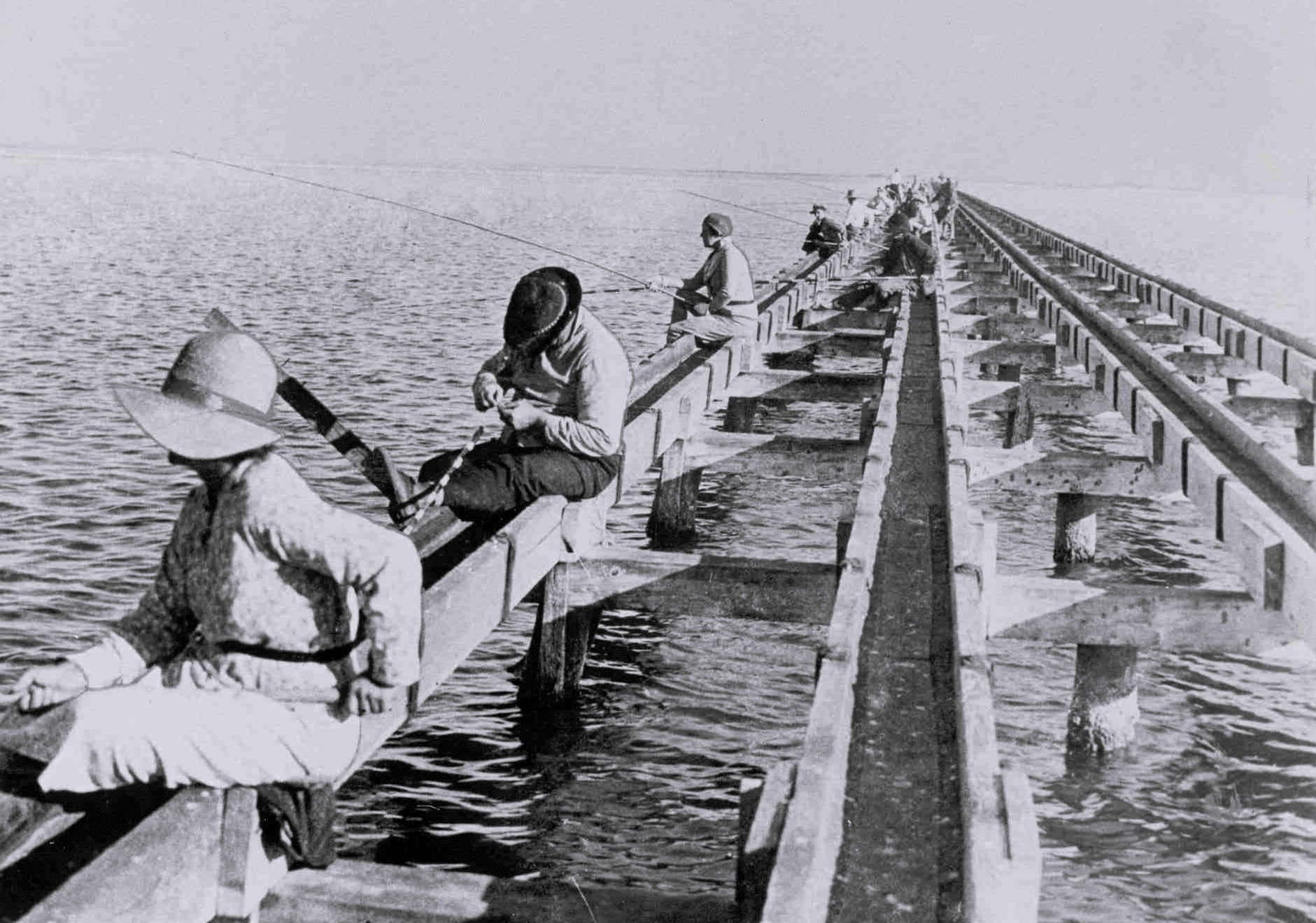
From the Padre Island National Seashore archives When Colonel Sam Robertson bought out Pat Dunn's interests (except for grazing and mineral rights) on the island, he envisioned developing Padre Island into the Miami Beach of the Texas coast. To that end he developed several projects to bring people to the island and which still exist, although not in their original form. In 1927 Colonel Robertson built the first causeway from the island's northern end to Flour Bluff on the mainland. He named it the Don Patricio causeway in honor of Patrick Dunn. The construction was very simple: four wooden troughs supported by a trestle. The troughs were spaced so that a standard automobile could place it tires in them and drive across. One pair of troughs was for eastbound traffic and one was for westbound. In the first month of its operation, 1,800 cars used the causeway and 2,500 used it the second month. After that use dropped. Robertson also stationed ferries at Port Aransas and built a bridge over Corpus Christi Pass. At the south end of the island he stationed another ferry. At the same time he began developing accommodations for the influx of tourists he anticipated. He built a hotel and four houses on the southernmost 45 miles of the island. He built a fifth house on the northern end about 3.5 miles south of the causeway. By 1930, however, it was apparent that Robertson's plan was failing the the tourist boom did not develop. After the 1929 depression, Robertson was unable to make his payments and he sold his interests on the island to two brothers from Kansas City named Albert and Frank Jones, instead of allowing the land to revert to the Dunn family per his original agreement with the family. The Jones brothers founded a company called the Ocean Beach Drive Corporation to continue Robertson's development, but actually did little or nothing. In 1933 a hurricane blew away most of Robertson's structures including the Don Patricio causeway. The brothers restored nothing and the island reverted to being primarily grazing land and a spot for fishermen. In 1936 a bill was introduced into the Texas legislature to develop Padre Island into a state and it received wide support from Corpus Christi and many other communities. The legislature passed the bill and allotted $400,000 to purchase land. However, Governor Jim Allred vetoed the bill saying that true ownership of the land had not yet been determined and that it was possible that the state already owned a large portion of Padre Island. This was not settled until 1945 in State of Texas vs. Balli et al. in which the Texas Supreme Court determined that the original land grant to Padre Balli covered the entire island and not just 50, 912 acres as the state had maintained. From 1933 to 1950 there was very little concrete development of Padre Island as a tourist destination. A few plans were dreamed up, but none came to fruition. The only real recreational development on the northern end came about in 1949, when 1,000 acres of land were set aside to establish a Nueces County Park. Development was also minimal on the southern end, where around the same time small areas were set aside for Isla Blanca and Andy Bowie county parks. The greatest concrete changes on the island during this time were the stationing of coast guard troops along the shoreline during the Second World War, development of a navy bombing range in the northern reaches (from the World War to 1960), and the beginning of drilling for oil and natural gas. During this time the idea started to take shape of developing the island into something other than a resort area. A few people started to discuss preserving the island's natural state and using it for outdoor recreation. In retrospect, this growing dialog had an enormous impact on the island's future and influenced all the development that was to home. It was during the 1940's though that the idea to establish a national park on the island began to form among a few Texans who wanted to preserve the island's unaltered environment. Scientists and nature enthusiasts had long recognized the island's value as an unaltered barrier island, which was becoming increasingly scarce. Professional and amateur ornithologists had a longstanding interest in the island because of the thousands of annual migrants and the abundant rookeries. Since the 1930's the National Audubon Society had taken a special interest in two prominent Laguna Madre rookeries known as the Bird Islands. When plans were raised in the 1940's to build the Intracoastal Waterway and the Queen Isabella causeway on South Padre Island, the National Audubon Society protested fearing their development would harm the environment. When the waterway and causeway were finally built, no harm was done to the environment, but interest in preserving the island for its environment had been stimulated. All the plans and dialogs began to take concrete form in the 1950's. The Queen Isabella Causeway to South Padre Island was completed in 1954, allowing easier access to the southern end of the island. A private channel was cut through the island in the present location of the Mansfield Channel in September, 1957, but its jetties were severely damaged by a hurricane in November of that year. It was rebuilt by the Corps of Engineers in 1962. In 1958, Senator Ralph Yarborough introduced a bill into congress to establish a national seashore on Padre Island with hearings on the proposal beginning in 1959. The final bill took into account the variety of interests connected with the island (oil and gas industry, environmentalists, developers, and private citizens) and was signed by President John F. Kennedy on September 28, 1962. |
Last updated: September 8, 2016