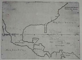
NPS Photo The first European to explore this area was Captain Alonso Alvarez de Pineda, who was commissioned by the Spanish Governor of Jamaica. In 1519, they left to explore the coast with four ships and 270 men in hopes of finding a water passage to the Orient. De Pineda mapped the entire coast of the Gulf of America from Florida to Vera Cruz (in present-day Mexico), including what was then known as "la Isla Blanca" (the White Island), which later became known as Padre Island. Legend claims he also discovered a small bay on June 24, 1519, which he named for the celebrated day of the Catholic feast of Corpus Christi. After his voyage of exploration, de Pineda went on to become a conquistador and eventually mayor of Peru, where he died in 1534. De Pineda is known only to have passed through the area, though he probably saw the island from off-shore. There is no record of de Pineda having set foot on Padre Island. The next European who passed through the area was Cabeza de Vaca, who was part of an unsuccessful exploratory expedition to what is now Florida in 1527. After Cabeza de Vaca and much of his company were marooned, he and several companions tried to return to Vera Cruz by sailing around the Gulf of America in makeshift boats. Unfortunately, they were caught by a storm and shipwrecked somewhere near present-day Galveston. Cabeza de Vaca and the few of his companions eventually became the slaves of the local indiginous peoples, with whom they had spent their first winter. Fortunately, the medical skills of Cabeza de Vaca were valuable to the natives and he was able to establish himself as a merchant between the two groups. As time progressed, Cabeza de Vaca lived and traveled with several native peoples along the coast and eventually made his way to the west coast, where he rejoined the Spanish who had been living in what is now California. Although the exact route of Cabeza de Vaca's journey is unknown, based on clues in his writings in later years, it is believed that he passed through the vicinity of Padre Island. Like de Pineda, there is no evidence that he ever actually set foot on the island, though it is possible that he did. In 1543, the remnants of Hernando de Soto's expedition that marched from Florida into what is now the American south came down the Mississippi to the Gulf under the leadership of Luis Moscoso (de Soto having died of fever a few weeks before). There they built crude boats with sails made from animal skins and sailed down the coast to Vera Cruz. They are known to have come ashore at several points along the way, and the descriptions of several of those locations are very similar to the terrain of Padre Island. Nothing explicitly states that they were on Padre Island, but it is quite probable that they did land on the island at least once. 
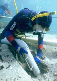
NPS Photo The first documented visit by Europeans was in 1554 when three ships were blown off course by a storm and shipwrecked near the present-day Mansfield Channel. The ships (the San Esteban, the Santa Maria de Yciar, and the Espiritu Santo) had been carrying colonists, cargo, and treasure from Vera Cruz to Spain. Of the approximately 300 passengers and crew onboard, thirty are believed to have sailed one of the ship's boats back to Vera Cruz under the command of Francisco del Huerto. They were to report the wrecks and begin rescue and salvage operations; however, those left at the wreck site were not so lucky. A chance meeting with local natives, which began peacefully, turned into a battle. The remaining survivors then began to walk back to Vera Cruz. Only two are known to have survived the trek, and the rest were either killed by native peoples or died from thirst or starvation. A salvage crew traveled from Vera Cruz to recover the gold and silver that had been lost in the wreck. They recovered most of the treasure and what little remained has probably been collected by treasure hunters and archaeologists since then. Unlike the survivors of the wrecks, the salvage crews did not encounter any hostile natives. The salvage crew was headed by Garcia de Escalante Alvarado, and salvage operations lasted from July 23 to September 12. Alvarado's arrival was preceded by Angel de Villafane, who arrived in June with a small unit of soldiers to protect the site of the wreck from looters from the (nearest) villages of Panuco and Tampico. Villafane stayed on the island until the end of operations and ultimately returned to New Spain with Alvarado. At the wreck site, Alvarado and Villafane found that only the superstructure of the San Esteban was visible. The Santa Maria de Yciar and Espiritu Santo were completely submerged and had to be located by dragging a chain. At the end of the operations, Alvarado recorded 29,075 pounds of silver and 22,000 pesos (in gold and silver, with one peso equaling about one ounce in weight) recovered. Also found were other articles, including clothing, utensils, cargo, and other items. In 1558, the Spanish crown commissioned a man named Martin Lavezares to take a small fleet and scout the Gulf coast between Vera Cruz and Florida, in order to establish colonies and outposts to protect Spanish interests in the region. The first stop he made was on the Texas coast at the latitude of present-day Kingsville, Texas. This is the same latitude as present-day Malaquite Beach. Lavazares did not attempt to establish a settlement here, so the stop may have been simply to explore the island or to search for fresh water or other supplies. 
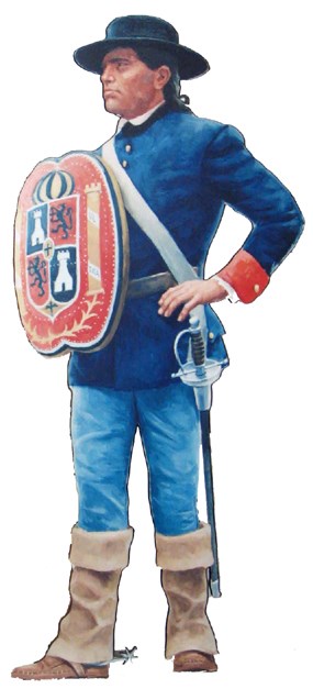
Courtesy of San Antonio Missions NHP Over the next 200 years, few people are known to have passed through the Padre Island area. Those that are recorded were mostly Spanish ships searching for the ill-fated Fort St. Louis, established at Matagorda Bay by the French explorer Robert Cavalier Sieur de La Salle in February, 1685. At least two of these expeditions recorded descriptions of Padre Island in their logbooks as they progressed along the coast. The first of these was led by Martin de Rivas and Pedro de Iriarte, who set sail from Vera Cruz on Christmas, 1686. In June of 1687, when Rivas and Iriarte were overdue to return, Spain sent two more ships under Captains Don Andres del Pez and Luis Gomez Raposo to search for the settlement. Based on the latitudes recorded in their logbooks, both expeditions are known to describe Padre Island. They described the island as low-lying and marshy, or subject to flooding, with dunes, tall-grass, and few, if any, trees. Four expeditions for the La Salle colony were mounted by land from 1686-1689 and led by Alonso de Leon. De Leon marched up the coast from the Rio Grande to the Baffin Bay area on his second expedition and may have been on Padre Island, but this is only supposition. He found one survivor of La Salle's colony (Jean Jarry) on his third expedition, and finally found the remains of the colony at Matagorda Bay on his fourth. The next documented visit was by Spanish troops and their Indian guides under the leadership of Diego Ortiz Parrilla in 1766. The Spanish government had heard that the English were trying to establish a settlement somewhere within the coastal bend area and sent Ortiz Parilla to scout the area for English settlements and to map it. Although the Colonel found no English settlers, he did draw up a map of the area which survives today and which shows the locations of several native bands living on the island, three channels breaking up the island into four smaller islands, and the location of several English shipwrecks on or near the island. At the time, the island was known as "Isla Corpus Christi", but afterwards it became known as "Isla de San Carlos de los Malaguitas" because of the Malaquite Indian settlements found in the southern half. By 1766, the area between the Nueces River and the Rio Grande had been already been designated as the Spanish province of Nuevo Santander. From that point on, settlers gradually replaced explorers in the area that was later to become south Texas. |
Last updated: February 18, 2025
