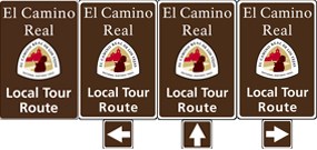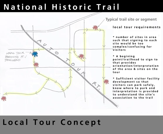
The local tour route sign is intended to mark a road route that will take visitors to a number of historic trail sites or segments. See figure below for an example of how a local tour concept works. The local tour functions similar to the auto tour route with the principle difference being the local tour route usually follows a number of local low speed, rural, or even dirt roads. The primary consideration for development of a local tour is when a number of historic trail sites or segments exist in a relatively small geographical area, and signing each of the sites separately would become difficult and confusing.
Considering a Local Tour Route
-
Identify a beginning point (a trailhead) to provide road signs that direct the traveling public to start the tour.
-
Provide a basic level of orientation at this starting point that includes a map, information about what to see and do on the local tour, and the length of the route.
-
Consider sufficient facilities to accommodate the public, i.e. safe parking off of the road, a site identification sign, and some level of interpretation (outdoor exhibits).*
-
If signing will be provided on public roads, obtain landowner’s permission to allow access to the general public.
*Signage and interpretation go hand-in-hand. A site that has historical significance — where you want to erect a sign — will also need interpretation, usually in the form of outdoor exhibit(s).

Sign Planning Links
| How to Create Your Sign Plan >> | NHT Family of Signs >> | Road Signs >> | Pedestrian Signs >> | Sign Plan Considerations >> |
| NHT Signs- How to Use Them >> |
Last updated: April 23, 2025
