|
You must teach your children that the ground beneath their feet is the ashes of our grandfathers. So that they will respect the land, tell your children that the earth is rich with the lives of our kin. Teach your children what we have taught our children-that the earth is our mother. Whatever befalls the earth, befalls the sons of the earth. If men spit upon the ground, they spit upon themselves. - Ted Perry (attributed to Chief Seattle)

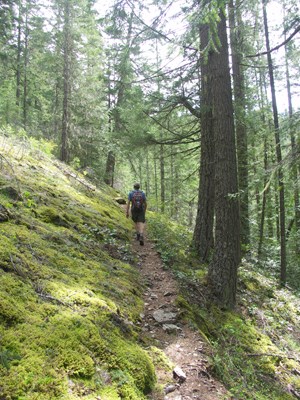
NPS/Rosemary Seifried At 3600 feet (1097 m), Fourth of July Pass is one of the earliest passes to melt out. For this reason, it is popular in early season, but day hikers and backpackers looking for a short trip enjoy this hike all season long. The west side follows popular Thunder Creek Trail and then heads steeply up the west slopes of the pass with occasional views out across the valley and the massifs of Snowfield and Colonial Peaks. The best views are from the camp. The pass itself is a broad, forested pass, but there are some views from above the tiny lakes known as Panther Potholes. The Panther Creek side of the trail is not a trail for mountain views, but rather a wild and beautiful forest with many opportunities to admire the frothing blue waters of the creek rushing and tumbling toward Ruby Creek below. The brush is legendary along this section of trail, especially between the pass and Panther Camp, as it passes through several avalanche chutes. Stinging nettles are common, mixed among the gorgeous array of wildflowers, so long pants are recommended. The Panther Creek Trail often surprises hikers by its steep ascent and descent in the first few miles as it leaves SR 20 and climbs steeply to cross a high knob before dropping into the Panther Creek Valley. The steep gorge below does not allow for a trail to contour through this area, thus the longer and steeper route over the knob. Special Concerns:
Backcountry Camping: A backcountry permit is required for all overnight stays. Permits are limited. There are two camps along this trail: cliff-side Fourth of July Camp on the west side of the pass offers nice views toward Neve Glacier, and forested Panther Camp offers creekside camping in the middle of the Panther Creek valley. Campfires are not allowed at Fourth of July Camp. Please help protect this area by bringing a campstove. Two camps on the Thunder Creek Trail, Thunder and Neve camps, allow for a base to explore the pass without carrying heavy packs up the switchbacks. Access via Thunder Creek Trailhead: Drive SR 20 to mile 130, Colonial Creek Campground. Park in the large lot near the boat ramp on the south side of the campground, and walk back through the campground toward the amphitheater, where the main Thunder Creek Trail begins. Access via Panther Creek Trailhead: Drive SR 20 to mile 139, the East Bank Trailhead. Park here and walk east on SR 20 across the highway bridge over Panther Creek. It is a few minutes walk to the start of the Panther Creek Trail, and you can't see the trail until you are right upon it. Look for the sign. There is a wide shoulder on SR 20, but traffic moves quickly, so please be careful crossing the highway and walk single-file along the shoulder.

NPS / Rosemary Seifried 
|
Last updated: September 1, 2021
