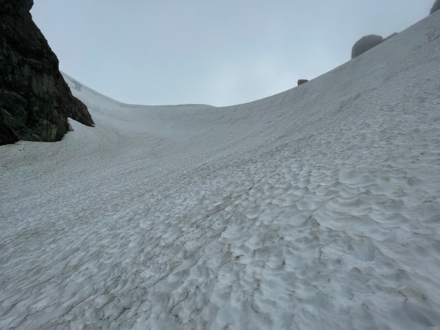
NPS /J.Shields Fisher Chimneys The Fisher Chimneys is a popular route right now and is in good condition. The chimneys are completely snow free until ~6,600ft (above the white salmon glacier) and the approach from Lake Ann travels through only a couple small snow patches. The bivy sites below Winnie's Slide are melted out with a small water source just below Winnie's Slide that ran consistently throughout the day. There are a couple bivy sites just above Winnie's slide with a larger water source. Crevasses are opening up on the Curtis Glacier but travel is generally straight forward to Hell's Highway. Hell's Highway does have some visible crevasses on climber's left, most parties seem to climb the shorter steep pitch on the right and ascend the ridge to the Sulphide Glacier. Both Winnie's Slide and Hell's Highway are still steep snow travel (not yet hard ice). Most climbing parties used 2 ice tools to descend these sections. 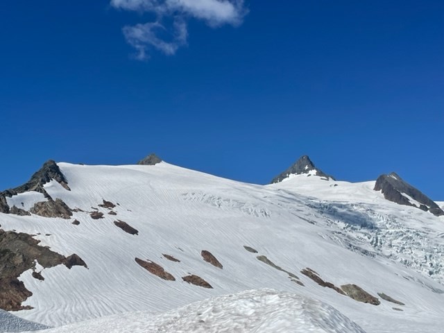
NPS/J.Shields Getting onto both the SE Ridge and gully of the pyramid is straight forward. The SE Ridge is completely snow free. The gully has a large patch of snow down low and one near the top that can be avoided. There is a lot of rappel stations set up in the gully for descending. Descending the gully with a 60m rope took most teams about 3 rappels with a combination of down climbing. 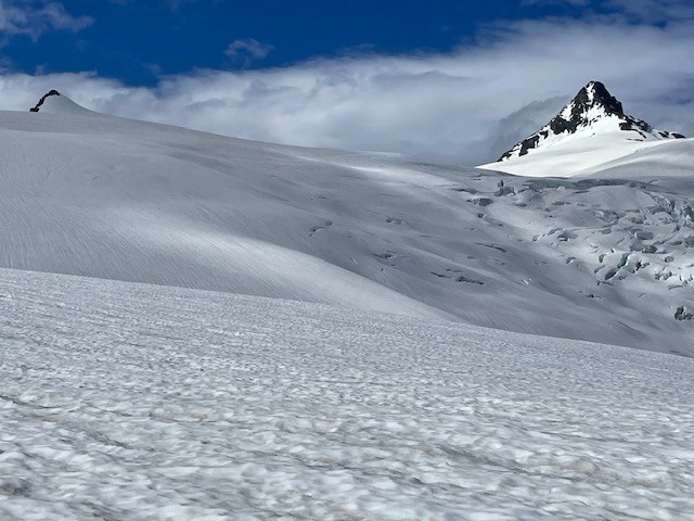
NPS/J.Shields Sulphide Glacier Snowpack continues to be higher than average for this time of year. Snow travel on Shannon Ridge Trail starts at ~4,200ft elevation and with continuous snow cover at ~4,600ft. Both the lower and upper bivy site toilets have been dug out. The lower bivy site toilet is currently at its capacity, so please try to use blue bags and the upper bivy toilet instead. Do not leave human waste on the snow – rangers had to clean up a lot of surface poop. There is a running water source at both the lower and upper bivy sites. A couple lower bivy sites have melted out, but still plan to camp on snow. A shovel can still be essential to build a platform for snow camping. As a reminder, food canisters or ursacks are required for camping below the vegetation line (~5,800ft), which includes “the notch” below the lower bivy site. There are subtle signs of crevasses on Sulphide Glacier approaching Summit Pyramid. Summit Pyramid itself is dynamic and snow is quickly melting off. The SE Ridge is snow free but there’s still snow hanging in the gully. Moats are starting to develop and will become a transitioning obstacle in the near future. 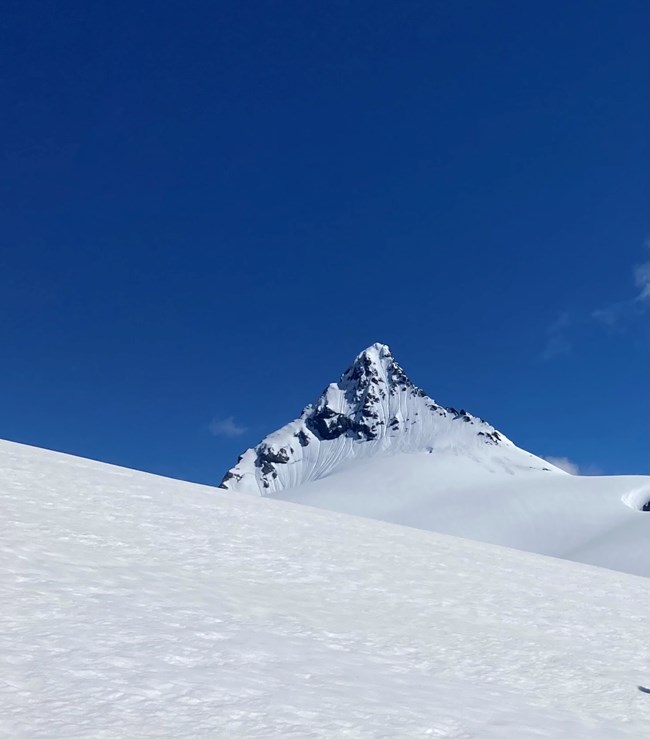
NPS K.Vollinger The road to the trailhead has been repaired! Most vehicles can drive to the parking area, but two stream gullies must be crossed and require some clearance (we saw one sedan managed to make it to the parking lot). Shannon Ridge trail has continuous snow coverage shortly after 4000 feet. There is running water currently near the lower bivy site. Both toilets are still buried under heaps of snow. Expect to camp on snow; at least one shovel can be an essential tool in the alpine. There are no crevasses visible on the climbing route proper at the moment. On the steeper slopes to climber's right of the standard route above the bivies, there are subtle signs of crevasses (long trenches). The rangers only went to about 7700 feet on the glacier, but the snow to that point was very supportable and consolidated for easier travel on snow. The summit pyramid is covered in snow still, and rock patches are slowly melting out. However, expect steep snow climbing to be all or the bulk of the route for a while. A guided party that climbed the route straight up the middle of the face early on 6/27 (middle of the first "heatwave'), reported that even with clear skies that night the route barely set up. It was breakable crust most of the way up the summit pyramid, making the route only doable by staying in the center runnel to the summit. They were able to move out of the trench only in the last section to the summit when it became firm neve for better front pointing. Being in the trench exposes climbers to terrain trap hazard as it funnels rock and snow/ice fall. The snow will likely be more supportive for front pointing with cooler, clear nights; but be concerned for overhead hazard if things have not set up overnight or when the face moves into the sun. Currently that face starts moving into the sun around 8:15 am. 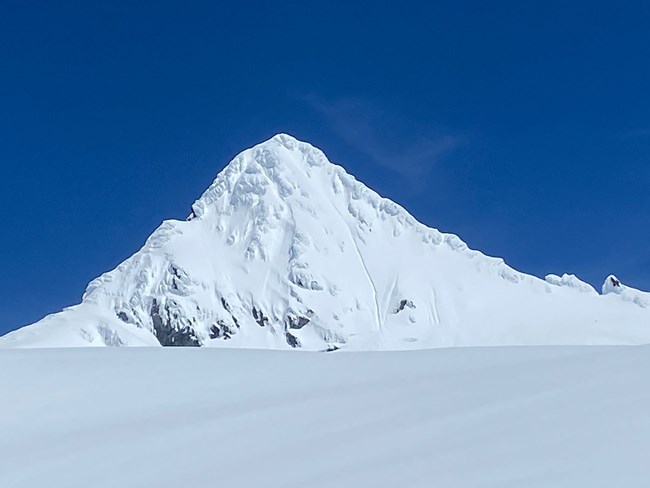
NPS/B. Muller June 5, 2022 Keep in mind that “above average snowpack” can be misleading if just looking at a percentage. Thunder basin snotel site, for example, is well above average for this date (currently 1500%), and the site currently has 20” of snow on the ground. Easy Pass is also above average at 130% snowpack but is recording 130” or over 10 feet. This amount of snow may sound great to some people and not as great to others. For skiers and riders, it is great to be able to utilize the flotation provided by backcountry gear. For climbers, it might mean more challenging approaches, snow on route, and lots of post-holing. Consider bringing snowshoes depending on the objective. For overnight visitors it might mean melting snow for water if the creeks are still far below the surface of the snow. One thing that backcountry rangers have noticed in recent weeks is that the snow is wet and heavy and not freezing overnight. This seems to be true at fairly high elevations, and for different areas including Rainy Pass, Cascade Pass, and Hannegan Pass. The slushy conditions have made for slow travel, at times adding about 25-50% extra time if not more. This has been true for skiers and riders, and especially true for climbers without any flotation. Along with snow considerations, the amount of snowmelt and rain have increased the flows in the rivers, and this could continue for weeks to come as the weather warms up. Even small creeks might not be crossable at some flows, and the timeline for high flows might look different this year than in years prior. It is important to look into current conditions and plan your trip based on what you might encounter this year rather than assuming that it will be similar to what you saw last year at the same time. This includes many considerations, from travel times if the road is still impassable due to snow, to travel speed on snow versus on a trail, and whether or not a creek will be crossable. It might also include planning for a colder environment if you will be camping on snow, requiring more warm layers and more fuel if you are melting snow for water. Remember, plan accordingly in order to have a fun and safe trip.
Check out the links below for climbing condition blog posts from previous years: Climbing Conditions - Mt. Shuksan 2024 Climbing Conditions - Mt. Shuksan 2023 |
Last updated: May 7, 2025
