Maps


Current Maps

On the map below, the park is accessed by turning onto Twnshp 2159E (306th Lane) from County Highway 2. Start at the information kiosk, which is immediately on the left side after turning. Visit the directions and transportation page for more information on visiting.


Historic Maps

 
Aerial black and white photo of the New Philadelphia area. Many yellow rectangles are transposed on it showing plots of land.
Excerpt of an April 1998 aerial photograph from the U.S. Geological Survey shows the landscape on which New Philadelphia was located.

Courtesy Chris Fennell, Professor of Anthropology and Law, University of Illinois

This excerpt of an April 1998 aerial photograph on this page from the U.S. Geological Survey shows the landscape on which New Philadelphia was located. Approximate graphic depictions of the town lots and streets, as platted by Free Frank McWorter in 1836, have been overlain onto this aerial photo. Sources: U.S. Geological Survey, Aerial Photographs Collection; D. W. Ensign, Atlas Map of Pike County, Illinois, Davenport, Iowa: Andreas, Lyter & Co., 1872, p. 84, from 1976 Unigraph reprint; Pike County Deed Book, Vol. 9, p. 183 (1836).
 
Graphic showing a grid of 20 groups of plots in a large square. Each group is comprised of several sub-plots ranging in number from eight to four. The names of streets are written between each group.
Excerpt from the 1872 Atlas Map of Pike County.

1872 Atlas Map of Pike County

This excerpt from the 1872 Atlas Map of Pike County shows the town lots and streets of Philadelphia, as it was originally known. It depicts the lot designations in a manner consistent with the original plat laid out by Free Frank McWorter in 1836. (The drawing of a river's edge along the lower left margin of this image is from an adjacent inset map unrelated to Philadelphia.) This Atlas also provided a map of the vicinity surrounding Philadelphia. Source: D. W. Ensign, Atlas Map of Pike County, Illinois, Davenport, Iowa: Andreas, Lyter & Co., 1872, p. 84. Illinois Historical Survey Collections, University of Illinois, Urbana-Champaign.
 
 Four interpretive panels mounted under a covered, kiosk overlooking a prairie landscape.
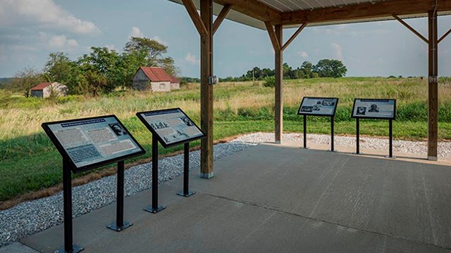
Visiting New Philadelphia

Planning to visit? Start here! Check out helpful information to plan your visit and know what to expect at this new national park.

A brown historic site sign stands on a roadside. On it, a white arrow points left.
Directions and Transportation

Directions to New Philadelphia and parking information.

A mowed path through prairie. There are numbered signs along the trail for a tour.
Things To Do

Find out what you can do on a visit to New Philadelphia.

Last updated: July 3, 2025

Park footer

Contact Info

Mailing Address:

New Philadelphia National Historic Site
413 S. 8th Street

Springfield, IL 62701

Phone:

(573) 880-3120

Contact Us

Tools