|
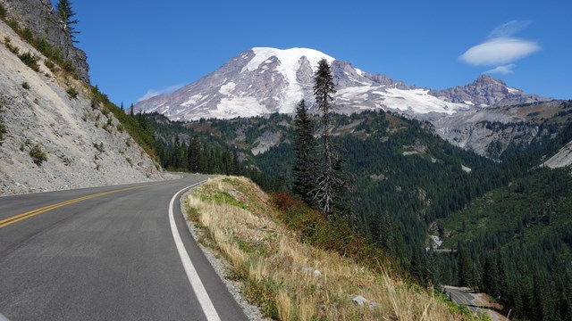
Mount Rainier National Park is actively improving roads, buildings, and campgrounds through a series of construction projects aimed at enhancing safety, accessibility, and overall visitor experience. Due to heavy winter snowfall, most of this essential work is limited to the short summer season.
Construction can shift day-to-day on park roads and parking lots and is especially weather dependent. Please expect major traffic disruptions during this time.
- Some roads may experience one-lane closures with up to 30-minute delays, 7 am to 7 pm, Mondays to Fridays, only.
- Some parking areas may be limited down to 30% of normal capacity.
- Some roads may close entirely.
We appreciate visitors' patience as we work to make improvements to park infrastructure. These efforts will improve safety, accessibility, and the overall visitor experience. Please examine the schedule below to plan ahead.
Last Updated: Monday, August 25, 2025
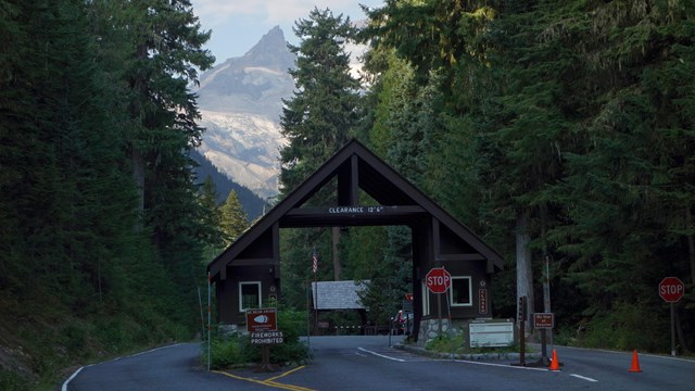
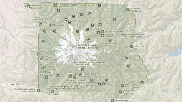
Road Status Map
For the best viewing experience, click on the "View full screen" link in the lower left corner of the map. Click on any section of road or notification symbol for more information.
Pavement Preservation Project
Pavement preservation work will include patching, resurfacing, and striping all roads, pullouts, and parking areas on the west side of Mount Rainier National Park.
- Project dates: May 2025 - September 2025
- No work is scheduled for weekends (Saturdays and Sundays).
- Schedule below is subject to change due to weather.
Dates
|
Pavement Preservation Work
|
Impact
|
Monday, May 5 -
Monday, September 22, 2025 |
There will be temporary impacts to roads, parking areas, and pullouts on the west side of Mount Rainier National Park, including:
- Nisqually-Paradise Road
- Longmire Area
- Cougar Rock Campground
- Paradise Area, including parking lots & picnic area
- Paradise Valley Road
- Stevens Canyon Road to Stevens Canyon Entrance
- Carbon River Ranger Station parking and Carbon River Entrance parking
- Detailed schedule below will be updated throughout the summer.
|
-
Expect pavement preservation work from 7 am to 7 pm, Monday - Friday.
-
One lane closures with cumulative delays of no more than 30 minutes.
-
No paving work on weekends & holidays.
-
Make a backup plan in case trailheads, pullouts, or parking areas are not readily accessible to vehicles.
|
Monday, August 25 -
Friday, August 22, 2025 |
Microsurfacing and Striping planned for the following locations:
- Paradise Area
- Picnic Area (partial closures all week)
- Lower Lot (partial closure all week; limited parking up to 50%)
- Glacier Hill (striping on Monday; minimal impact)
- Longmire Area
- Nisqually Entrance
- Residence Parking (full closure on Tuesday; no impact to visitors)
- Service Area Parking (full closure on Tuesday; minimal impact to visitors)
- Kautz Creek Trailhead Parking (full closure Monday; striping on Tuesday)
- Westside Road (closure on Tuesday; minimal impact Wednesday)
- Twin Firs Trailhead Parking (full closure on Monday)
- National Park Inn Loop (full closure Monday; striping on Tuesday and Wednesday with minimal impact)
- Longmire South Back Gate Road (full closure Monday to Wednesday; no impact to visitors)
- Community Building Parking (full closure Tuesday; minimal impact to visitors)
- Residential Road and Parking (full closures from Monday to Wednesday with impacts to visitors likely)
- Tahoma Woods
- Headquarters Building Parking (full closure Monday; striping on Tuesday; no impact to visitors)
|
-
Visitors will experience heavy congestion, parking delays, and detours.
-
Parking in Paradise will be limited to just 30% of normal capacity at worst and 50% at best. Make a backup plan in case trailheads, pullouts, or parking areas are not readily available to vehicles.
-
Some sites may open as work allows, check Recreation.gov to check campground status.
-
Stevens Canyon Road will be limited to one-lane with up to 30-minute delays.
-
Follow all road signs and instructions.
-
Do not move construction cones to accomodate parking; vehicles found violating signs will be towed and fined.
-
Please observe posted speed limits and drive mindfully; hikers may be on park roads and blind curves may make it difficult to see traffic building up in advance.
-
Give construction crews plenty of space to work.
|
State Route 123 (SR 123) Rehabilitation
SR 123 travels north-south along the east side of the park from the southeast entrance near Packwood, WA, to the junction with SR 410 at Cayuse Pass. The rehabilitation project will work on a 2.8 mile section of SR 123 from Laughingwater Creek Bridge (milepost 2.5) to Panther Creek Bridge (milepost 5.2). The project will replace substrate to level the road, rehabilitate ditches, and replace/upsize 18 culverts.
Dates
|
SR 123 Closures
|
Impact
|
| May 23, 2025 - September 1, 2025 |
- One lane closure when crews are working, typically Tuesday - Thursday. One lane open for intermittent traffic.
|
- Expect work from 7 to 7 pm, typically Tuesday - Thursday.
- Expect delays of up to 30 minutes.
- Expect gravel road for the northern half of the construction zone.
- Reduced speed limit of 25 mph in construction zone.
|
- Pullouts along the road, including Laughingwater Creek (Three Lakes) Trailhead, closed for staging equipment and materials.
|
- Hikers must park and walk to the Laughingwater Creek Trail from Stevens Canyon Entrance.
- Equestrian access loading and unloading is allowed in designated coned-off area ONLY. Parking of horse trailers on SR 123 is not allowed.
|
| September 2 - September 30, 2025 |
- Full road closure of SR 123 between Deer Creek Bridge and the intersection just north of Stevens Canyon Road and SR 123.
- Stevens Canyon Entrance will remain open via SR 123 from the south except for a 6-hour period on Wednesday, September 24 (weather dependent). See more below.
- Northern Closure at Cayuse Pass
- Large Vehicles
- Large vehicles, including RVs, campers, and any vehicles towing trailers, must turn around at the closure at Cayuse Pass.
- Beyond this point, there is no safe turn-around.
- Drivers with large vehicles who fail to turn around will be forced to back up as far as 3.5 miles.
- Small Vehicles & Bicyclists
- Turnaround is available at both Cayuse Pass and Deer Creek Bridge.
- Trail Access
- Trails remain open but parking and trailhead access will be challenging.
- 1. Have an alternative hike prepared if preferred parking is full.
- 2. Plan to be dropped-off/picked-up if no parking is available.
- 3. Understand that vehicles left in "no parking" zones may be towed.
- See more information here.
- Traffic Restriction
- All southbound traffic is prohibited beyond Deer Creek Bridge.
- Southern Closure at intersection of SR 123 and just north of Stevens Canyon Road
- All Vehicles, Bicyclists, and Pedestrians
- All northbound traffic will be prohibited beyond the intersection, just north of the intersection of Stevens Canyon Road and SR 123.
- Stevens Canyon Entrance will remain open via SR 123 from the south except for a 6-hour period on Wednesday, September 24 (weather dependent). See more below.
|
- Expect major traffic disruptions during this time.
- No access will be available through SR 123 north of Stevens Canyon Entrance nor south of Cayuse Pass.
- White River Entrance, White River Campground, and the Sunrise area will remain open via SR 410. Expect a detour of 3-4 hours if travelling to White River Entrance from Stevens Canyon Entrance.
- For questions about trail access or detours, find answers to frequently asked questions here.
|
Wednesday, September 24*
*Date subject to change for the following days pending weather conditions |
- Stevens Canyon Entrance will be fully closed for a period of 6 hours between 8 am and 4 pm prohibiting all through traffic.
- Through traffic will be permitted prior to 8 am and after 4 pm.
|
- Expect major traffic disruptions during this time.
- Southbound traffic beyond the Grove of the Patriarchs parking lot will be prohibited.
- Continue to expect a detour of 3-4 hours if travelling from either end of the closure at Stevens Canyon Entrance to White River Entrance.
- Continue to expect a detour of at least 1.5 hours if travelling from the southern end of Stevens Canyon Entrance or Packwood to Longmire / Paradise through the Nisqually Entrance.
- For questions about trail access or detours, find answers to frequently asked questions here.
|
| October 1, 2025 - Winter Closure |
- One lane closure. One lane open for intermittent traffic.
|
- Expect delays of up to 30 minutes.
|
Ohanapecosh Campground Construction Project
Ohanapecosh is a developed area in the southeast corner of Mount Rainier National Park. Work will include the rehabilitation of 185 campsites and nine restroom buildings, replacing the wastewater collection system, upgrading electrical and water systems, road repairs, and accessibility improvements.
Dates
|
Ohanapecosh Closures
|
Impact
|
| February - End of 2025 |
- The entire Ohanapecosh Developed Area is CLOSED for the duration of the construction project, including all campsites, group camping sites, Cowlitz Indian Tribe Designated Use Area, visitor center, restrooms, auditorium, Ohanapecosh river access, picnic area and parking facilities.
|
- No vehicle access.
- No pedestrian access, including with pets, to any part of Ohanapecosh, including roads, trails, visitor center, auditorium, day use areas, & campground.
- No recreational access, including bicycling and camping.
- No visitor center services, including permits.
- No public WiFi.
- No restrooms.
- No water fountains/potable water.
|
- The Silver Falls Trailhead located in the Ohanapecosh Campground is closed.
|
- No access to the Silver Falls Trail from the Ohanapecosh Campground.
- Silver Falls can be accessed from the Grove of the Patriarchs parking lot via the Eastside Trail. There is additional parking and access to Silver Falls from the Cowlitz Divide Trailhead along Stevens Canyon Road.
- NOTE: The portion of the trail connecting to the Ohanapecosh Campground is closed and the Silver Falls Trail cannot be hiked as a loop. The two sides of the trail on either bank of the Ohanapecosh River can be hiked as out-and-back routes only.
|
Road Status
Find out current road conditions, including access to Paradise during the winter season.
Directions
Need directions to get to different park entrances? Also includes information on driving times to park locations.
Park Maps
Maps of Mount Rainier National Park, including the Wilderness Trip Planner Map and area trail maps.

Park Construction FAQs
Find detailed information about park construction projects that are underway or upcoming in Mount Rainier National Park.
|