Flood Photos

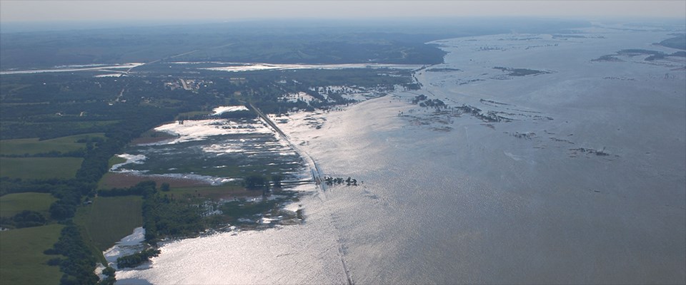
View looking West of a flooded Nebraska Highway 12 with the town of Niobrara in the distance.
Westbound Nebraska Highway 12 leading to the town of Niobrara during the 2011 Flood.

Civil Air Patrol. June 12, 2011.

The spring of 2011 brought the highest water levels since the flood of 1952 and the greatest runoff volume since the U.S. Corps of Engineers began keeping records in 1898. The flood began in the spring and continued well into the summer due to the melt of a large snow accumulation during the winter and a large rain event in near Three Forks, Montana; the headwaters of the Missouri River.

Additional information on the 2011 Flood:
Geomorphic Change on the Missouri River During the Flood of 2011
Examples of Channel Impacts from the 2011 Flood

 
View of a flooded Nebraska Highway 12 looking East during the 2011 Flood.
View looking downriver on Eastbound on Nebraska Highway 12 during the 2011 Flood.

Civil Air Patrol. June 12, 2011.

 
All gates on the Gavins Point Dam are open allowing water to pass through into the Missouri River during the 2011 Flood.
All gates open on the Gavins Point Dam allowing water to pass through during the 2011 Flood. Crowds of spectators gathered on the South Dakota side to watch as water poured out from the spillway. Close to 150,000 cubic feet per second was released during the flood event.

NPS

Last updated: June 14, 2018

Park footer

Contact Info

Mailing Address:

508 East 2nd Street
Yankton, SD 57078

Phone:

605-665-0209 x21

Contact Us