|
You are viewing ARCHIVED content published online before January 20, 2025.
Please note that this content is NOT UPDATED, and links may not work. For current information,
visit https://www.nps.gov/aboutus/news/index.htm.

NPS
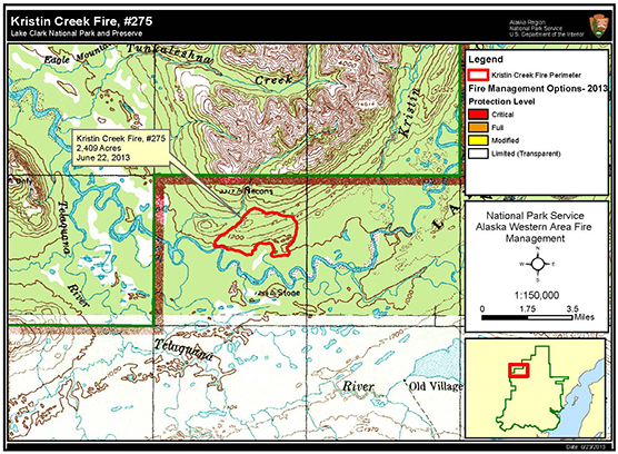
Contact: Mary McBurney, 907-602-2333 Port Alsworth, Alaska –The State of Alaska Division of Forestry mapped the Kristin Creek Fire from the air yesterday and reported that it had grown from 635 acres on June 20 to 2,409 acres. The fire was 65 percent active, smoldering primarily in tundra and moving predominately to the northwest. Four helitack fire fighters are on the ground monitoring the fire and its movements closely and focusing their efforts on reducing the wildfire risk to structures. Where there is fire, there is smoke. Fire and smoke are often part of Alaskan summers and park visitors and local residents can anticipate varying levels of wildfire smoke due to current and expected fire activity. Generally, worse conditions occur overnight and during the early morning hours, as the atmosphere cools and brings smoke to the surface. During the day, surface heating will mix smoke and carry it upwards, temporarily improving air quality. For the latest information on wildfire smoke and air quality in your area, check the Alaska Department of Environmental Conservation Division of Air Quality website at http://dec.alaska.gov/air/smokemain.htm. Currently, more than 70 fires are active statewide. Visit http://fire.ak.blm.gov/ for information about statewide wildfires, especially those near Lake Clark NPP. |
Last updated: April 14, 2015
