Glacier Monitoring

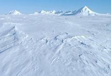
The Harding Icefield

NPS / Deb Kurtz

Kenai Fjords National Park was established in 1980 with the specific goals of maintaining the scenic beauty and environmental integrity of the Harding Icefield and its glaciers and fjords.

Since the park was established, evidence of global climate change has been brought to the forefront of science. Changes in weather, wildlife, and vegetation patterns around the world have been documented by numerous scientific studies. These changes are most apparent in regions where snow and ice dominate the landscape. The Harding Icefield and its outflowing glaciers are no exception. Researchers at Kenai Fjords National Park work together with university researchers and scientists from other government agencies to understand this environment, to monitor changes, and to determine the impacts of those changes on other ecosystems in Kenai Fjords National Park.

Glacier monitoring projects allow scientists and managers to understand the condition of the icefield and glaciers through time. They allow us to measure and document change, and possibly, to forecast future change. With this information, we can better understand and manage the park for today and the future.

The National Park Service has five ongoing monitoring projects in Kenai Fjords National Park that help us to understand and document changes to the Harding Icefield.

Glacier Monitoring Projects

Clicking a topic will bring you further down this webpage to that topic.
Repeat photography
Time-lapse photography
Exit Glacier terminus mapping
Glacier mass balance
Glacier extent mapping


Repeat Photography
A picture may be worth a thousand words, but the same picture taken decades, or even a century, apart is priceless when it comes to detecting landscape change. In the early 1900s, U. S. Grant and D. F. Higgins of the USGS photographed many of the tidewater glaciers of Kenai Fjords National Park. In 2004-5, USGS scientist Bruce Molina revisited those sites, matching the current images to the historic. The contrast is shocking. Resource managers at Kenai Fjords are continuing this monitoring effort to record changes in the glaciers, snow line, and vegetation.


Time-Lapse Photography
Daily repeat photography can be used to document smaller scaled changes such as those that occur within a season, a week, or even a day. By viewing these photos in a rapid, time-ordered sequence, they appear like a video. In late summer 2010, researchers recorded daily images of Exit Glacier that captured and revealed glacial flow, thinning, melt, and the phenology of the nearby flora. In August of 2011, a similar project was done from Squab Island, showing the changes of Aialik Glacier.


Exit Glacier Terminus Mapping
Historic positions of the Exit Glacier terminus have been mapped using existing aerial photography. In more recent years, Kenai Fjords has used either GPS or aerial photography each fall to track Exit Glacier's annual movement. This mapping effort allows us to document the changes to the length and width of the terminus that we observe seasonally and annually.

 
An aerial view of Exit Glacier.  Colored lines on the map denote the different years that the Exit Glacier Terminus was at those places.
Map of the terminus of Exit Glacier from 2023, with the past terminus positions digitized from aerial photographs or mapped with a GPS.

NPS Image

 
Terminus Mapping of Exit Glacier
Georeferenced aerial photographs of Exit Glacier taken in 1993, 2005, 2006 and 2007.

NPS Image

 
Researchers measuring snow depth and density.
Researchers dig snow pits, so they can measure snow depth and snow density.

NPS Photo

Glacier Mass Balance
Glacier mass balance is the difference between the accumulation of snow and ice during the winter and the ablation or loss of snow and ice through melting and sublimation in the summer. If compared to a bank account, it is the balance of deposits and withdrawals. Changes in mass balance dictate long-term changes in a glacier's behavior. A trend of negative balances indicates that a glacier will get smaller in size and a positive trend indicates growth in glacier mass. Geometric changes resulting from a negative balance include thinning and increased rates of terminus retreat.

Glacier mass balance studies help scientists and managers understand long term climate trends and associated changes to the glaciers. Variations in temperature and snowfall resulting from climate change directly affect a glacier's mass balance. Mass balance measurements help researchers correlate climate change with glacier behavior more than any other existing glacier monitoring project in the park.


Glacier Extent Mapping
Researchers at the NPS Southwest Alaska Network of the Inventory and Monitoring program use remote sensing to map glacial extent on a decadal scale. This long term monitoring effort will provide managers with an understanding of changes to glacial extent across the Harding Icefield, without regard to management boundaries.


Last updated: February 20, 2024

Park footer

Contact Info

Mailing Address:

PO Box 1727
Seward, AK 99664

Phone:

907 422-0500

Contact Us