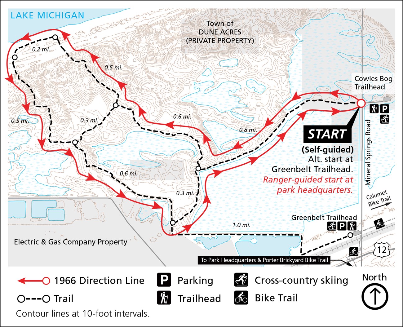
Cowles Bog, a National Natural Landmark, is a mosaic of plant communities named in honor of Henry Chandler Cowles (pronounced “coals”), an impactful scientist and conservationist whose research around the Indiana Dunes helped define the field of ecology. The trail brings visitors through a diverse combination of different habitat types, including ponds, marshes, swamps, savannas, woodlands and beaches. Steep sand dunes near Lake Michigan can make this 4.7 mile hike a strenuous journey. Many visitors pack a lunch to enjoy at the shoreline while resting for the return trip (don't forget to "pack out" your trash). Make sure to bring plenty of water, sun protection, and extra clothing layers as the the weather at the lake can be very different than at the parking lot. The 1966 Hiking Challenge is comprised of 19 hikes that cover 66 miles of trail in the park- celebrating the park’s founding in 1966. The ranger-led hike for this trail meets at the Park Headquarters parking lot. For more information, including specific dates and trail locations, visit this Thing to Do and scroll down. Do not worry if you cannot make each of the 19 ranger-led hikes. A check-off sheet will be available at the Visitor Center or the the Paul H. Douglas Center for those who complete the hikes on their own. REMINDER: Information found on this page is specific to the 1966 Hiking Challenge
BE PREPARED
Getting ThereIf you plan to join us for the guided hike, be advised that due to limited parking, the meeting location is the Park Headquarters South Parking Lot (Fire station parking lot) at: Trailhead Parking Lots Main Lot (north): 1450 North Mineral Springs Road, Dune Acres, IN 46304 Trailhead GPS Coordinates Main (North): 41.645191, -87.084633 (Decimal Degrees) Need to Know

Hike from the north lot or south lot (Greenbelt) in a counterclockwise direction. PLEASE NOTE: The ranger-guided hike (scheduled for Saturday, August 26th at 8:00 am) meets at the park headquarters parking lot at 1100 North Mineral Springs Road, Porter, IN 46304. |
Last updated: June 10, 2025
