
Charles Flagg / Stony Brook University
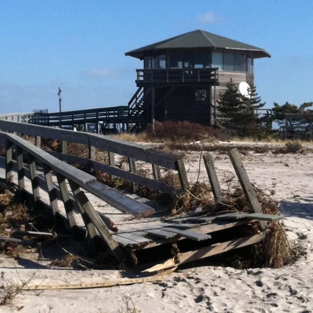
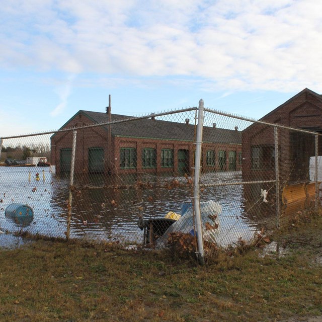
It's no doubt that we're living in a time of great changes. Global temperatures have increased and will continue to do so, sea levels are rising as ice masses melt more and more, and natural disasters are increasingly frequent. A notable example of what our parks and park managers must contend with in a changing climate was Hurricane Sandy in 2012.
One of the most powerful storms of the century, Hurricane Sandy swept through many federal lands, including coastal parks within the Northeast Coastal and Barrier Network (NCBN). Fortunately, for some of these places, recovery appeared to be fairly quick. Following the storm, NCBN and our counterparts within the National Park Service's Northeast Region received funding to conduct research on Hurricane Sandy's short- and long-term impacts. With our findings, we hope to understand how our parks' natural resources will recover after such a powerful storm, especially if we can expect more to come in the future. Below are resources and videos from our work.
Elevation Mapping Projects
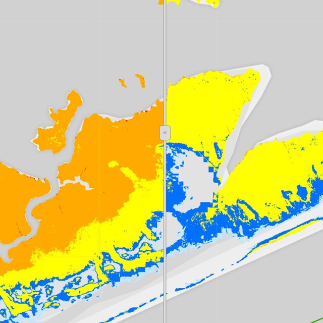
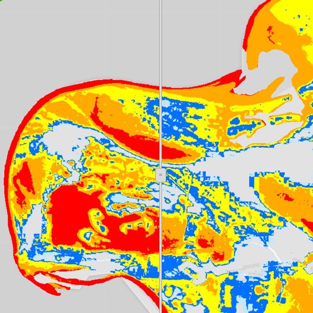
This project aimed to create data infrastructure and technical procedures to prepare and respond to future storm events at Assateague Island National Seashore, Fire Island National Seashore, and Gateway National Recreation Area. We focused primarily on compiling elevation data and creating inundation models. The interactive maps below show potential inundation zones, infrastructure flood vulnerability, critical areas for elevation mapping, and salt marsh elevation points.
Elevation Maps
-
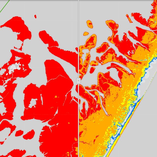 ASIS: ADCIRC Models
Interactive map showing potential inundation at Assateague Island National Seashore
-
 FIIS: ADCIRC Models
Interactive map showing potential inundation at Fire Island National Seashore
-
 GATE: ADCIRC Models
Interactive map showing potential inundation at Gateway National Recreation Area
-
 ASIS: Building Flood Vulnerability
A web tool to facilitate understanding of building flood vulnerability at Assateague Island National Seashore
-
 FIIS: Building Flood Vulnerability
A web tool to facilitate understanding of building flood vulnerability at Fire Island National Seashore
-
 GATE: Building Flood Vulnerability
A web tool to facilitate understanding of building flood vulnerability at Gateway National Recreation Area
-
 ASIS: Critical Areas
An app that highlights the GPS elevation data collected in critical areas at Assateague Island National Seashore
-
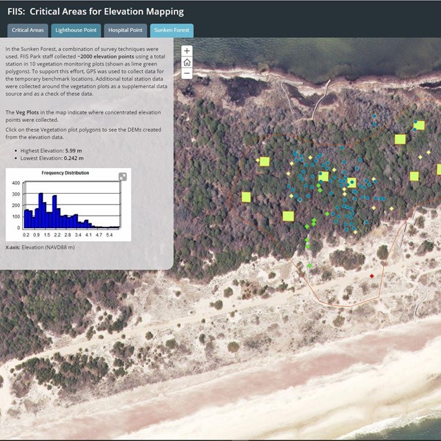 FIIS: Critical Areas
An app that highlights the GPS elevation data collected in critical areas at Fire Island National Seashore
-
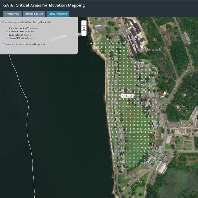 GATE: Critical Areas
An app that highlights the GPS elevation data collected in critical areas at Gateway National Recreation Area
-
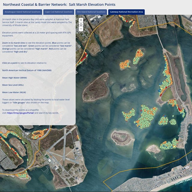 NCBN Salt Marsh Elevation Points
Elevation points collected in salt marsh sites at four coastal national parks using survey grade GNSS equipment
Coastal Resilience Videos
Learn about the resilience of our coastal national parks after a catastropic storm like Hurricane Sandy.
Visit our keyboard shortcuts docs for details
- Duration:
- 12 minutes, 17 seconds
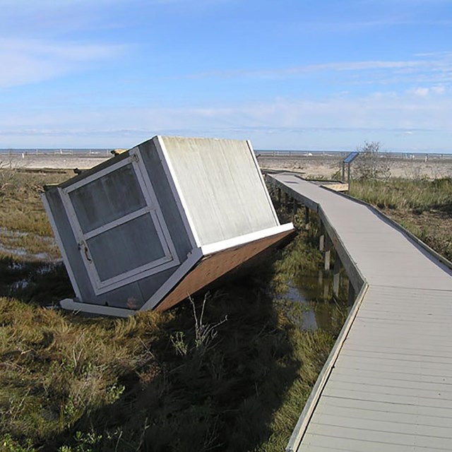
Hurricane Sandy made landfall on October 29, 2012, creating a breach within the Otis Pike Wilderness at Fire Island National Seashore, New York. This breach provided an array of scientists and researchers the opportunity to investigate how coastal storms affect coastal processes, as well as natural and cultural resources at the park.
Visit our keyboard shortcuts docs for details
- Duration:
- 10 minutes, 56 seconds
The real power of coastal processes was realized after Hurricane Sandy struck Gateway National Recreation Area, New York, in 2012. The after-effects of the superstorm opened up opportunities for understanding how to become more resilient and how to manage our coastal parks resources in a way that will prepare us for future storms using the most effective science techniques possible. The research and restoration that has taken place in Jamaica Bay since then have become an example of how to manage natural resources in an urban environment in the face of climate change.
Visit our keyboard shortcuts docs for details
- Duration:
- 3 minutes, 32 seconds
Have you seen aerial photos of the breach in the Fire Island National Seashore wilderness area after hurricane Sandy? Most likely they were taken by Charlie Flagg as part of an ongoing project to visually document the evolution of the breach. Go behind the scenes to see the breach from above!
Science Stories
Read about our collaborative work to understand the impacts of Hurricane Sandy on our coastal parks.
Last updated: June 26, 2024