



News Release
You are viewing ARCHIVED content
This content was published online before January 20, 2025. Please note that this content is NOT UPDATED, and links may not work. For current information, visit https://www.nps.gov/aboutus/news/index.htm.
NPS Map/Mark Wasser
News Release Date: May 2, 2018
Contact:
Jessica Ferracane, 808-985-6018
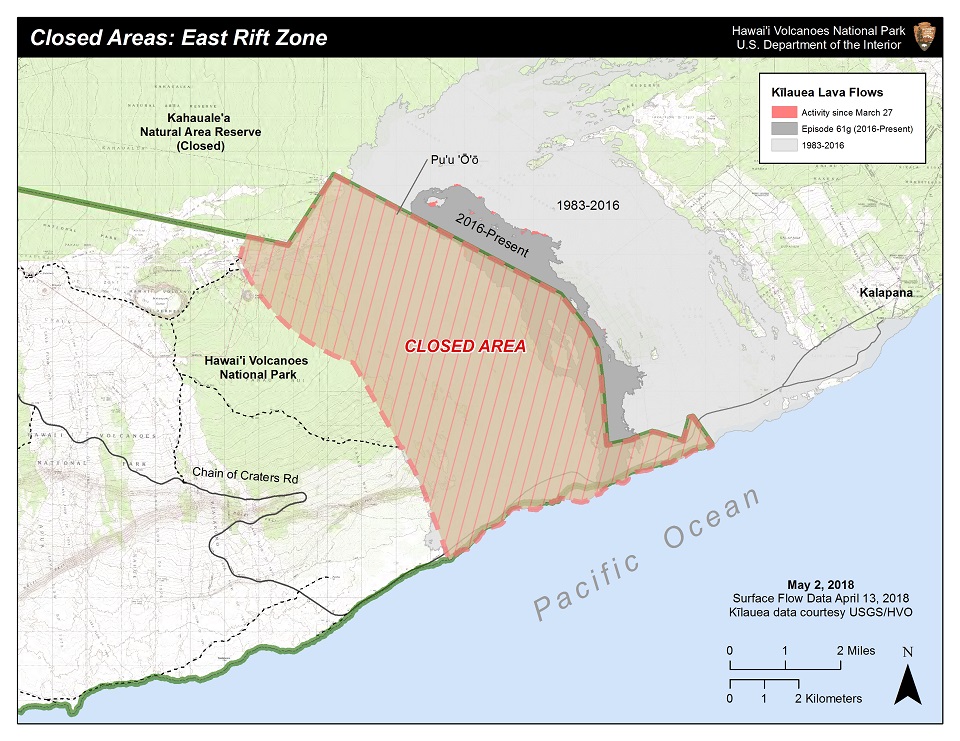
“The recent eruption changes and increased seismicity around the East Rift Zone and Pu‘u ‘Ō‘ō vent may threaten land and the community outside the park. The partial closure in the park is necessary to prevent unsafe travel onto lands under the jurisdiction of Hawai‘i County and to keep people safe,” said Park Superintendent Cindy Orlando. “Most of the park, which is 333,308 acres in size, remains open,” she said.
On Monday afternoon, April 30, the crater within Pu‘u ‘Ō‘ō collapsed, and a flurry of low magnitude earthquakes continues to shake the eastern side of the island, particularly communities in lower Puna. A small fissure opened to the west of the vent on Tuesday, May 1, but scientists at the U.S. Geological Survey Hawaiian Volcano Observatory report that an intrusion of magma is heading eastward from the vent towards Highway 130.
Puna residents are encouraged to sign up for Hawai‘i County Civil Defense messages at http://www.hawaiicounty.gov/active-alerts/, and to subscribe to volcanic updates via USGS: https://volcanoes.usgs.gov/vns2/.
The current eruption at Pu‘u ‘Ō‘ō is off limits to hikers. However, the summit of Kīlauea continues to erupt within Halema‘uma‘u Crater within the park, and is best viewed from the Jaggar Museum overlook. The lava lake within the crater has risen dramatically since April 21, and has occasionally spilled onto the crater floor. The park is open 24 hours a day.
-NPS-
Tags:
volcanoes
Last updated: May 14, 2018