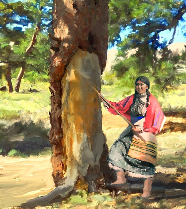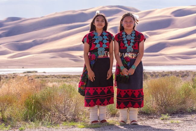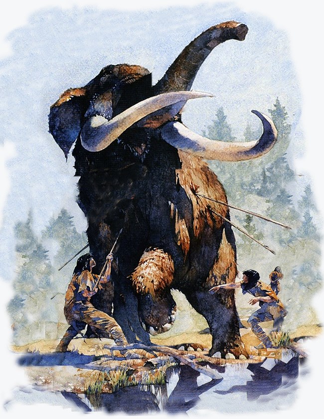
![]() Courtesy Monte Vista Historical Society People and Great Sand Dunes: An Enduring Connection Human beings have known about, visited, or lived near the Great Sand Dunes for a long, long time. The oldest evidence of humans in the area dates back about 11,000 years, and the most recent visitors may include you and your family. What brought those early people here? What will bring you? People have had an enduring connection with Great Sand Dunes for many generations. Below is a history of those who have travelled through or lived near this natural landmark.
![]() NPS ![]() NPS/Patrick Myers A Living Connection: Great Sand Dunes' Affiliated Tribes
![]() Original painting at the Palace of the Governors, Santa Fe, New Mexico; courtesy Tumacacori National Historic Site Spanish Explorations In 1694, Don Diego de Vargas became the first European known to have entered the San Luis Valley, although herders and hunters from the Spanish colonies in present-day northern New Mexico probably entered the Valley as early as 1598. De Vargas and his men saw and hunted a herd of 500 bison, apparently in the southern part of the Valley, before returning to Santa Fe. In 1776, Juan Bautista de Anza II and a huge entourage of men and livestock probably passed near the dunes as they returned from a punitive raid against a group of Comanches. At this time, the San Luis Valley was a travel route between the High Plains and Santa Fe for Comanches, Utes, and Spanish soldiers. For some of them, the dunes were likely a visible landmark along the trail. ![]() Independence National Historical Park Westward Expansion: Zebulon Pike, 1807 The first known writings about Great Sand Dunes appear in Zebulon Pike’s journals of 1807. As Lewis and Clark’s expedition was returning east, U.S. Army Lt. Pike was commissioned to explore as far west as the Arkansas and Red Rivers. By the end of November 1806, Pike and his men had reached the site of today’s Pueblo, Colorado. Still pushing southwest, and confused about the location of the Arkansas River, Pike crossed the Sangre de Cristo Mountains just above the Great Sand Dunes. His journal from January 28th, 1807, reads: "After marching some miles, we discovered ... at the foot of the White Mountains [today’s Sangre de Cristos] which we were then descending, sandy hills…When we encamped, I ascended one of the largest hills of sand, and with my glass could discover a large river [the Rio Grande] …The sand-hills extended up and down the foot of the White Mountains about 15 miles, and appeared to be about 5 miles in width. Their appearance was exactly that of the sea in a storm, except as to color, not the least sign of vegetation existing thereon." ![]() Illustration: NPS/Patrick Myers Old Spanish Trail 1830-1849 When you visit Great Sand Dunes, you also visit the Old Spanish National Historic Trail, a part of the diverse cultural heritage of the San Luis Valley. Learn more on our Old Spanish Trail page.
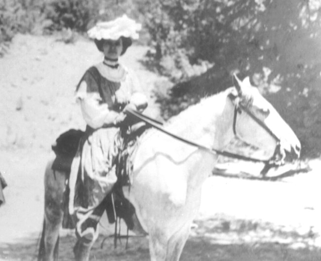
![]() Public Domain Westward Expansion: In 1848, John C. Fremont was hired to find a railroad route from St. Louis to California. He crossed the Sangre de Cristos into the San Luis Valley in winter, courting disaster but proving that a winter crossing of this range was possible. He was followed in 1853 by Captain John Gunnison of the US Topographical Survey. Gunnison’s party crossed the dunefield on horseback: "Turning the southern base of the sand-hills, over the lowest of which we rode for a short distance, our horses half burying their hoofs only on the windward slopes, but sinking to their knees on the opposite, we for some distance followed the bed of the stream from the pass, now sunk in the sand, and then struck off across the sandy plain…The sand was so heavy that we were six hours and a half in making ten miles…" ![]() NPS Archives Routes into the Valley In the years that followed, the Rockies were gradually explored, treaties were signed and broken with resident tribes, and people with widely differing goals flooded into Colorado from the United States and Mexico. In 1852, Fort Massachusetts was built and then relocated to Fort Garland, about 20 miles southeast of the Great Sand Dunes, to safeguard travel for settlers following the explorers into the San Luis Valley. Although many settlers arrived in the San Luis Valley via the trails from Santa Fe or La Veta Pass, several routes over the Sangre de Cristo Mountains into the San Luis Valley were well-known to American Indians and increasingly used by settlers in the late 1800s. Medano Pass, also known as Sand Hill Pass, and Mosca Pass, also called Robidoux’s Pass, offered more direct routes from the growing front-range cities and dropped into the San Luis Valley just east of the Great Sand Dunes. Trails were improved into wagon routes and eventually into rough roads. The Mosca Pass Toll Road was developed in the 1870s, and stages and the mail route used it regularly through about 1911. That year, the western portion was badly damaged in a flash flood. Partially rebuilt at times in the 1930s through the 1950s, it has been repeatedly closed by flooding and is now a trail for hikers. ![]() NPS/Patrick Myers Fort Garland, 1852-1883 Diverse soldiers from Fort Garland, including African American Buffalo Soldiers (see below), patrolled the area around Great Sand Dunes from 1852-1883, protecting both settlers and American Indian tribes. Originally called Fort Massachusetts and built on the side of Blanca Peak in 1852, the fort was moved to the valley floor and renamed in 1858. Now a state historic site, Fort Garland features original buildings and artifacts, dioramas, exhibits, and scheduled living history events. Browse Fort Garland's website for details, and view photos of Fort Garland and its living history events on Flickr. Located in the town of Fort Garland, Colorado, on US Highway 160. ![]() Illustration: NPS/Patrick Myers Buffalo Soldiers, 1876-1879 Based at nearby Fort Garland, the 9th Cavalry once even evicted white setters who had encroached on recognized Ute tribal lands. Today, we can only imagine the three-way cultural tension in that moment. Learn more about Buffalo Soldiers at nearby Fort Garland Museum. ![]() NPS Archives Making a Home: Homesteaders The Herard family established a ranch and homestead along Medano Creek in 1875, using the old Medano Pass Road to travel to and from their home. The modern road, open only to 4WD, high clearance vehicles, follows the old route, skirting the dunefield before rising to Medano Pass and continuing east into the Wet Mountain Valley. The Herards grazed and bred livestock in the mountain meadows, built a home, raised horses, cattle, and chickens, and established a trout hatchery in the stream. Other families homesteaded near the Dunes as well, including the Teofilo Trujillo family, who raised sheep west of the Dunes, and Frank and Virginia Wellington, who built the cabin and hand-dug the irrigation ditch that parallels Wellington Ditch Trail, just south of today’s campground. Their son, Charles, ran a sawmill on Sawmill Creek, just north of the campground. As people established homes, they often petitioned the US Postal Department for post offices to serve their tiny villages. Zapata (1879); Blanca or North Arrastre; Orean (1881); Mosco (1880); later called Montville (1887-1900); Herard (1905); Liberty (1900); Duncan (1892) and others helped connect isolated homesteaders with the larger world. ![]() Courtesy Maria Causby The Trujillo Homesteads National Historic Landmark preserves an important piece of the volatile history of settlement near Great Sand Dunes. Learn more on the Trujillo Homesteads page. ![]() NPS/Patrick Myers Seeking Wealth: Gold and silver rushes occurred around the Rockies after 1853, bringing miners by the thousands into the state and stimulating mining businesses that operate to this day. Numerous small strikes occurred in the mountains around the San Luis Valley. People had frequently speculated that gold might be present in the Great Sand Dunes, and in the 1920s, local newspapers ran articles estimating its worth at anywhere from 17 cents/ton to $3/ton. Active placer mining operations sprang up along Medano Creek, and in 1932 the Volcanic Mining Company established a gold mill designed to recover gold from the sand. Although minute quantities of gold were recovered, the technique was too labor intensive, the stream too seasonal—and the pay-out too small—to support any business for long. ![]() Courtesy Bob Linger Preserving Beauty: Establishing a The idea that the Dunes could be destroyed by gold mining or concrete-making alarmed residents of Alamosa and Monte Vista. By the 1920s, the Dunes had become a source of pride for local people, and a potential source of tourist dollars for local businesses. Members of the Ladies P.E.O. lobbied politicians, asking for national monument status for Great Sand Dunes. Widely supported by local people, a presidential proclamation was signed in 1932 by President Herbert Hoover. Similar support in the late 1990s resulted in the monument’s expansion into a national park and preserve in 2004. Today, hundreds of thousands of people visit Great Sand Dunes each year, brought perhaps by the same interests that brought you—the oddly beautiful combination of desert dunes and high mountain peaks, the spring-time flow of Medano Creek, dark and quiet nights in the Dunes wilderness, camping, hiking, photography opportunities, or—what? Where do you fit in the long history of people and the Dunes? |
![]() |
![]() |
Last updated: August 29, 2023