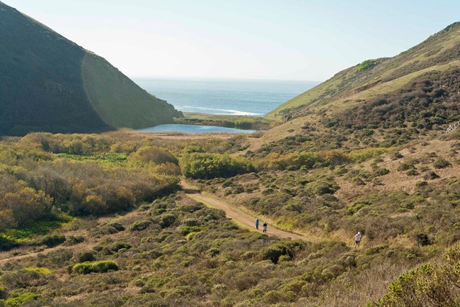
Trail OverviewDistance: 1.75 mi (2.8 km) The Tennessee Valley (TV) Trail begins at the TV parking lot. The parking lot contains four accessible parking spaces, an accessible vault toilet and a small accessible picnic area. There is a large opening in the center of the main trail head gate that provides easy access for wheelchair users. The beginning of the trail is asphalt. This section of the trail is relatively flat in grade and continues as a paved surface for approximately ¾ of a mile. The trail is approximately 13.75’ wide. Beyond the paved surface the trail turns to a compacted natural material. Stick to the Lower Spur Trail to avoid steep terrain. Note: this section of the trail can narrow to 3’ wide due to encroaching vegetation. The view of the surrounding hillsides and vegetation is vast. At approximately 1 mile the trail begins to quickly climb and the running and cross slopes begin to exceed 12.5% and 8%. For those looking for a relatively flat hike this would be the place to turn back. Beyond this section there is an additional accessible vault toilet adjacent to the trail as you near the beach. Access to the beach is steep and likely not possible by wheelchair. In total the trail is approximately 1 ¾ miles long. The trail serves as a service road; depending on weather conditions the trail may contain pots holes, proceed with caution. Trail Profile
Safety
ParkingThere is trailhead parking at the Tennessee Valley Trailhead, including three accessible parking spots. BathroomsAccessible restrooms can be found adjacent to parking area. WaterPotable water is not available at Tennessee Valley. Plan ahead and pack water. Avoid becoming dehydrated or experiencing heat exhaustion. Drink plenty and drink often; pace yourself; rest in the shade; and eat salty snacks. Trail EtiquetteThe Tennessee Valley Trail is closed to dogs. Please remain on the established trails. Off-trail travel harms plants and causes erosion. |
Last updated: April 3, 2024
