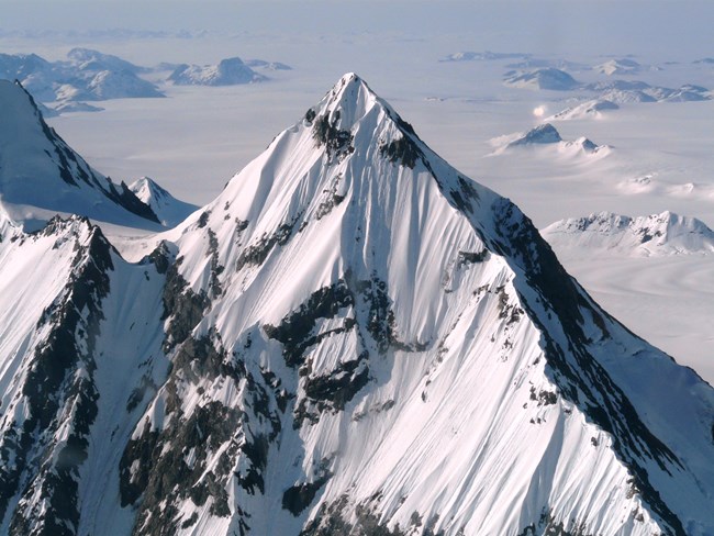
NPS Photo Although many ice ages sculpted the landscape of Glacier Bay, glaciers are only a part of the geologic history and dramatic scenery of the park. Geologic forces still at work created the Fairweather Mountain Range, one of the tallest coastal mountain ranges in the world, with several peaks over 10,000 feet and the tallest peak, Mount Fairweather, reaching just over 15,300 feet. Without these mountains and the abundant snowfall they receive at high elevation, glaciers would not exist at sea level in a temperate rainforest environment. Glacier Bay National Park sits on the boundary between two of the Earth’s major crustal, or tectonic plates: the oceanic Pacific Plate and the continental North American Plate. These plates are currently sliding past one another at a rate of 5 cm per year along the Fairweather-Queen Charlotte Fault, a crack in the earth’s crust along which plate movement occurs. This is enough motion to cause powerful earthquakes periodically. Today the Pacific Plate is sliding northwest relative to the North American Plate, much like the plate motion along the San Andreas Fault in California. However, many geologists believe that the plate motion was different in the past, with the Pacific Plate moving toward North America and sliding under the North American plate. The Pacific Plate would have acted as a conveyor belt, carrying island chains as big as Japan or New Zealand towards North America where they then crashed against the continent, adding land to it. Fossils and rock types in Glacier Bay provide evidence for the past motion of the plates. Limestone layers containing seashell fossils are found in Glacier Bay today. Since limestone usually forms in shallow, warm waters, scientists believe that this rock formed around ancient tropical islands near the equator and was then transported toward the North American continent over millions of years by the Pacific Plate’s motion. Similarly, high in the Fairweather Mountains a certain type of igneous rock that forms from cooling magma on the ocean floor is found, indicating that rock was probably scraped off and pushed up onto North America from the Pacific Plate. The Earth’s crust around Glacier Bay is still rising with these mountain building forces, and much of the dramatic scenery throughout Southeast Alaska was created along ancient, extinct fault zones in the same way. The boundary between the plates moved westward after each new island chain was added onto the edge of the continent, gradually building Southeast Alaska.
Glacial Landforms Plate tectonic forces form mountains, but glaciers sculpt them. Geologists came to Glacier Bay in the late 1800s to compare areas where glaciers were still shaping the landscape to areas thought to have been covered by glaciers in the past. Since the 1800s, glaciologists have shown that much of Canada and the northern United States was indeed covered by ice during the Wisconsin Ice Age, ending 11,000 years ago. There have been several little ice ages since that time, with advances and retreats of the ice in Glacier Bay reshaping the landscape each time. Glacial and mountain building processes continue to shape the landscape, providing an opportunity to watch these forces at work and setting the stage for the dramatic scenery of Glacier Bay. 
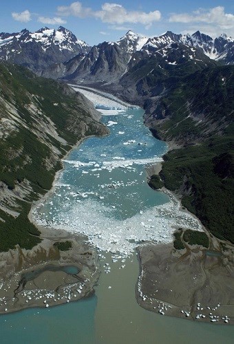
NPS Photo As glaciers advance, they bulldoze the land, clearing it of rocks, soil, and vegetation. Glaciers wipe the land clean, often scouring it to the bedrock. This makes land that has been recently exposed by glacial retreat the premier laboratory to study primary plant succession. 
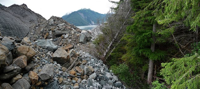
NPS Photo As glaciers move, they collect rock and particles from fine silt to huge boulders and transport them like a conveyer belt. A mass of rocks carried and deposited by a glacier is known as a moraine. Terminal moraines form at the terminus, or end, of a glacier and are large piles of rock that have been pushed ahead of the glacier or left behind as the glacier retreats. Terminal moraines can be used to determine the extent of a glacier in the past. Much morainal material has been left behind following the glacial retreat in Glacier Bay, including some piles of rock big enough to form islands. The park headquarters, Bartlett Cove, is situated on the moraine of the glacier that covered the Bay 200 years ago. 
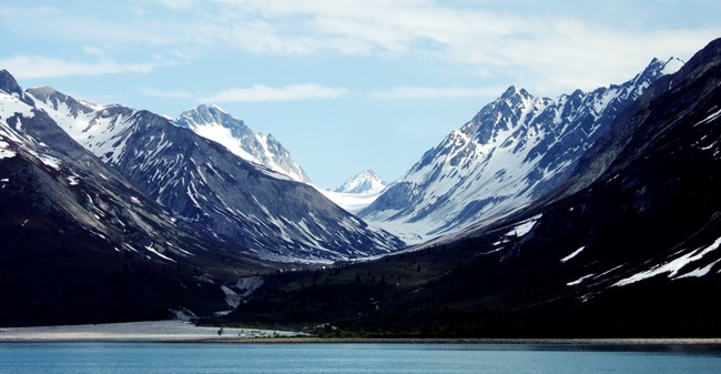
NPS Photo All of the rock that is transported by a glacier gives it the force of a giant sheet of sandpaper, grinding away at the landscape it travels through. Glaciers have the power to round out mountains and carve U-shaped valleys and fjords, glacially carved valleys flooded by the sea. Sometimes the larger chunks of rock in the glacier carve out grooves or glacial striations in the surrounding rock in the direction of their motion. Finer rock particles smooth out the bedrock, polishing it. |
Last updated: March 12, 2018
