Glacier Bay Story Map
The Glacier Bay National Park and Preserve (GBNP&P) region is an environment dominated annually by snow precipitation and snow melt processes. Historically, the high inputs of snowfall have produced a stunning landscape, with some of the most famous glaciers in the country. These glaciers are undergoing immense changes documented by naturalists, tourists, park employees, and scientists for more than a century. At Oregon State University, we recently completed a modeling study of historic and future trends in precipitation, temperature, and components of runoff into Glacier Bay, Alaska. This is the culmination of multiple years of research using one of the premier snow models available to scientists.

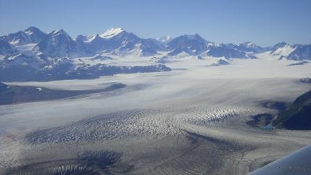
Figure 1: A photo of the Brady Icefield in Glacier Bay National Park with Mount Fairweather in the background. NPS Photo
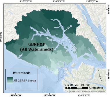
This study is an attempt to quantify the historical influence of snow on this rugged landscape and look to the future: a place where rainfall and rain runoff may become more dominant hydrologically. We chose to communicate our findings in the form of an ESRI Story Map to make the results interactive and accessible to all. You can find a link to the Story Map here. We aggregated the results into several groups: 1) individual watersheds; 2) sub-regional groups of watersheds that empty into the Western and Eastern arms of Glacier Bay, and; 3) regionally grouped watersheds that empty into the Pacific Ocean and Glacier Bay. A regional map with all watersheds in the study area is below.

Figure 2: Map of the Glacier Bay study area.
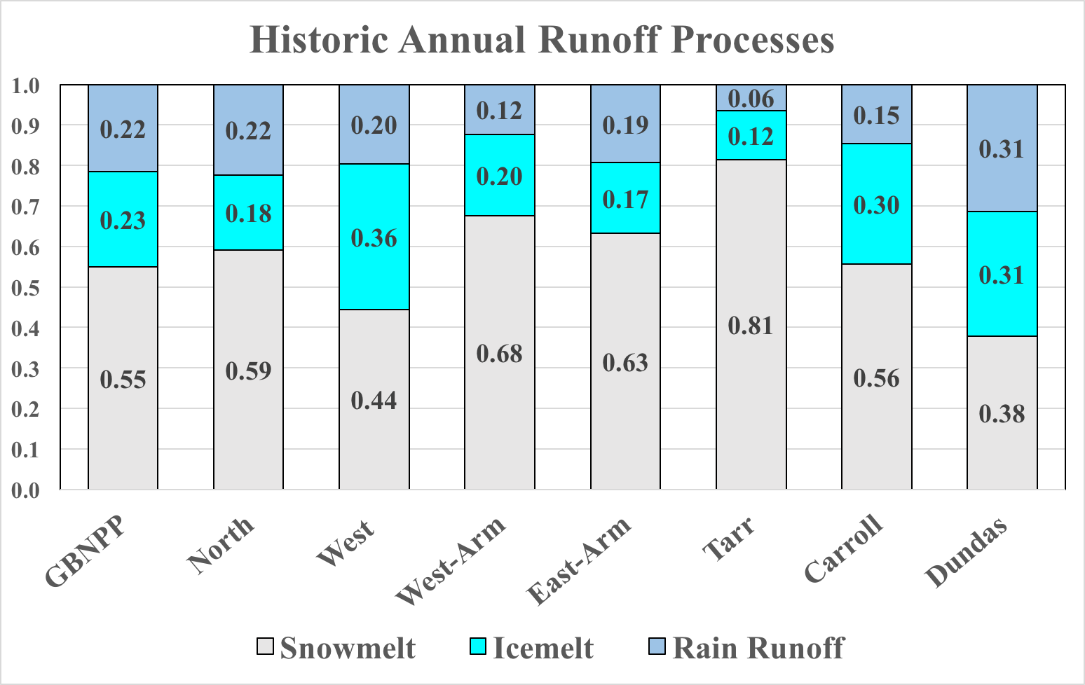
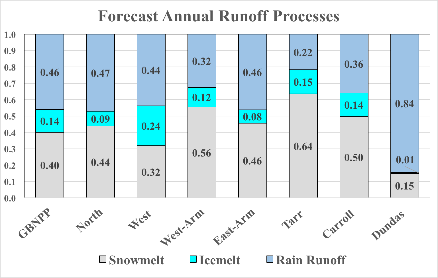
Finally, we base our future hydrologic projections on a climate scenario that maintains current levels of greenhouse gas emissions, a ‘business as usual’ scenario. This potential future landscape contains significant reductions in glacier surface area as well as average temperature increases from 3 to 5 degrees Celsius. This scenario means more rain and less snow, clearly shown in the precipitation and runoff figures contained in the Story Map and in the graph below. Components are displayed as fractions of total annual runoff.


Figure 3: The annual historic and forecast runoff processes as a fraction of the annual total for each watershed group in the study area.
This project was funded in part by the National Park Service in collaboration with the Coastal and Ocean Engineering program and the Water Resources Graduate Program at Oregon State University. Look for a link at this blog for the upcoming publication the coming months!
Authors:
- Ryan L. Crumley, Ph.D. Student, Oregon State University, Water Resources Science, 116 Gilmore Hall, Corvallis, OR, 97331; crumleyr@oregonstate.edu
- David P. Hill, Ph.D., Oregon State University, School of Civil and Construction Engineering, 101 Kearney Hall, Corvallis, OR, 97331; david.hill@oregonstate.edu
