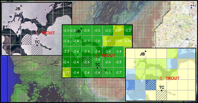
Hydrologic modeling is a tool used to analyze effects of water management alternatives on the south Florida system of wetlands, impoundments, and canals. The consequences of sea level rise are of great concern to Department of the Interior managers and have added another set of criteria to consider when evaluating water management alternatives affecting Everglades National Park (ENP). The South Florida Water Management Model (SFWMM) has been widely used to simulate hydrologic effects of these management alternatives, but the model domain does not extend into the mangrove areas of ENP. The Tides and Inflows in the Mangroves of the Everglades (TIME) model was created to simulate the hydrology of the mangrove-dominated ecotones of ENP, as well as to perform more detailed and spatially resolved hydrologic simulations. The domain of the TIME model includes the land areas of ENP and some of Big Cypress National Preserve, and extends southward into the northern portion of Florida Bay.
This report summarizes the joint project between the U.S. Geological Survey and the South Florida Natural Resources Center of the National Park Service that uses the TIME model to develop ecosystem restoration and sea level rise simulations for ENP. Analysis of preliminary simulation results necessitated an investigation of TIME v2.0 model input datasets and an evaluation of model performance in order to provide context in interpretation of results. This report contains documentation of the input datasets used in the model simulation, an evaluation of TIME v2.0 calibration run results, and an analysis of results from simulations of water management alternatives and sea level rise scenarios. The final section in this report summarizes several performance issues with the TIME v2.0 model discovered during this project and, where possible, provide recommendations for improvement.

APPENDICIES
The following plots show input boundary surface water stage and salinity timeseries pre-scribed for TIME v2.0 simulations documented in this report. Twelve different stage and salinity timeseries were defined along the southern and western boundaries, and are named in the station location map on page A-2. At the Shark River and Florida Bay locations respectively, separate timeseries were prescribed for each of five points along the boundary. Boundary timeseries for the intermediate cells were interpolated during the simulation by the TIME code. Within the Lostmans and Gulf Coast Rivers locations, the same timeseries was applied to all specified cells within the circled area. The stage and salinity timeseries were derived from output of an Alt7r5e run of the EFDC model.
APPENDIX B TIME V2.0 CALIBRATION RESULTS (4.58MB)
This appendix presents the depth and stage timeseries results from the TIME v2.0 calibration run. The plots for stations are ordered by sub-basin, and the location of the sub-basins and stations are shown in the first figure. The performance statistics calculated for groundwater stage at each station are presented in a table at the start of each section.
APPENDIX C STAGE AND SALINITY RESULTS FOR ALT7R5E SEA LEVEL RISE RUNS (4.6MB)
This appendix presents the groundwater stage and surface water salinity results from the TIME v2.0 Alt7r5e alternative. The plots for stations are ordered by sub-basin, and the location of the sub-basins and stations are shown in the first figure.
APPENDIX D ALT7R5E SENSITIVITY TO SALINITY BOUNDARY (4.06MB)
This appendix presents results from the TIME v2.0 Alt7r5e sensitivity run. The plots for stations are ordered by sub-basin, and the location of the sub-basins and stations are shown in the first figure. The graphics for the 0 cm, 30 cm, and 60 cm sea level rise amounts combined with the 30 and 36 ppt prescribed boundary values are presented. Stations with salinity values less than 5 ppt are not shown.
APPENDIX E RESULTS FOR ALTERNATIVES WITH SEA LEVEL RISE (9.87MB)
This appendix presents groundwater stage and surface water salinity timeseries from the alternative runs, with and without sea level rise. The plots for stations are ordered by sub-basin, and the location of the sub-basins and stations are shown in the first figure. The graphics for the no sea level rise, the 30 cm and the 60 cm rise are presented for each of the alternatives (NSM, Alt7r5e and CERP0). Timeseries for stations with salinity values less than 5 ppt are not shown.
APPENDIX F KOHLER REPORT ON TIME DEVELOPMENT (1.72MB)
This Appendix contains an unpublished memo written by Mike Kohler that contains relevant documentation on development of TIME v1.0. Since described by Wang et al. (2007), the TIME model was used to simulate hydrologic conditions under varying restoration plans as part of the Florida Bay Florida Keys Feasibility Study (FBFKFS), cosponsored by the U.S. Army Corps of Engineers and the South Florida Water Management District. In the FBFKFS, TIME output was used as boundary input in a Florida Bay version of the Environmental Fluid Dynamics Code (EFDC) (Hamrick, 2006) to improve salinity approximations produced by the EFDC. The development of TIME v1.0 as a result of the work on this project was completed before the project described in the main section of this report had commenced. The reproduction of the Kohler memo in this Appendix is intended to fill in the documentation gap on development of TIME during that period. The date on the original document file obtained by NPS station from Mike Kohler is May 17, 2007.
APPENDIX G TIME V2.0 TECHNICAL CODE UPDATES (101KB)
The TIME v2.0 model consists of the FTLOADDS code applied to the land domain of Everglades National Park. FTLOADDS has been modified in a number of ways since this original application in TIME v1.0 (Wang et al. (2007)). The modifications have several purposes, such as removing hardcoding of files and variables, reorganizing and streamlining the run process and file hierarchy, and resolving compile and run-time errors. One goal of the revision process was to produce a `package' of the model's input files, output files, and source code that compiled, ran, and could be easily modified by the end user. Other goals were to assign the model a version number, and produce a report associated with that version for purposes of accurate documentation, referencing, and future development. For future use of the TIME model, it is recommended that the TIME code and input files be compared to this package to determine exactly what features have changed, and their potential influence on the model results.
|
Last updated: February 16, 2018
