|
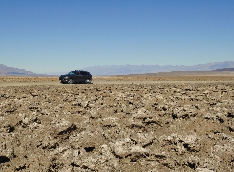
Death Valley is a marvelous exhibit of the forces that shape our planet: it’s clash of tectonic plates that have lifted sea floors to towering heights, the extremes of temperature from the heat of the valley floor to the freezing snow on the mountaintops, and the flash floods that flip cars and tear the earth apart. Crossing Devils Golf Course - 1926The Death Valley saltpan is one of the largest protected saltpans in North America. Recurring floods continue to deposit salt and other minerals on the valley floor. The unrelenting sun evaporates the water, leaving crystallized salts that are shaped by winds and rain into the jagged, piercing formations of Devils Golf Course. 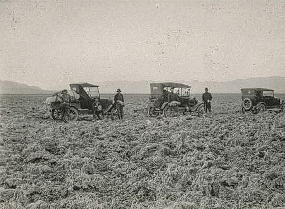
Left image
Right image
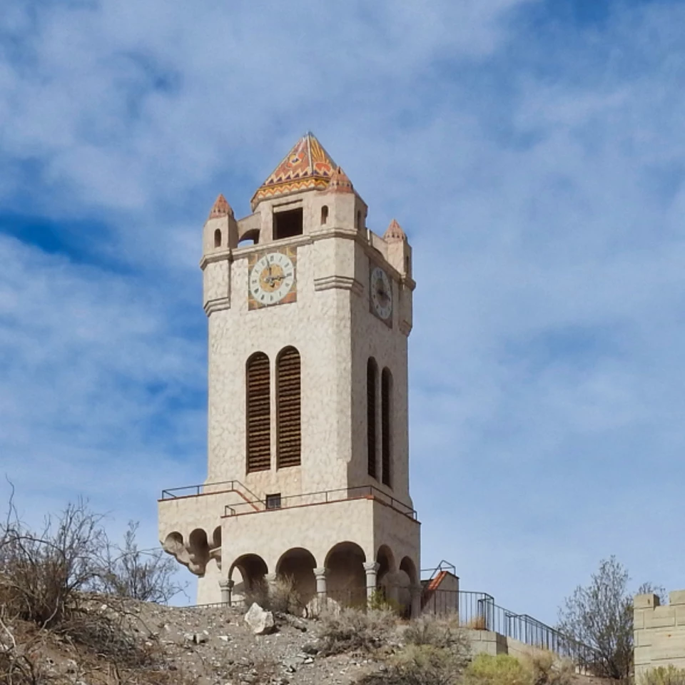
Scotty's Castle in the Snow - 1929Death Valley is known as being one of the hottest places on Earth. However, as the photograph shows, Death Valley is really a land of extremes. The clock tower at Scotty's Castle was surrounded by snow during a very rare snowstorm that dropped 18 inches during the construction of the castle in 1929. 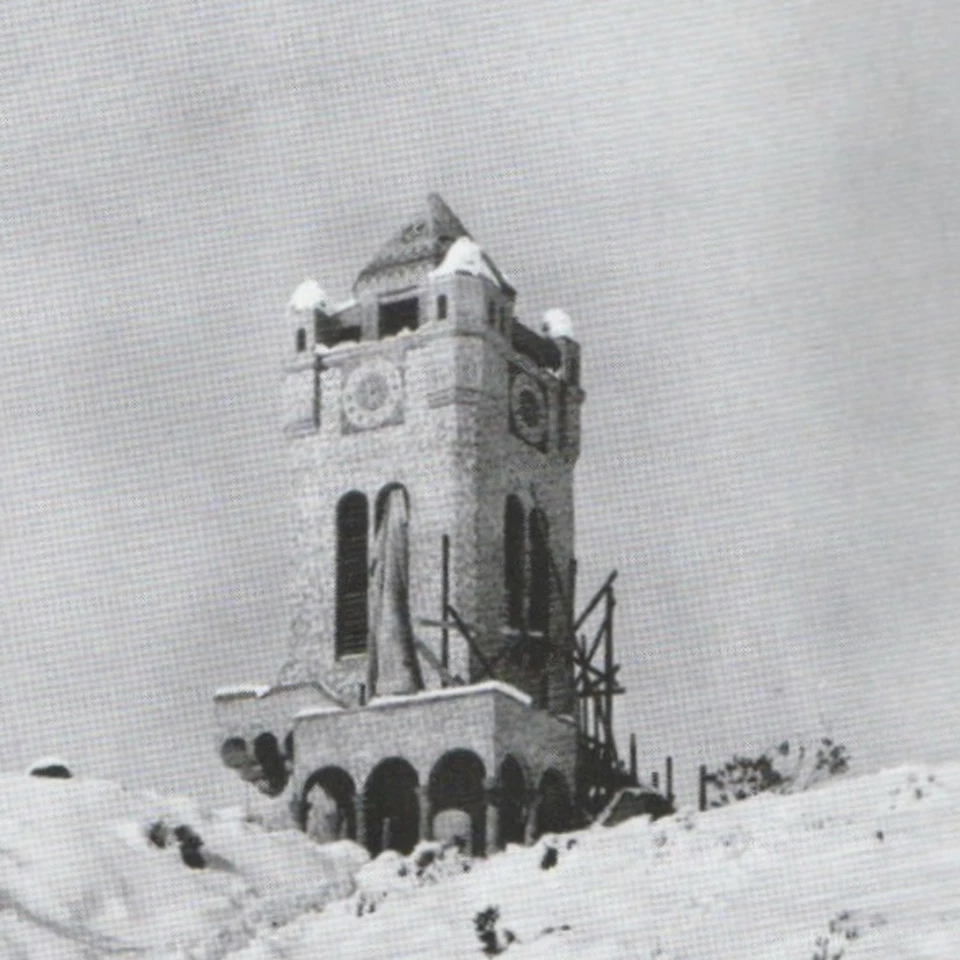
Left image
Right image
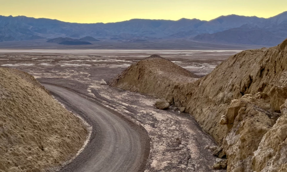
Mustard Canyon West Entrance - 1934Mustard Canyon is a narrow canyon cut into the light-colored, claylike lake deposits of the Furnace Creek Formation. Lake Manly was a lake that filled Death Valley for two extended periods of time. The longest one existed from about 186,000 years to 120,000 years ago. The shorter from 35,000 to 10,000 years ago, corresponding with glaciation at higher latitudes and elevations. 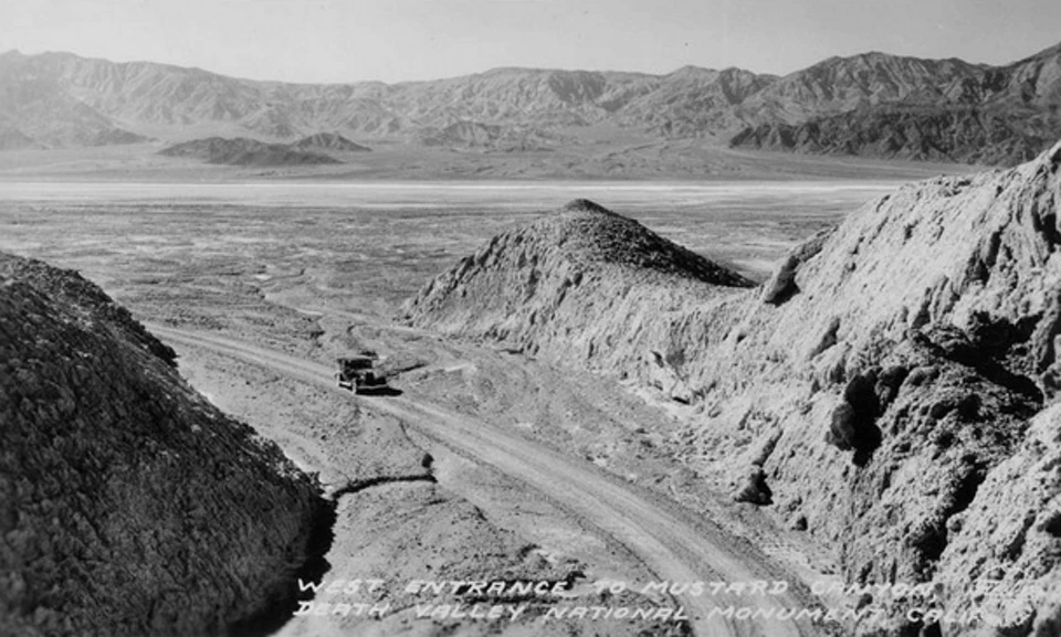
Left image
Right image
Automobile Trapped in Grotto Canyon - ca. 1935In the desert heat of Death Valley, it’s hard to remember that the erosion is the result of wind and water. Winter rainfall in the mountains surrounding Death Valley is a regular occurrence. Even if the rain doesn’t reach the valley floor, flash floods have the potential to destroy roads, structures, and vehicles. Water falling on the high peaks and ridges is not easily absorbed by the dry and compact desert soils and it rushes down the canyons as if they were concrete culverts. 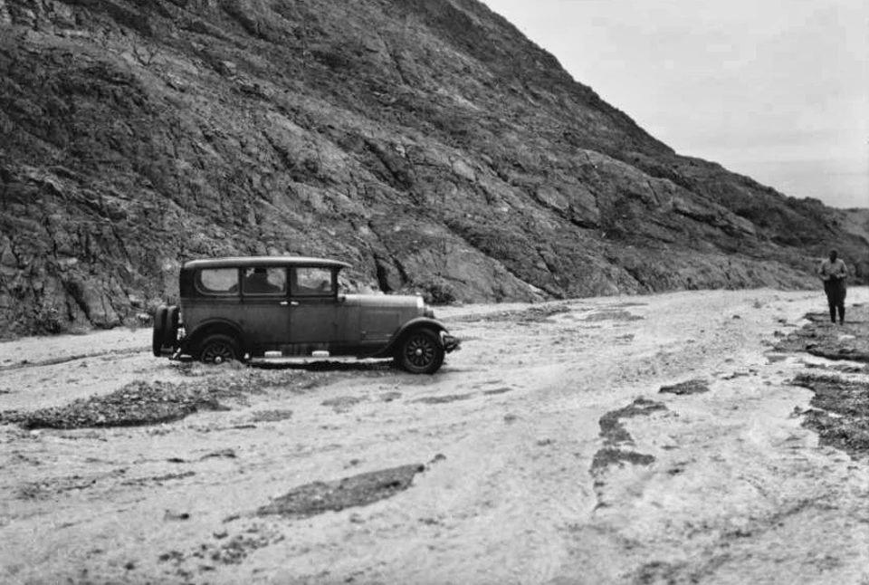
Left image
Right image
Blasting Open Salt Pools - 1935The salt pan of Death Valley is the dried-up bed of Lake Manly, a 600’ deep lake that existed about 150,000 years ago. As the water evaporated after the last Ice Age (10,000 to 15,000 years ago), salts and other minerals that had been deposited in the lake, were concentrated and left as a thick layer of salt on the valley floor. Exploratory drilling by the Pacific Coast Borax Company discovered that the salt deposits are as much as 4,000 feet deep in the Devils Golf Course area. 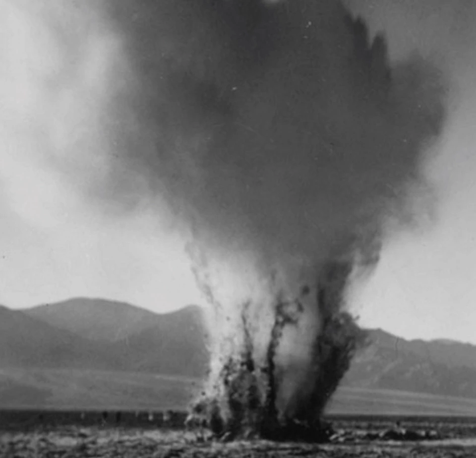
Left image
Right image
Ubehebe Crater Postcard - 1941A Timbisha creation story tells of people’s emergence on Earth at Ubehebe Crater when Coyote, who carried the people, put down his basket and fell asleep. The people climbed out and scattered around the valley and mountains. 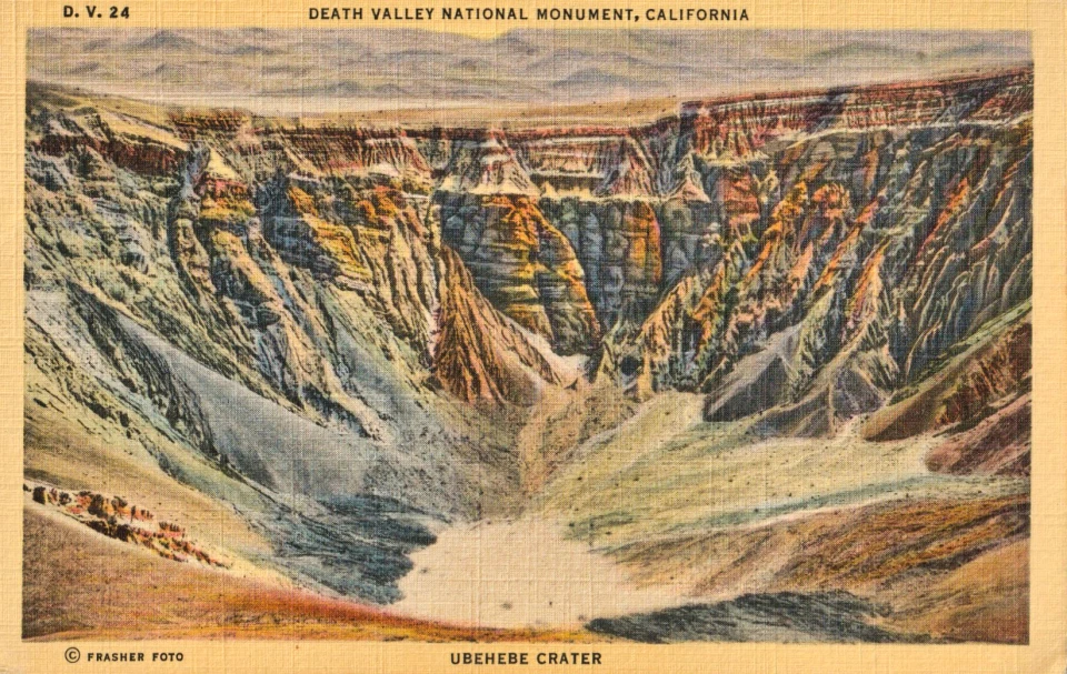
Left image
Right image
Badwater in the Snow - 1962On January 4th and 5th of 1974, during a strong La Niña, traces of snow fell on the valley floor. Only four times has snow ever been recorded at Death Valley’s lowest elevations. 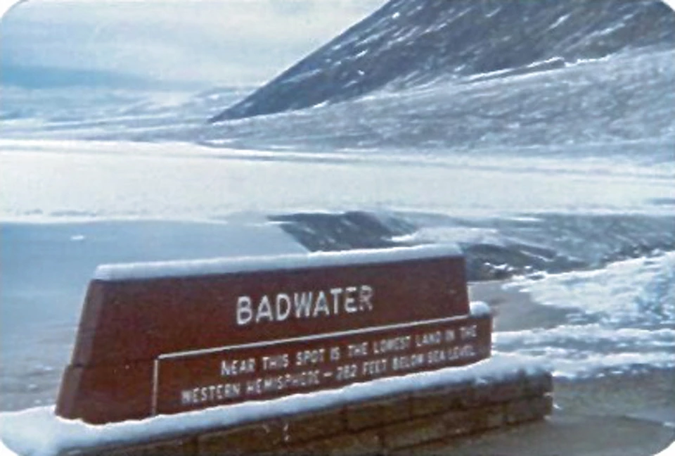

Left image
Right image
Zabriskie Point in the Snow - 1974Snow is a very rare occurrence at the low elevations of Death Valley. At Furnace Creek Ranch (190 feet below sea level), records indicate only four years since 1900 that snow fell – 1922, 1949, 1962, and 1974. Only the 1922 snow event was measurable, with half an inch recorded at the old Greenland Ranch on January 29. Zabriskie Point (823 feet above sea level) has a greater chance of measurable snow, but it is still extremely rare. 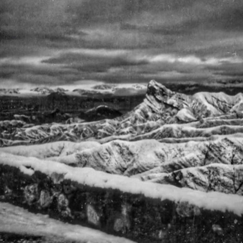
Left image
Right image
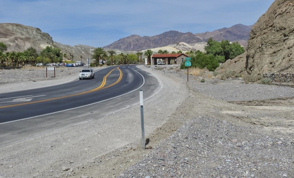
Flooding at Furnace Creek Junction - 2004On the night of August 15, 2004, heavy rainfall over the Black and Funeral Mountains caused intense flooding, particularly along Highway 190 and the Furnace Creek Wash. One vehicle was pushed off the road and flipped near the junction of Highway 190 and Dante’s View Road, where the two branches of the Furnace Creek Wash come together. At Zabriskie Point, two people died in their car when they couldn’t outrun the wall of water, and over a dozen cars washed out, some completely buried in mud. Further down the wash, eight cars parked in the lot near the Furnace Creek Inn were washed several hundred feet away. High water marks indicate that the water was roughly eight feet deep at this point. 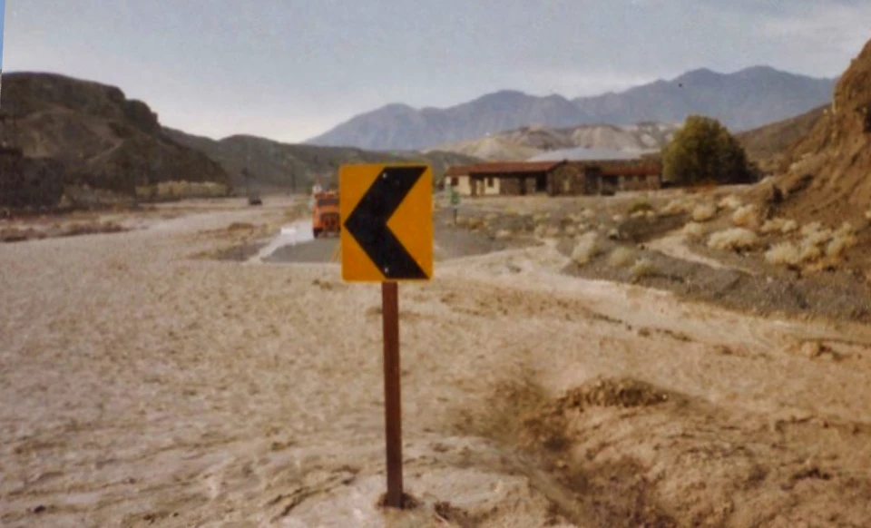
Left image
Right image
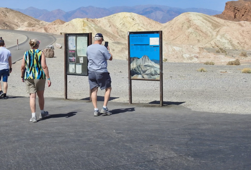
Zabriskie Point Bathrooms After the Flood - 2004The flooding through the Furnace Creek Wash in 2004 was the latest in a long history of violent gullywashers that tore through the landscape. The badlands around Zabriskie Point were formed when fine silt and volcanic ash washed into the ancient Lake Manly, creating a thick deposit of clay and sandstone. Seismic activity tilted the lakebed’s deposits upward and periodic rainstorms and the resulting floods eroded the soft rocks into the corrugated patterns we see today. 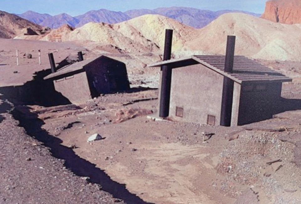
Left image
Right image
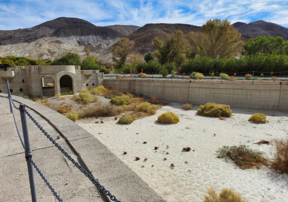
Scotty's Castle Pool Flooded - 2015In October of 2015, a year’s worth of rain - a half-inch of rain in one day and 2 ¾ inches of rain the next - fell on the steep slopes of Grapevine Canyon above Scotty’s Castle. A flash flood descended upon the castle at 3,200 cubic feet per second. Visitors were evacuated from nearby campgrounds, and power poles and metal dumpsters floated out of Grapevine Canyon. 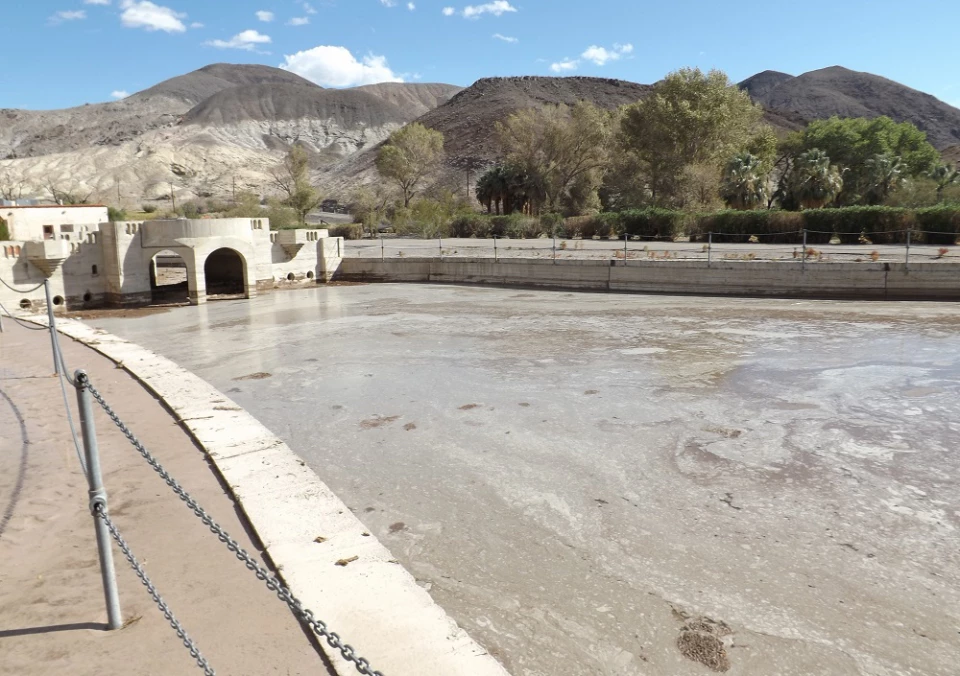
Left image
Right image
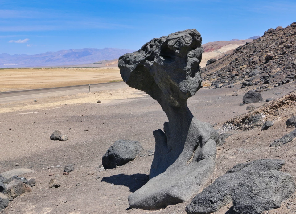
Mushroom Rock - 1941Featured by the photographer Burton Frasher in his 1941 postcard series, Mushroom Rock is a pillar of rock molded by erosion. Exactly how the erosion happened and the feature formed is a subject of debate. Some scientists claim that the smooth bottom portion was sculpted by blowing sand, leaving the rougher upper portion relatively untouched because wind can lift sand only about 4 to 5 feet from the ground. Others think that the rock’s weathering was brought on by the crystallization of salt. 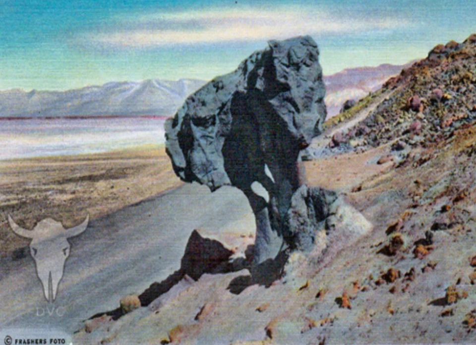
Left image
Right image
|
Last updated: January 18, 2024